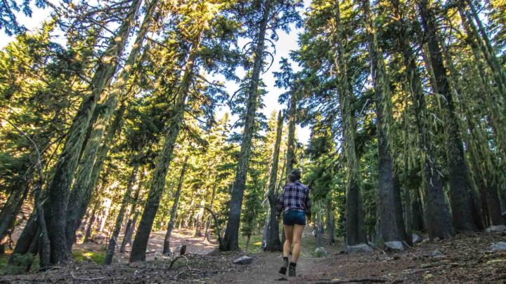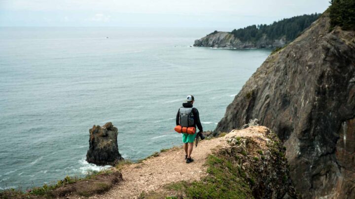
19 Badass Hikes in Bend, Oregon to Conquer
There’s no doubt that the hikes in Bend are some of the best in Oregon.
And the best part? There are TONS of them just in Bend’s backyard, so you’d need a few solid months to conquer them all.
While I’m sure most of us can’t spend our days hiking all day (although we wish we could), we think this list of cool Bend hikes will start you off well.
We have everything from quick hikes to multiday treks listed here. Plus, a few are just a tad further outside of Bend but still doable within a day.
👉 Want Our Personal Favs?
We’ve done TONS of hikes around Bend, but here’s the quick lowdown on our personal favorites:
- Pilot Butte – Easy intro hike to Bend (or be lazy and just drive up)
- South Sister – A HARD grind, but the views are epic
- Misery Ridge – Awesome alien landscapes
- Deschutes River – Can’t go wrong with this classic, in-town stroll
- Proxy Falls – One of the coolest waterfall hikes in the state
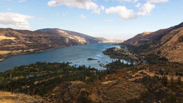
Best Bend Hikes to Conquer
For our visual people, here are all the hikes listed here in map form.
If you’re going beyond Bend to hike, we’ve got you covered! Here’s our epic list of amazing things to do in Bend and more of our favorite hikes in Oregon.
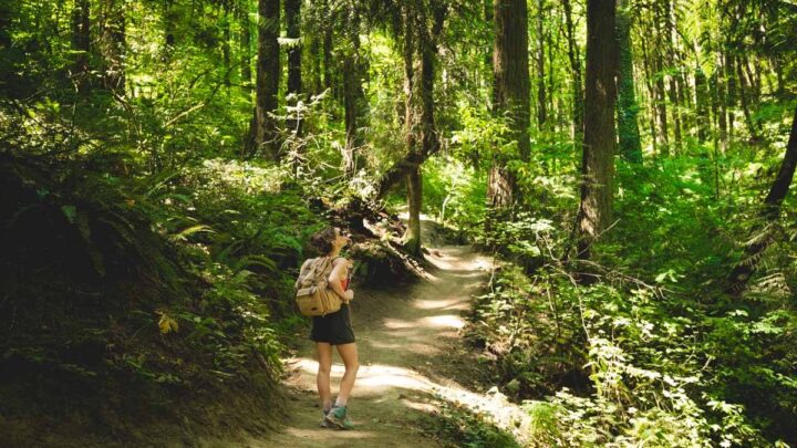
After spending years on these trails, trust me when I say I gathered the best of the best here for you!

📍 GET THE ULTIMATE PNW MAP 🗺️
Get our curated list of the best adventures, things to do, and places to grab a brew loaded onto your maps with just two clicks!
✅ Waterfalls ✅ Hikes ✅ Viewpoints
✅ Craft breweries ✅ National Parks ✅ 1400+ Pins


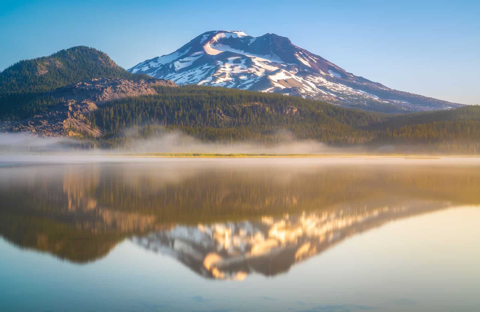
1. Moraine Lake Trail
Distance: 5.2 miles
Type of Trail: Out & Back
Difficulty: Moderate
Elevation Gain: 1,476 feet
Other important info:
- Dogs are allowed
- Wilderness Permit is required for this trail from June-October
Easily accessible off the Cascade Lakes Highway, this Bend hike provides a sturdy uphill climb. With nearly 1,500 feet in elevation gain and some patches of loose terrain, make sure your hiking boots have solid traction.

Don’t let the first couple miles of dense forest fool you—some heart-racing views are waiting on the latter part of the trail. Once you pop out of the forest, you’ll be perched above a scenic plateau with South Sister and Broken Top looming on the horizon.
Take the signs pointing towards Moraine Lake and march along until you’re greeted with a crystalline lake facing the snow-lined peaks. Moraine Lake provides a refreshing swim to cool off if you find yourself drenched in sweat.

If you’re up for a more challenging climb, you can connect to the South Sister Trail to ascend the mountaintop.
TIP: Bug spray is a must for this path, as mosquitoes are relentless in this forest!
READ MORE: Hiking Moraine Lake Trail in Oregon—2 Spectacular Routes!
2. South Sister Trail
Distance: 11.6 miles
Type of Trail: Out & Back
Difficulty: Hard
Elevation Gain: 4,986 feet
Other important info:
- Dogs are allowed
- Wilderness Permit is required for this trail from June-October
When it comes to mountain hikes in Bend, Oregon, it doesn’t get any better than South Sister! A successful summit of this iconic mountain will take you to Oregon’s third-tallest peak and present a life-changing adventure.

With just under 5,000 feet of elevation gain, be prepared to have your heart pound for much of the journey. This hike will not require as many technical skills as others in Oregon, but trekking poles, spikes, and gaiters are advised.
The first few miles lead through the dense forest but soon become exhausting with a steep climb along rocky terrain. Try to begin your ascent before sunrise to avoid slush caused by melting snow.

Whether you witness the sunrise above the horizon or have clear skies, the otherworldly vistas from the summit are pure magic. Admire neighboring peaks such as North Sister, Broken Top, Three Fingered Jack, and Mount Bachelor.
READ MORE: Hiking South Sister in Bend, Oregon
3. Three Sisters Loop
Distance: 47.8 miles
Type of Trail: Loop
Difficulty: Hard
Elevation Gain: 7,201 feet
Other important info:
- Dogs are allowed
- Wilderness Permit is required for this trail from June-October
- Overnight permit is required if camping
- Some sections of trail go through recently burned areas – expect difficult conditions and little shade
Spanning nearly 50 miles, the Three Sisters Loop is the ultimate hiking adventure on Bend’s doorstep.
Typically completed in three or four days, this thrilling journey will give you excellent views of several famous Cascade Mountain Peaks, including the Three Sisters, Broken Top, and Mount Bachelor, to name a few.

In general, the elevation gains along the loop are not the steepest, but expect some steady climbs throughout the trip.
If you have time for some side trips, there are lots of shimmering turquoise lakes nearby. You’ll discover a diverse range of terrain, including spruce forests, blooming wildflowers, alpine meadows, enchanting streams, and volcanic landscapes.

Just keep in mind that compared to other long-distance hikes, this route offers fewer camping options and places to find drinking water.
Prepare for crowds around famous landmarks and day hikes along the loop, especially during the peak hiking period of July-August. If you decide to hike during a later part of the season, always check weather forecasts for potential snow.

And don’t forget to fill out a permit at your starting trailhead before beginning this incredible voyage.
4. Broken Top Summit
Distance: 12.3 miles
Type of Trail: Out & Back
Difficulty: Hard
Elevation Gain: 3,674 feet
Other important info:
- No dogs allowed
- Wilderness Permit is required for this trail from June-October
Experienced mountaineers only on this Bend hike!

A proper mountain climbing experience is definitely recommended for this exhilarating adventure. Expect a full-day climb of upwards of 10 hours with an elevation gain of nearly 4,000 feet.
Be prepared for a scramble part of the way— spikes, a rope, and trekking poles are highly recommended. Much of the trail is exposed, and loose rocks can potentially cause a dangerous stumble.

Once you reach the summit, the views of the surrounding peaks are jaw-dropping, and the feeling of adrenaline turns into pure ecstasy. Standing face to face with other mountains like North Sister and South Sister makes you feel on top of the world.
🏨 Need a place to crash nearby?
From rustic cabins to boutique inns—check prices and availability in just a click.
5. Misery Ridge Trail
Distance: 2.6 miles
Type of Trail: Out & Back
Difficulty: Hard
Elevation Gain: 1,138 feet
Other important info:
- Dogs are allowed
- A day-use permit is required for all trails inside Smith Rock State Park
Nestled in Central Oregon’s high desert, Smith Rock State Park offers some of the best hikes near Bend, Oregon, outside of verdant forests and snowy peaks. Sheer canyons, basalt cliffs, and craggy geologic formations create an otherworldly atmosphere when exploring the region.

The Misery Ridge Trail is one trek that should top your list for unbelievable views of the canyon rim and rocky spires. There is much elevation gain on the unstable terrain, and trekking poles will help if you have bad knees.
Once you reach the summit, take in the breathtaking views of the jagged pinnacles from the Monument Area and spot the famous Monkey Face.

There is no shortage of exhilarating hikes to conquer in Smith Rock State Park, and you could spend days exploring the canyon.
RELATED: 7 COOLEST Smith Rock Hikes to Tackle!
6. Tumalo Mountain Trail
Distance: 4.1 miles
Type of Trail: Out & Back
Difficulty: Hard
Elevation Gain: 1,423 feet
Other important info:
- Dogs allowed (may be off leash in certain areas)
- Northwest Forest Pass is required
For spectacular alpine scenery, this Bend, Oregon hike MUST be on your list when in central Oregon!
The relatively short path is nearly 100 percent uphill, but you’ll be grinning ear to ear with the panoramic views of the snowy mountains that dominate the horizon.

Broken Top, Mount Bachelor, and pristine alpine meadows decorate the landscape as you reach the final stretches of the trail.
Ensure your hiking shoes have plenty of traction, as the steep inclines and loose gravel could lead to a fall if you’re not careful. The trail can potentially be icy and snowy, and bringing some spikes along will make the climb much easier during colder months.
Otherwise, the trail is well marked and maintained to reach this jaw-dropping vista of the Oregon Cascades.
7. Pilot Butte
Distance: 1.8 miles
Type of Trail: Out & Back
Difficulty: Moderate
Elevation Gain: 456 feet
Other important info:
- Dogs are allowed
- There is no fee to hike this trail
- The parking gate on the east side closes at 7 pm
This brisk walk is perfect for its central location in Bend and to get your blood flowing for lengthier hikes in the region. However, don’t underestimate the phenomenal views of the Cascades from this vantage point.

Although the trail won’t even surpass two miles, there is still a fair elevation gain of over 450 feet. If you’re not in relative shape, then the trail might eclipse the easy scale for you.
The path is well maintained and provides a gravel route to the top, with cars passing alongside you. Save this hike in Bend for a clear day as you’ll be rewarded with a breathtaking bird’s eye view of Bend and all the surrounding peaks near town.

TIP: If you’re not up for a hike, you can just drive to the top! Either way, don’t miss a sunset from this vantage point.
8. Deschutes River Trail: Old Mill Reach
Distance: 4.4 miles
Type of Trail: Loop
Difficulty: Easy
Elevation Gain: 157 feet
Other important info:
- Leashed dogs allowed
- There is no fee to hike this trail
Need a pallet cleanser between some of the more epic (leg and lung burning) hikes in Bend? Check out this easy trail along the Deschutes River.

The trail starts out paved, then turns to dirt once you approach the river. Despite a recent fire that charred some of the landscape along the Deschutes River, positive signs point the road to recovery.
Blooming wildflowers, vibrant grasslands, and other vegetation should make this one of the most peaceful hikes in Bend.


Gorgeous rolling hills dot the landscape around the river, and you’ll often spot kayakers and fishermen in the water. Search for the cliffs of the Deschutes Canyon nearby as the path is nestled along the outskirts of the desert.
TIP: Lots of wildlife can be found. It’s essential to be mindful of rattlesnakes and cougars that sometimes frequent the area.
RELATED: How to Float the Deschutes River
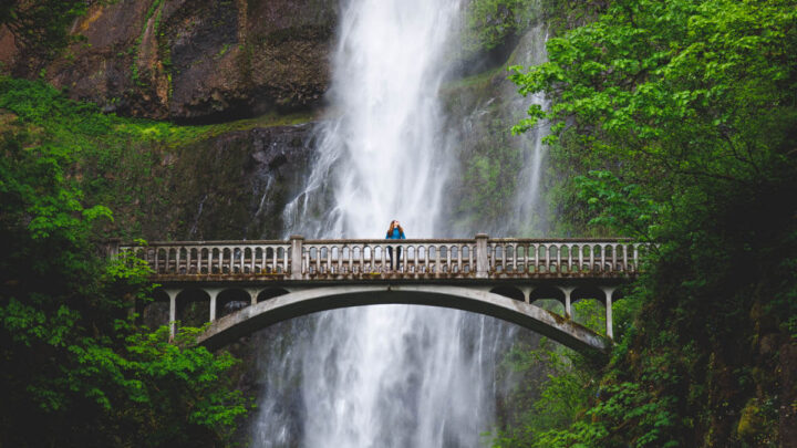
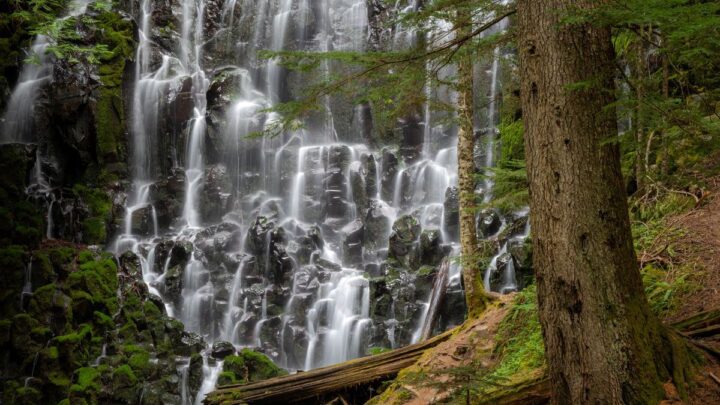
9. Tumalo Falls
Distance: 6.4 miles
Type of Trail: Out & Back
Difficulty: Moderate
Elevation Gain: 557 feet
Other important info:
- Leashed dogs allowed
- Northwest Forest Pass is required for this trail
The Deschutes National Forest is packed with some of the most dramatic terrains near Bend, and Tumalo Falls is one of its many magical settings.
Surrounded by evergreen forests, the falls plunge over the edge of basalt cliffs into a soothing creek below.

The viewpoint of Tumalo Falls is easy to spot from the trail, and the viewing area can get quite crowded during peak hiking time.
Venture further along the path and hear the Tumalo Creek peacefully flowing beside you as the crowds fall further behind. Keep your eyes peeled for numerous viewing areas of other cascading waterfalls along the river.

TIP: Elevation gain on the trail is minimal, but several sections become incredibly narrow, and it is crucial to watch out for mountain bikers who share the route.
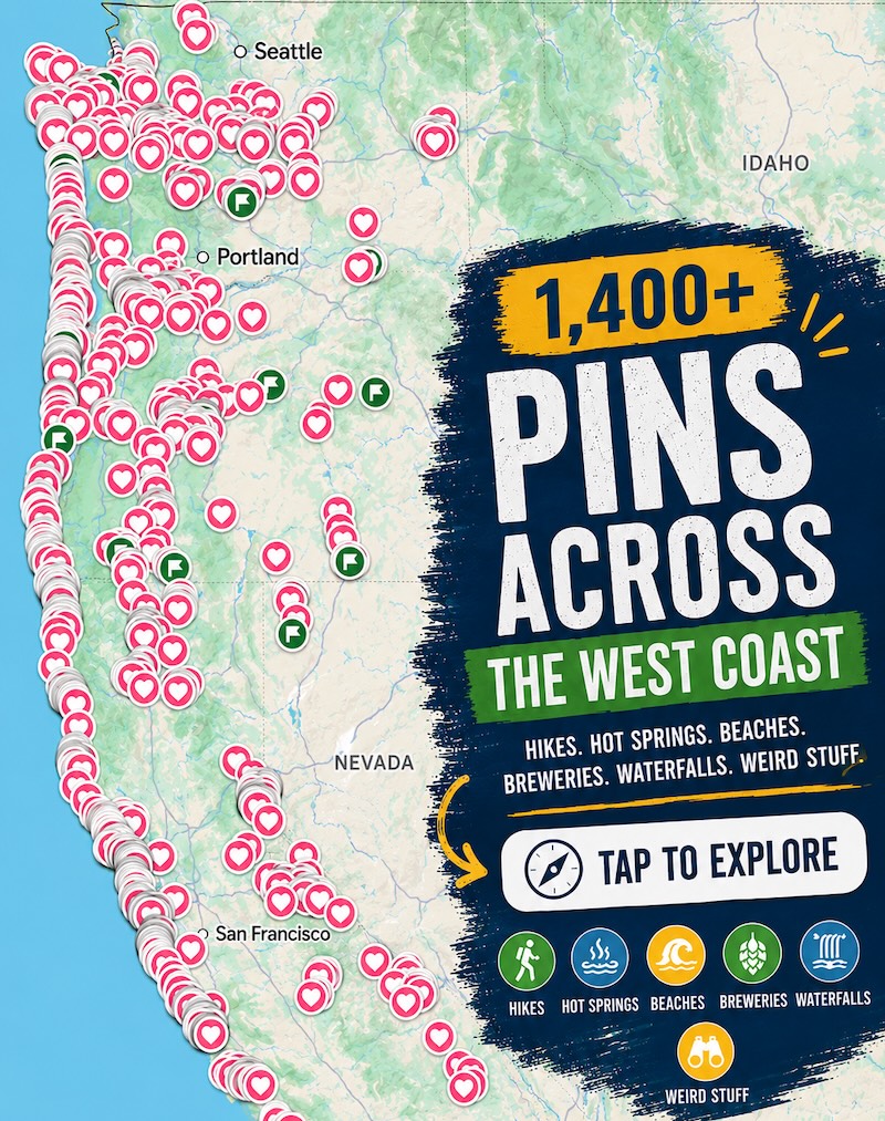
🕒 Save hours of planning time! ⛰️
📍 Get The Ultimate West Coast Map
1400+ breweries, trails, waterfalls, beaches, and weird roadside stops—mapped for you!
10. Green Lakes Trail
Distance: 9.1 miles
Type of Trail: Out & Back
Difficulty: Moderate
Elevation Gain: 1,174 feet
Other important info:
- Dogs are allowed
- Wilderness Permit is required for this trail from June-October
- A fee OR a Northwest Forest Pass is required for parking at the trailhead
Located only 27 miles from Bend, the Green Lakes hike near Bend, Oregon, provides some of the most awe-inspiring images in the area.

Meander around peaceful rivers, listen to cascading waterfalls, and gaze at snow-capped mountains.
With ideal conditions, the area around the trail is excellent for camping should you wish to trek at a slower pace and fully appreciate the magical setting.
Plan to arrive early if hiking during the summer as the enchanting scenery and short distance from Bend makes this a popular trek. You may want to invest in some crampons if tackling this route during the winter as ice and snow build-up is common.
READ MORE: Tackling the Green Lakes Trail Near Bend, Oregon
11. Badlands Rock Trail
Distance: 12.5 miles
Type of Trail: Out & Back
Difficulty: Moderate
Elevation Gain: 354 feet
Other important info:
- Dogs allowed
- There is no fee for this trail
Get to know another side of the unearthly terrain near Bend by wandering the Badlands Wilderness Area. Located only 16 miles east of Bend, this flat trail will take you through central Oregon’s high desert and barren landscapes.

The path is surrounded by gorgeous Juniper trees and lava systems while showing you the nearby peaks looming on the horizon. Sage and gorgeous wildflowers dot the landscape, and you’ll likely get a glimpse of desert wildlife.
As you venture further into the desert, admire the striking 360-degree views of the wide-open terrain before reaching the craggy geologic formations.


TIP: Since this Bend hike is exposed, sunscreen and a hat are critical to protecting yourself from the sun. For more comfortable temperatures, consider this trail outside of summer.
12. Ray Atkeson Memorial Trail
Distance: 2.4 miles
Type of Trail: Out & Back
Difficulty: Easy
Elevation: 108 feet
Other important info:
- Dogs are allowed
- Toxic algae may be present in lakes – do not let dogs swim or drink
- Northwest Forest Pass is required for this trail
Short, sweet, and featuring stunning views, the Ray Atkeson Memorial Trail is one of the best easy hikes near Bend. The trail winds through forests of lodgepole pines, with cool lava rock formations accenting the landscape.

The elevation is negligible at just over 100 feet, and you’ll get great views of Sparks Lake for much of the way. The real stars of the show are the domineering views of Broken Top, South Sister and Mt. Bachelor looming over the lake.
RELATED: The Best Lakes in Oregon – Your Guide for Adventures and Camping
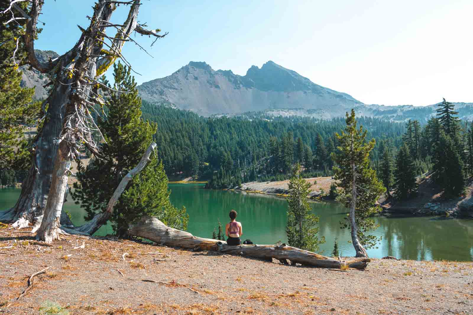
13. Paulina Peak Trail
Distance: 6.2 miles
Type of Trail: Out & Back
Difficulty: Hard
Elevation Gain: 1,610 feet
Other important info:
- Dogs are allowed
- $5 entrance fee
- This trail is subject to seasonal closure (depending on the weather)
This is one of the more strenuous hikes near Bend, but the views from Paulina Peak are worth it! Being the highest point of the Newberry National Volcanic Monument, conquering this hike is no small feat.

The steep climb presents roughly 1,600 feet of elevation gain, but you’ll get a unique glimpse of Oregon’s volcanic past. Notice the extensive lava fields around the ancient Newberry Caldera rim, the result of numerous volcanic blasts.
Admire the pristine forests next to the sparkling shores of Paulina Lake as you ascend to the craggy summit. Walk further along the Crater Rim to see breathtaking images of lodgepole pines, hemlocks, and other species.

Don’t have a lot of time? Check out this epic tour that takes you all around Newberry and Paulina Peak!
READ MORE: Your Guide to Newberry National Volcanic Monument
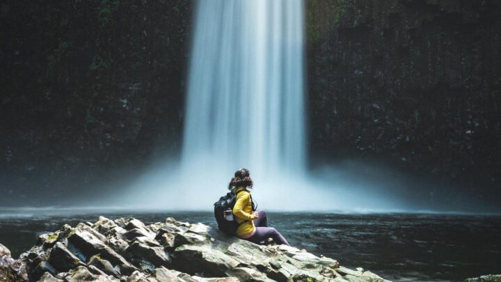
14. Proxy Falls Loop Trail
Distance: 1.6 miles
Type of Trail: Loop
Difficulty: Easy
Elevation Gain: 164 feet
Other important info:
- Dogs are allowed
- Northwest Forest Pass is required for this trail
- Roads leading to the trail are subject to seasonal closure (depending on the weather)
For some incredible scenery that’s not as rough on the knees, this is the Bend, Oregon hike for you!


This quick loop takes you through lush forests, tumbling waterfalls, lava fields, and radiant foliage. The terrain is flat and easily walkable for all skill levels for a relaxing stroll.
It’s possible to shimmy down to the base of the Lower Falls, but it can be a scramble getting back up. Should you venture down the steep descent, the pool at the bottom is a mesmerizing sight. Be prepared for your socks to get a bit damp, though.

This is one of our favorite waterfalls in Bend!
TIP: If you’re coming in winter and from Hwy 126, check to see if the gate to reach the trailhead is closed. If you find the gate shut, add an extra two miles to your hike in each direction.
READ MORE: Proxy Falls Hike—Central Oregon’s Most Epic Waterfall!
15. Cleetwood Cove Trail
Distance: 2.1 miles
Type of Trail: Out & Back
Difficulty: Moderate
Elevation Gain: 610 feet
Other important info:
- No dogs allowed
- Entrance Pass or America the Beautiful Pass is required for this trail
- Roads leading to the trail are subject to seasonal closure (depending on the weather)
Unsurprisingly, there are endless hiking opportunities to explore one of Oregon’s greatest natural wonders. Crater Lake is the deepest lake in the country, and its alluring blue waters attract hundreds of thousands of visitors every year.

For a vantage of the lake beside the water, wander down the Cleetwood Cove Trail for a unique view. The short two-mile path has an elevation of over 600-feet and can be a challenge for novice trekkers.
You’ll start walking downhill along a series of switchbacks (which you’ll eventually have to climb back up) before reaching the lake.

Once you’re here, you can spend the day relaxing. Bring a fishing pole, a picnic, and your swimsuit if you’re brave. The water only reaches 57°F even in the peak summer months, so prepare for an icy dip!
This is a relatively easy hike, leaving you with plenty of time to complete the Crater Lake Rim Drive.
READ MORE: 9 Best Crater Lake Hikes
16. Toketee Falls Trail
Distance: .8 miles
Type of Trail: Out & Back
Difficulty: Moderate
Elevation Gain: 170 feet
Other important info:
- Dogs are allowed
- There is no fee for this trail
- The best time to hike this trail is between April and November
Umpqua National Forest is home to some of the best hikes near Bend, especially if you love a good waterfall hike.
The Toketee Falls Trail is a short and easy trek that leads to one of the most stunning viewpoints in the entire forest. The two-tiered waterfall cascades over a massive basalt slab and gushes into a picturesque pool below.

This is a popular area for hiking, so be ready to hike amongst the crowds or try to visit early in the day or during the week.
NOTE: Some famous photos of the falls were taken by sidestepping the fence. There are signs clearly posted asking visitors NOT to do this—so please be respectful and stay on the path. The views are still great even if they’re not straight on.
READ MORE: Guide to Umpqua National Forest: Waterfall Hikes & Hot Springs
17. McKenzie River National Recreational Trail
Distance: 24.1 miles
Type of Trail: Point to Point
Difficulty: Hard
Elevation Gain: 823 feet
Other important notes:
- Dogs are allowed
- There is a fee for this trail, display your Northwest Forest Pass
Be prepared to share this path with mountain bikers, given its renowned reputation as a biking paradise. However, you’ll be just fine cruising along on foot, and there are plenty of ways to enjoy the beauty surrounding the trail.

Despite the substantial length, this Bend hike is almost entirely flat, and there are lots of camping spots to spend the night. Split the trek into three days for a more relaxed pace or two days for a tougher challenge.
Much of the trail is through the old-growth forest but offers splendid views of enchanting pools and cascading waterfalls.
The 73-foot Sahalie Falls sits next to the rushing waters of the McKenzie River and is not to be missed. Also, make sure to stop by the idyllic waters of Clear Lake and Blue Pool.


Scoot across log bridges, gaze at lava fields, and immerse yourself in the tranquility of the forest for one of Oregon’s most captivating adventures.
Here’s our guide on how to hike to Sahalie and Koosah Falls if you’re looking for a shorter trek.
RELATED: Your Guide to Hiking The McKenzie River Trail
18. Skylight Cave
- Dogs are not allowed
- There is no fee for this trail
- The cave is closed from October-April
The Skylight Cave hike is kind of a two-for-one deal. You get to have a quick wander in the forest and then down underground to check out one of the coolest caves in Oregon.

There isn’t much of a hike here but we had to include it in our list of hikes in Bend because it’s such a cool spot and well worth a visit.
Once you reach the cave, head inside and explore. The roof has three “holes” that let in beautiful beams of light (especially on a clear day around 10 a.m.).

NOTE: The cave is only open from May through September to protect hibernating bats.
READ MORE: How to Get to Skylight Cave
19. Black Butte Trail
Distance: 4.1 miles
Type of Trail: Out & Back
Difficulty: Hard
Elevation Gain: 1,558 feet
Other important info:
- Dogs are allowed
- Northwest Forest Pass is required for this trail
- The trail is open year-round but you may need AWD to reach the trailhead in the winter
Hiking Black Butte is a bit of a right of passage for anyone living in Central Oregon, and it’s definitely doable from Bend if you want to cross this bad boy off your bucket list.

This conical volcano has retained its shape over the (many) years, and the views from the summit are absolutely spectacular. While the hike is definitely a bit challenging, the drive to the parking lot gets you about halfway up the mountain.
You’ll have to work the rest of the way, though, and the trail maintains a pretty steep degree for much of the way. Luckily, there are plenty of great views to distract you as you climb.


This is also one of the best things to do in Sisters, Oregon, so make sure to stop by the town on your way down from the mountain.
READ MORE: Hiking the Black Butte Trail Just Outside of Sisters, Oregon
Where to Stay Near Bend
We have a massive list of great camping spots in Bend, but here are a few quick recommendations…
- Tumalo State Park Campground: One of the closest campgrounds to Bend, beautiful Tumalo State Park Campground is right on the Deschutes River and has lots of tent and full hook-up sites.
- Driftwood Campground: Driftwood offers beautiful views of the Three Sisters Lake, and is a peaceful campground to relax in nature.
- Bend Sunriver RV Campground: This campground is located on the Little Deschutes River and offers full hook-up and tent sites, as well as yurts, cabins, and cottages.
- Hummingbird Cottage: Hummingbird Cottage is an adorable craftsman style Bungalow in a quiet part of Bend that is close to breweries, hikes, and more.
- Tall Pines A-Frame: This cute A-Frame in La Pine sits on an acre of Ponderosa Pine and has a full kitchen, bathroom, and two bedrooms.
- Cozy Sunriver Cabin: Located right in central Sunriver, this cute woodsy cabin is surrounded by trees and has a wood-burning fireplace, a full kitchen, and WiFi.
We hope this helped you choose some epic Bend hikes to conquer! Be sure to check out our other posts on Bend.