Hiking The EPIC McKenzie River Trail in Oregon
Following the beautiful McKenzie River, the McKenzie River trail is 26 miles long, starting at the headwaters of Clear Lake in the Cascade Mountain Range. This is a popular trail, largely thanks to the beautiful surroundings and many things to do and see along the way.
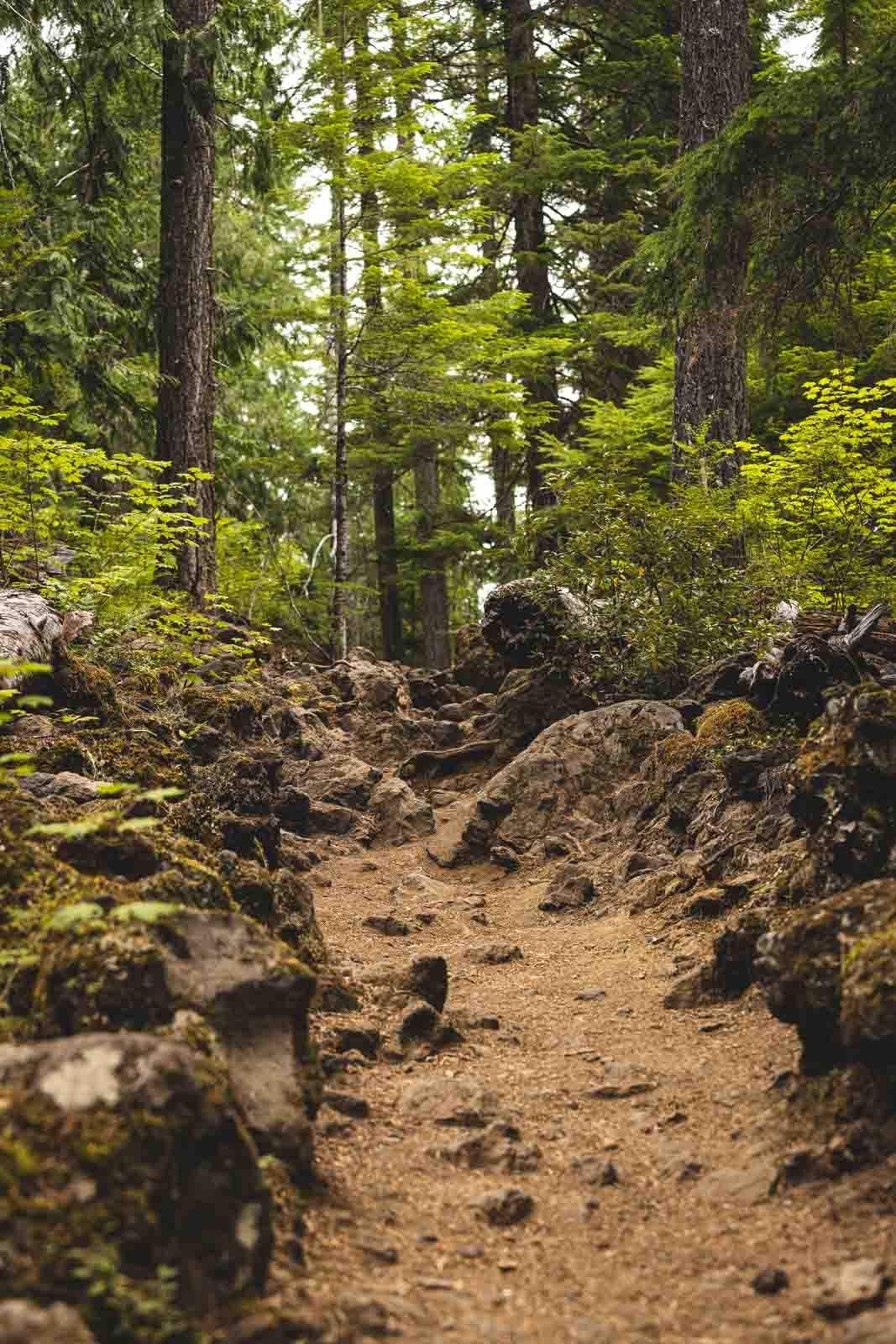
Picture multiple cascading waterfalls, old-growth forest, lava fields, and twinkling blue pools, all on one trail. This incredible route draws both hikers and bikers from all over the world. It very rarely gets overcrowded due to its length, which just adds to its appeal.
Hiking The McKenzie River Trail
Distance: 26 miles
Type of Trail: Point to point
Difficulty: Hard
The trail follows the river’s path for most of its 26 miles. For the more hard-core hiker, the whole trail might seem like an easy walk, but for the average hiker, it is common to make it a multi-stay trip.
Although many hikers will tackle the whole trail, you will find a much more significant crowd of day hikers in the upper section, where you will find some of the bigger natural attractions, such as the Blue Pool, Sahalie Falls, and Koosah Falls.
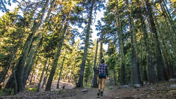
McKenzie River Trail 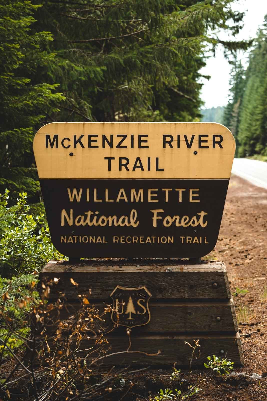
Start of the McKenzie River Trail
If it is solitude and beautiful surroundings you are after, then it is the lower half of the hike that is for you. The trail runs along the riverside through beautiful forests, and the further up the river you go, the more volcanic and rocky the path becomes.
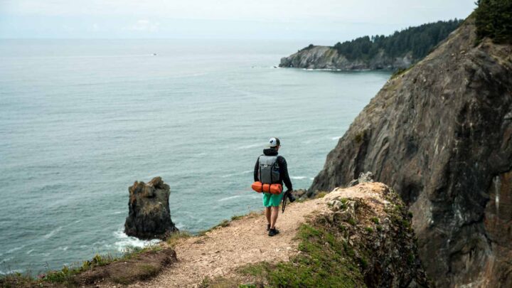
You can take on as much or as little as the hike as you like, as it intersects through side roads off the highway, making access easy. Most people do the McKenzie River Trail in one direction rather than treating it as an out and back trail, organizing a shuttle with friends, or using a shuttle service.
📍 GET THE ULTIMATE PNW MAP 🗺️
Get our curated list of the best adventures, things to do, and places to grab a brew loaded onto your maps with just two clicks!
✅ Waterfalls ✅ Hikes ✅ Viewpoints
✅ Craft breweries ✅ National Parks ✅ 1400+ Pins


The Route for The McKenzie River Trail
If you start at the Upper Trailhead, you’ll find yourself on an old lava flow that originates from Mount Washington. The trail heads down through the trees and winds it’s away along the river’s edge before arriving at Clear Lake and the Great Spring, which is a primary source for the river.
After heading past the southern end of the lake, the route will have you twisting and turning past the turbulent river until you cross over Highway 126 and then cross to the western side of the river, taking you to some spectacular viewpoints of Sahalie and Koosah Falls.
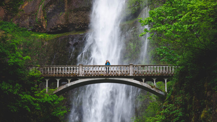
Wooden bridge on McKenzie River Trail 
Koosah Falls on The McKenzie River Trail
The river disappears at the Carmen Reservoir as it continues its voyage underground, meaning at this point you will be following a dry creekbed for a while. The old-growth forest here is stunning, and the next point of interest you come across will be the incredible Blue Pool, which is where the river bubbles up from the ground again.
From the pool, follow the ever-growing river all the way to the Trail Bridge Reservoir. At this point, the trail is much easier and smoother, crossing several streams and beside forest roads.
The trail comes to an end past the McKenzie River Ranger station at the Lower McKenzie River Trailhead.
Highlights Along The McKenzie River Trail
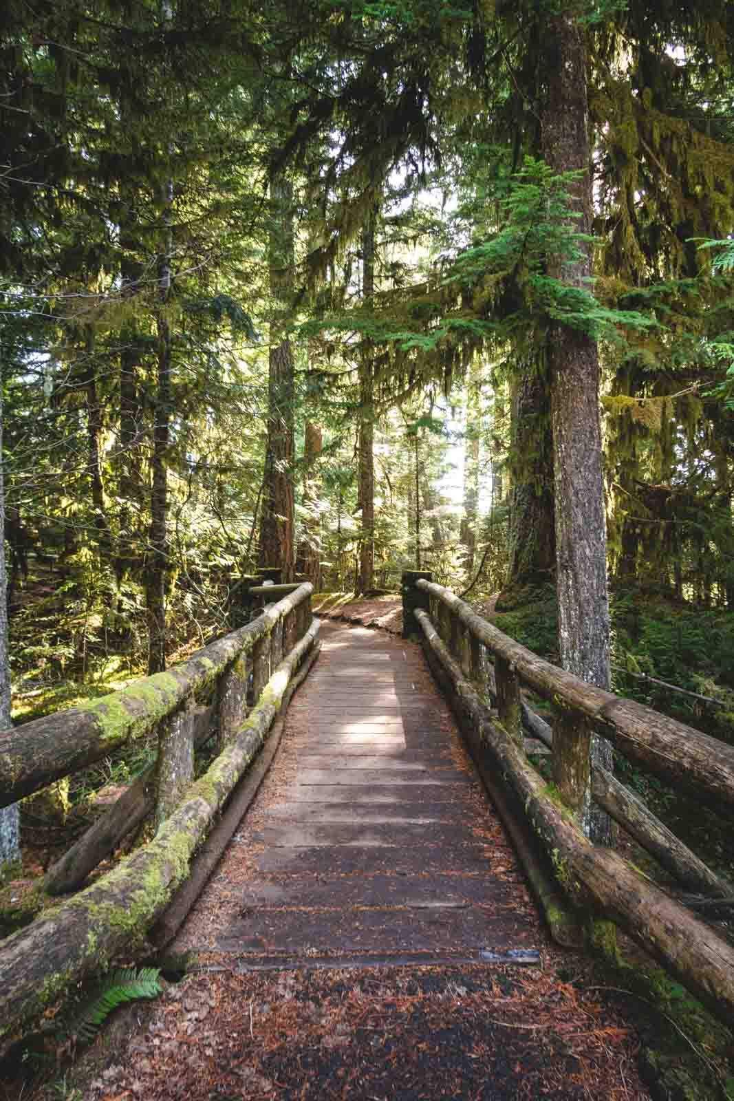
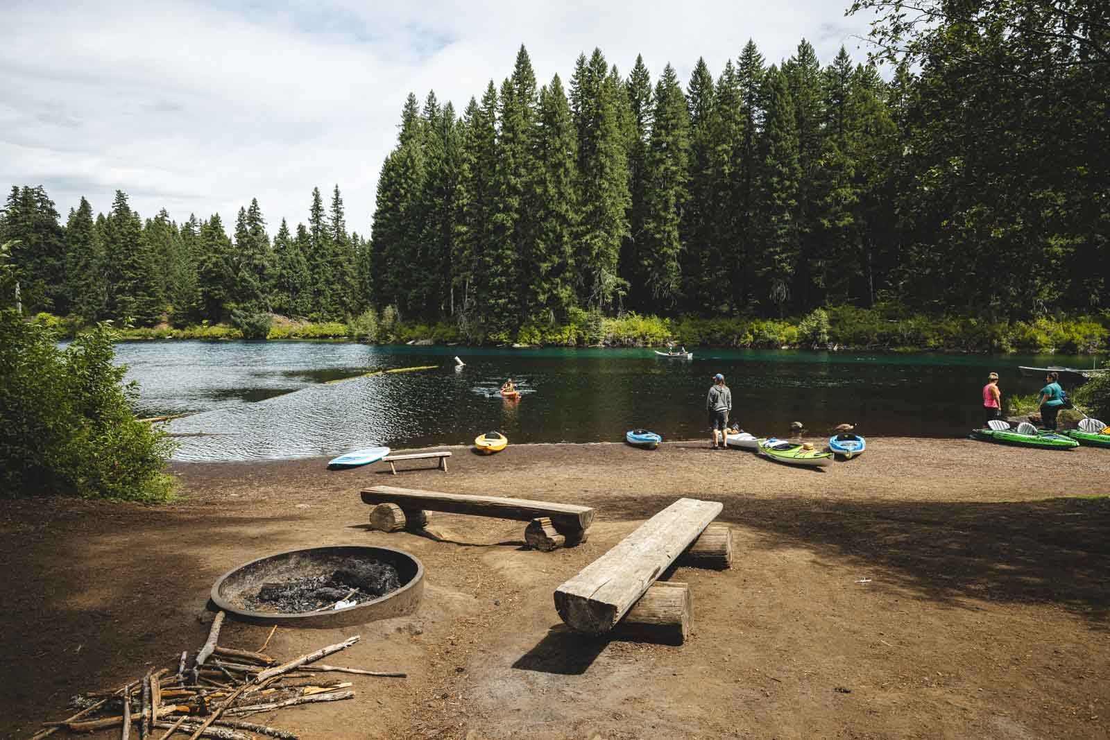
Clear Lake
Clear Lake is the ultimate place for kayaking. From your position on your kayak, you’ll be able to see a preserved forest underneath the depths of the crystal clear waters of the lake.
There is also a great hike around the lakeshore, where you can better take in its beauty. Clear Lake is the McKenzie River’s headwaters and was formed when an ancient lava flow dammed the stream around 3000 years ago. When the stream was dammed, the water rose to cover the forest, leaving it underwater.
The forest has been preserved so well thanks to the 37-degree water all year round. Whether you fancy relaxing, picnicking, kayaking, rowing, or stand-up paddleboarding, it is a great place to head for a few hours or the whole day.
RELATED: Your Guide to Exploring Clear Lake, Oregon
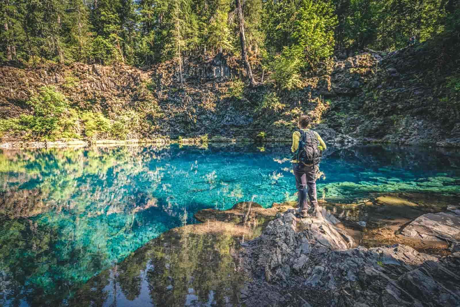
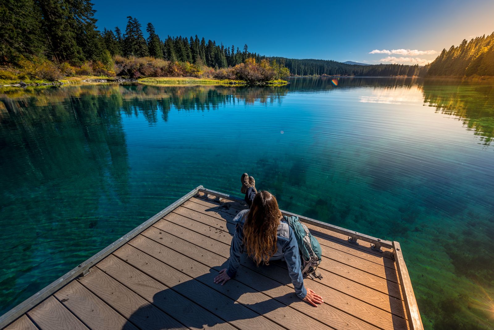
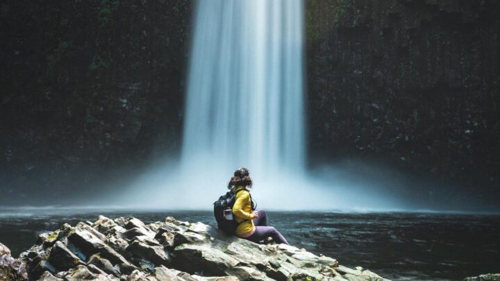
Blue Pool
The Tamolitch Blue Pool is arguably the most popular and beautiful spot on the McKenzie River Trail. This incredible pool was created thousands of years ago, when lava erupted in the area, creating a lava tube. The pool was then formed where the river comes up from the ground after traveling for 3 miles through the lava tube.
The color of the water really is hard to describe, and the photos do not do it justice; it is doubtful you’ll see water this blue anywhere else.
The trail to the pool is around 4 miles, blossoming with traditional Oregon scenery such as moss-covered trees and rich forest. The pool itself changes with the seasons. During the spring, frothing white water pours into the pool below, while in the summer and fall, the water transforms into its namesake blue color.
RELATED: Hiking to Tamolitch Blue Pool in Central Oregon
The word ‘Tamolitch’ actually means ‘tub’ or ‘bucket’ in Chinook, and you will easily see why it is named this when you see the steep sides of the pool.
🏨 Need a place to crash nearby?
From rustic cabins to boutique inns—check prices and availability in just a click.
Hot Springs
There are a few different hot springs experiences available along the McKenzie River Trail. One of the best local experiences is the Terwilliger Hot Springs. You’ll walk for around a quarter of a mile through verdant forest, and before long, you’ll arrive at five stunning pools separated by large rocks.
Bigalow Hot Springs is another option and is completely free to use – and is a little cooler, and Belknap Hot Springs is a little further south. You can bathe in the hot springs for a small fee, which is more like natural pools. The pools are open 365 days a year and have two mineral hot springs and many acres of beautiful gardens to enjoy.
RELATED: 13 Oregon Hot Springs to Soothe Your Post-Hike Muscles
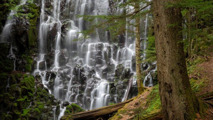
Sahalie and Koosah Falls
At just 2.2 miles, the Sahalie and Koosah Falls trail is well worth it. It contains two amazing waterfalls that tumble over the rocks. There is a direct route that follows the river, or there is a longer 2.2-mile loop that takes you through the forest.
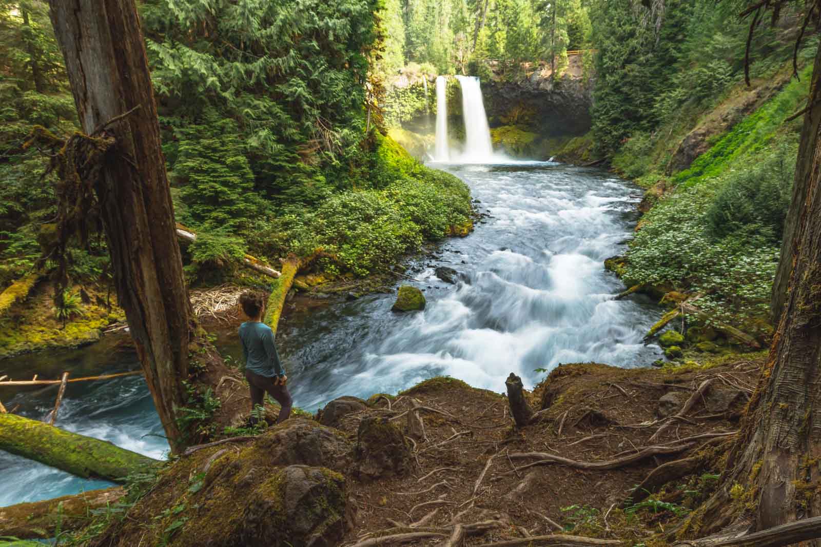
Sahalie is a raging 100-foot waterfall, and Koosah is a beautiful 70-foot gushing waterfall. Both are incredibly beautiful and are running all year round. These two falls were created due to the lava that poured down the McKenzie River Valley around 3000 years ago.
The hike itself is pretty easy, with just a 400-foot elevation gain along the way and plenty of viewpoints that will allow you to see the falls from different angles. If you are not up for a hike, there are parking lots at both waterfalls, meaning you can still experience their beauty without the walk.
RELATED: Exploring the Sahalie and Koosah Falls Hiking Loop
Mountain Biking The McKenzie River Trail
If you want a little more of an adrenaline rush when hitting the trail, it is also a popular mountain biking route. The trail has actually been considered the number one MTB trail in America, so it really is pretty exciting.
When ridden north to south, it has a 1600 feet elevation gain, and 3200 feet elevation loss, meaning this is a very desirable ride as much of it is downhill.

The McKenzie River Trail map at trailhead 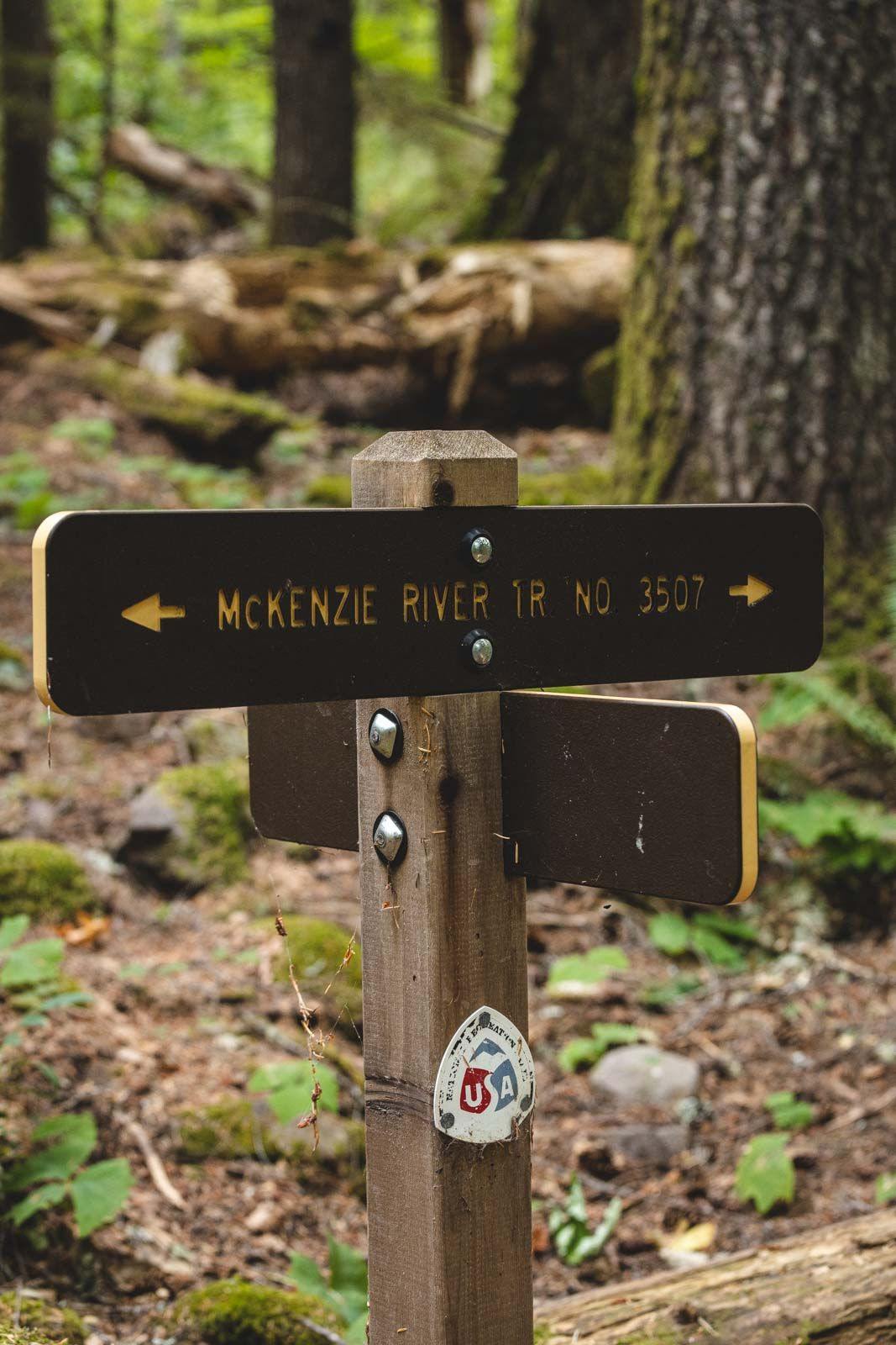
Sign for The McKenzie River Trail
When biking, the trail is considered moderate, although there are quite a few difficult sections near the beginning. The best time to hit the trail on a bike is early summer to late spring.
More info on biking the Mckenzie River Trail here.
Camping on The McKenzie River Trail
There are plenty of places to camp along the trail, making it great for a multi-day adventure.
Paradise Campground – Tucked within a rich, old-growth forest is Paradise Campground, a popular spot for those hiking the river trail. Set on the McKenzie River banks at 1,600 feet, the sites are located underneath Douglas fir and western red cedar. Many of the sites face the river, so you can wake up with an impressive view of the water, while others are deeper into the forest.
McKenzie Bridge Campground – Shaded by the tall trees, this campground is small and often quiet, providing the perfect spot for a little relaxation after a long day of hiking or biking. All of the campsites are nicely spaced out from each other, and there are vault toilets and drinking water available on site.
Ice Cap Campground – Ice Cap Campground offers plenty of facilities, including fire rings, picnic tables, piped drinking water, and vault toilets, offering a comfortable camping experience. This campground is located around 17 miles northeast of McKenzie Bridge at an elevation of 3,000feet.
Coldwater Cove Campground – If you want to camp right alongside Clear Lake, go for Coldwater Cove Campground. The stunning turquoise Clear Lake, dense trees, and 3000-year-old lava fields make it an ideal location for those that want to wake up to a view. There are 34 campsites available, all of which have their own campfire ring and picnic table, plus it has vault toilets and fire pits.
Olallie On McKenzie Highway – This 16 site campground is located just south of the Blue Pool, set beside the gushing waters of the McKenzie River. When camping on the lower loop, you’ll wake up to mesmerizing incredible views of the river and creek, while the upper loop will give you plenty of shade and privacy in the trees. There are 16 sites overall with picnic tables, vault toilets, and drinking water.
Trail Bridge Campground – Trail Bridge Campground is located on the shores of Trail Bridge Reservoir. There are two different types of campsites here, some are located under large old-growth Douglas Fir, and some are in large grassy meadows. It is a very popular campground in the summer as it has fishing and a boat ramp, and easy access to the McKenzie River Trail.
Other Lodging Near The McKenzie River Trail
If camping is not your style, then there are also a number of fantastic holiday homes close to the McKenzie River Trail.
Stay close to the small town of McKenzie Bridge at the peaceful Romantic Cabin Getaway. This 2-bedroom property has a waterfront patio with spectacular views of the river and surrounding forest.
If you’re traveling with a group, there’s room for nine people at Renee’s Log House, also near McKenzie Bridge. This rustic cabin is located in the woods, right on the river.
Located between the towns of McKenzie Bridge and Rainbow, the tranquil River Haven is as close to the river as you can get. The two-bedroom cabin is set on the water and surrounded by greenery.
More Hiking in Oregon
We hope this helped you plan your trip but don’t leave yet! There’s more to see in Central Oregon and more adventures in Oregon to be had.