Owyhee Canyonlands: 9 TOP Things to Do
150+ miles of a federally designated Wild & Scenic River, jaw-dropping scenery, a bountiful reservoir and wildlife haven, and one of the last truly primitive recreation areas in the lower 48 – welcome to Owyhee Canyonlands!
There’s no cell signal, no fast food, and no major highways, yet the Owyhee Canyonlands is a welcoming and must-see adventure. Just a few miles from the Idaho border, this is Oregon’s last frontier, and it’s certainly worth the drive.
So, once you’re ready to leave civilization behind, here are some of the best adventures in the Owyhee Canyonlands.
1. The Start of All Things Owyhee Canyonlands – Jordan Valley
Fewer than 200 call the town of Jordan Valley home, but one does not, or should not, go to the Owyhee Canyonlands without a stop here.
You can stock up on provisions, get repairs, and generally learn all that is needed for a safe and memorable trip.

While you’re in town, talk to the locals -they know the best routes and times to explore the area.
Conditions change dramatically seasonally, even from day to day, so be prepared for all types of weather during your vist.
READ MORE: Exploring Around Jordan Valley, Oregon
📍 GET THE ULTIMATE PNW MAP 🗺️
Get our curated list of the best adventures, things to do, and places to grab a brew loaded onto your maps with just two clicks!
✅ Waterfalls ✅ Hikes ✅ Viewpoints
✅ Craft breweries ✅ National Parks ✅ 1400+ Pins


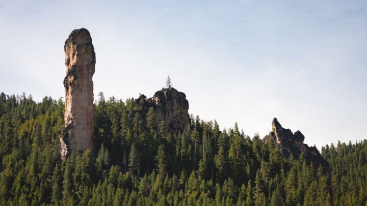
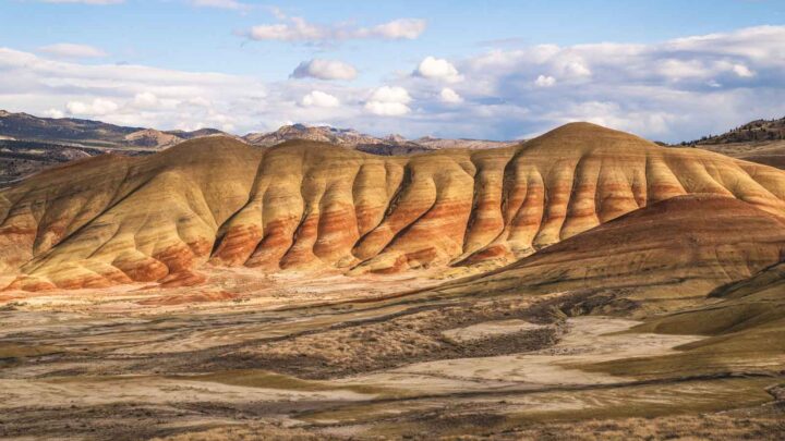
2. The Pillars of Rome
On the edge of the Owyhee Canyonlands are the Pillars of Rome, so named for their resemblance to Roman Temple ruins.

Standing alone in the flattened desert at a length of 5 miles and a width of 2 miles, the 100-foot tall clay formations are a sight to behold.
They create an imposing, fortress-like monument that is highly photogenic. The color of the rock changes by the hour as the sun travels overhead.
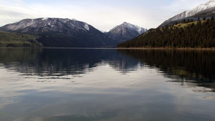
3. Lake Owyhee State Park
Lake Owyhee is actually a 53-mile-long reservoir resulting from the Owyhee River dam. True, the ‘lake’ is dominated by fisher folk, but even non-anglers can enjoy the awesome views of the canyons from the water.

The park boasts two scenic campgrounds (more on that below), both of which are popular and often booked out early, so get those reservations in early if you want to snag a spot here.
RELATED: 27 Oregon State Parks That Are Unmissable!
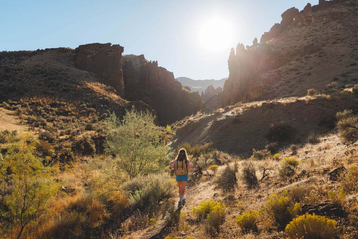
4. Hiking in the Owyhee Canyonlands
You can hike the Owyhee Canyonlands for days following popular trails or blazing your own, provided you have a good compass or SAT GPS. Remember, no cell coverage here!
Among the most used trails, there are several worth noting:
Juniper Gulch
• Distance: 3.4 miles (extendable to 6 miles)
• Type: Out and Back
• Difficulty: Moderate to Difficult
Juniper Gulch trail is only 3.4 miles roundtrip, but the steep elevation gain makes the short trail moderately difficult.
Head north from the easy-to-find trailhead, and stay to the right when reaching the .6-mile mark. Then follow the ridge to the rocky amphitheater where Mahogany Mountain comes into view.
This is where things get challenging (aka STEEP). You will want to make the final push, staying left along the narrow gulch and making the steep trek to the saddle.
Stop here for panoramic views of the reservoir and canyons. Your odds of seeing bighorn sheep are high, and you may even see the occasional wild horse!
🏨 Need a place to crash nearby?
From rustic cabins to boutique inns—check prices and availability in just a click.
Jordan Craters
• Distance: .5 miles
• Type: Loop
• Difficulty: Easy
For an easier hike, check out Jordan Craters. This half-mile loop winds around the rim of one of Oregon’s “youngest” volcanic flows – Coffeepot Crater.

The trail drops 150′ onto the red cinder path to the center of the crater. Along the way, you will discover lava tubes and trenches on a lunar-like surface.
Leslie Gulch
• Distance: 4.2 miles
• Type: Out & Back
• Difficulty: Easy
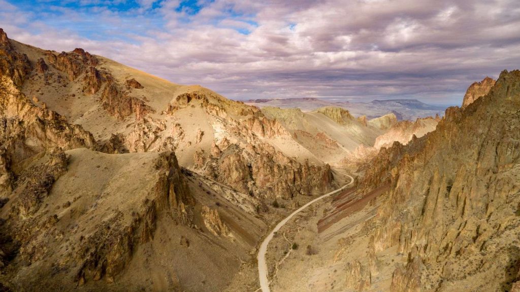
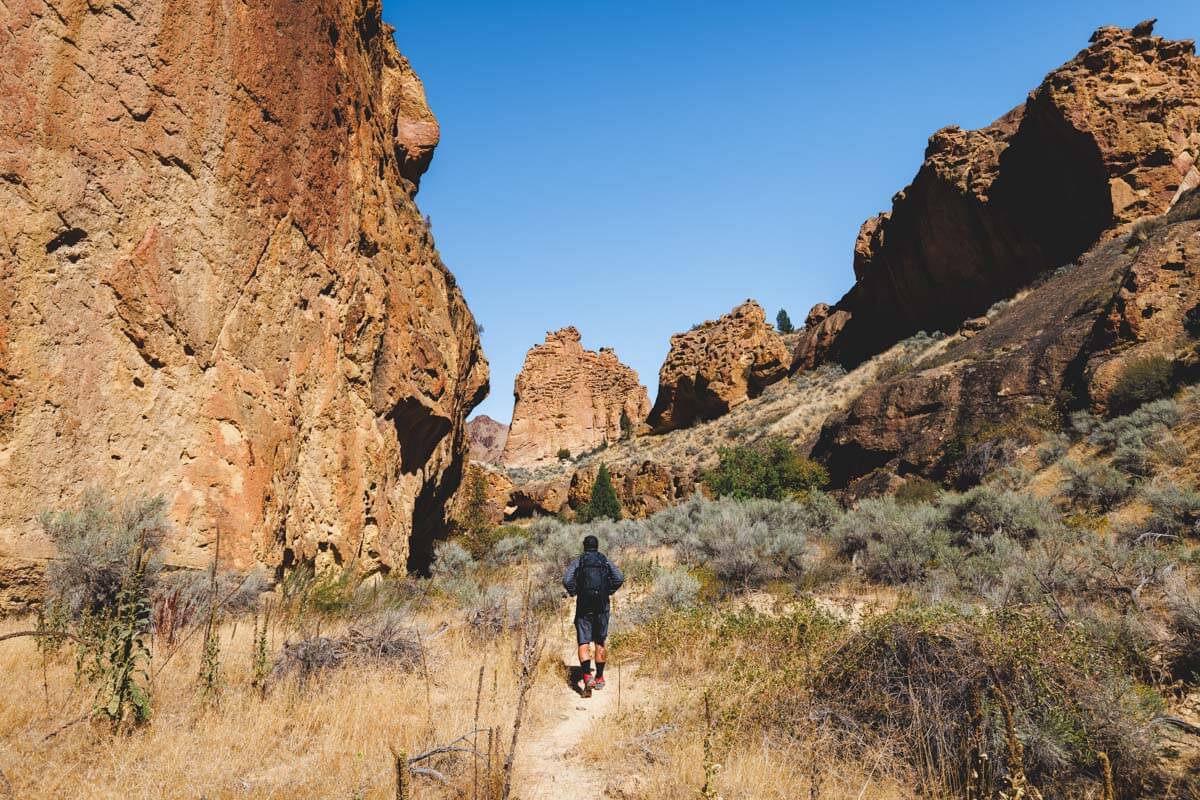
More impressive geological formations await at Leslie Gulch, a scenic area created by millions of years of winds, water, and volcanic activity.
There are a few trails in this area, but the Upper Leslie Gulch Trail offers some of the best scenery. You’ll start at Leslie Gulch Road and make your way through the canyon along a dry creek bed.

As you hike, you’ll see towering hoodoo formations and mountains in the distance. There are several spots for bouldering and climbing along the path if you’d like to make a pit stop.
READ MORE: Leslie Gulch: Oregon’s Stunning Alien Territory
Succor Creek Campground Trail
• Distance: 3.9 miles
• Type: Out & Back
• Difficulty: Moderate
You’ll probably get this trail to yourself, especially if you camp at the trailhead overnight, which is what we did.
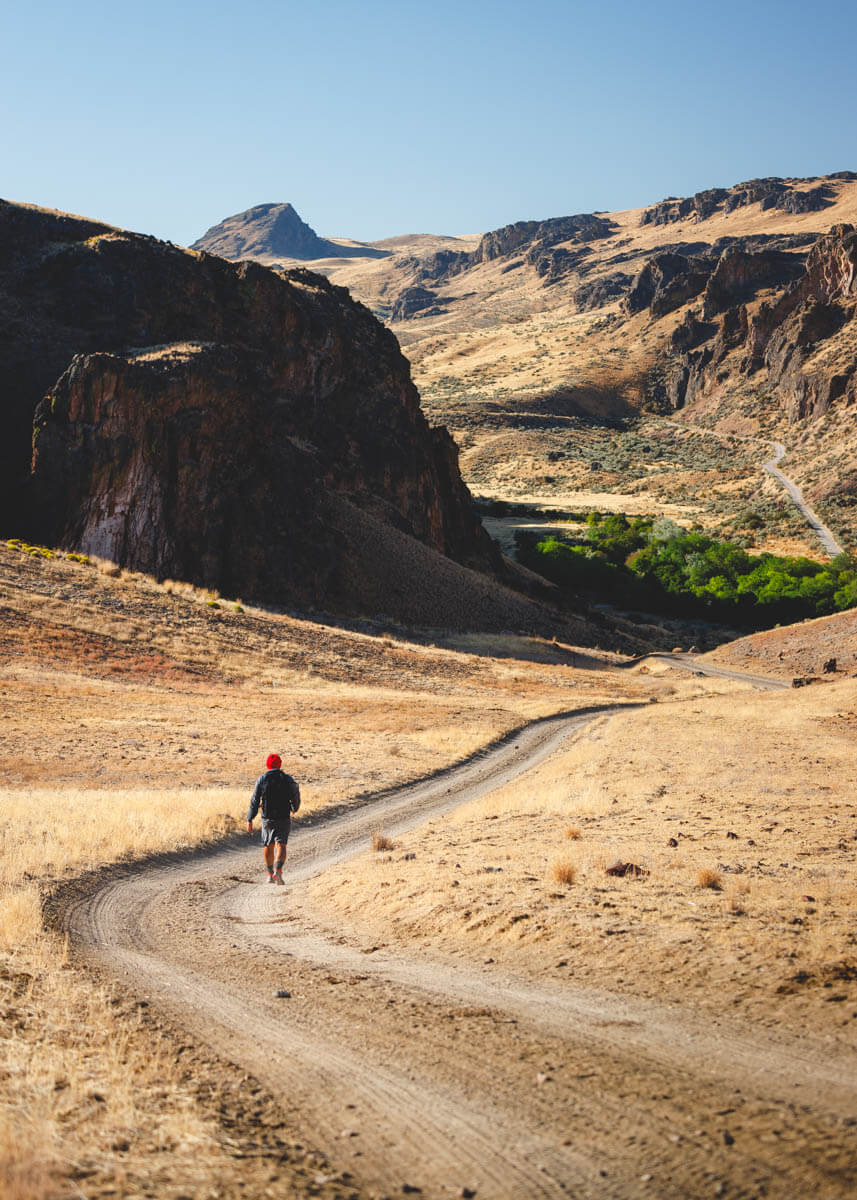
The bizarre landscape is STUNNING to walk through, and the trail has views the whole way.
5. Hot Springs in the Owyhee Canyonlands
If you need a break from the adrenaline-pumping adventures within Owyhee Canyonlands, you can get some R&R in one of the area’s hot springs.
Three Forks Hot Springs
Named among the top hot springs in Oregon, the Three Forks Hot Springs are a must-see. Located just beneath a waterfall, the springs feature views of mountains, otherworldly rock formations, and a high desert canyon.

This is an undeveloped hot spring, and you’ll need to hike for a few miles to get there. The good news is that the location deters big crowds, and you may be able to soak in solitude!
You can walk about three miles to the springs from the campground on the jeep road or boat out here. This takes you to Three Forks Dome, a spectacular spot overlooking the canyon.
🕒 Save hours of planning time! ⛰️
📍 Get The Ultimate West Coast Map
1400+ breweries, trails, waterfalls, beaches, and weird roadside stops—mapped for you!
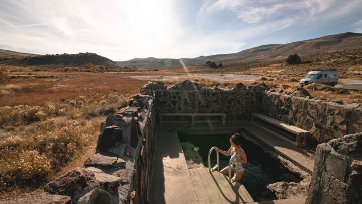
Snively Hot Springs
Despite the somewhat remote location, the Snively Hot Springs is a favorite in the Owyhee Canyonlands. The springs sit at the end of a dirt road, but it’s just a short walk from the parking lot to the water.
This lovely oasis features a variety of pools that range in temperature, and while there are no amenities, you won’t miss them while you soak up the incredible scenery.
This is a more accessible and, therefore, more popular hot spring, so expect to see other people here.
RELATED: 14 Oregon Hot Springs That Are Totally Worth the Trip!
6. Rafting the Owyhee Canyonlands
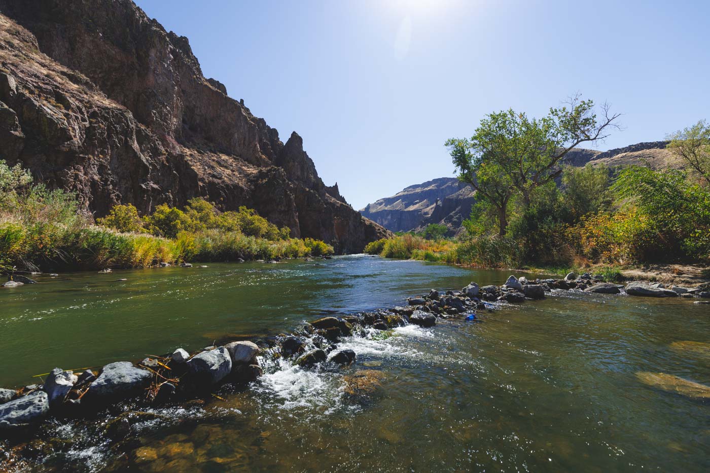
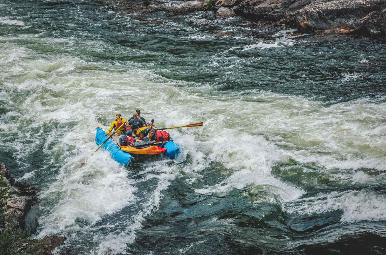
Dubbed “Oregon’s Grand Canyon” by the New York Times, we are talking big time water. Catch some white water action or just meander as you gaze at 1,000-foot canyon walls such as you’d find in Green Canyon Dragon.
This is a Mecca for white water rafting, and depending on what time of year you visit and which section you tackle, you’ll find thrilling rapids, hot springs, stunning scenery, and plenty of wildlife.
There are even white sandy beaches dispersed along the Owyhee, so you can stop for a picnic, some sunbathing, or simply admire the stunning scenery.
RELATED: 7 of The Most Legendary Rivers For White Water Rafting in Oregon
7. Fishing in the Owyhee Canyonlands
Some would say – mistakenly – that there is not much adventure in fishing inland. Part of the adventure in fishing the Canyonlands is getting there.
Take, for example, the Upper Owyhee River and the confluence of its three forks. Fly casting for native redband trout is pure joy. You may not see a fellow angler the entire day. Just you and the fish.

Fishing man-made Lake Owyhee is best by boat and only in the high water spring and early summer season.
Here, you will find a fisherman’s delight of mostly non-native fish, including large and smallmouth bass, plus perch, crappie and catfish that are as good to eat as catch.
Below the dam is a utopia for Owyhee fishing. Trophy-size brown trout rule, yet it’s a strict catch-and-release species. Hatchery rainbows are also present but not in abundance.
RELATED: 29 Awesome Things to Do on an Eastern Oregon Road Trip
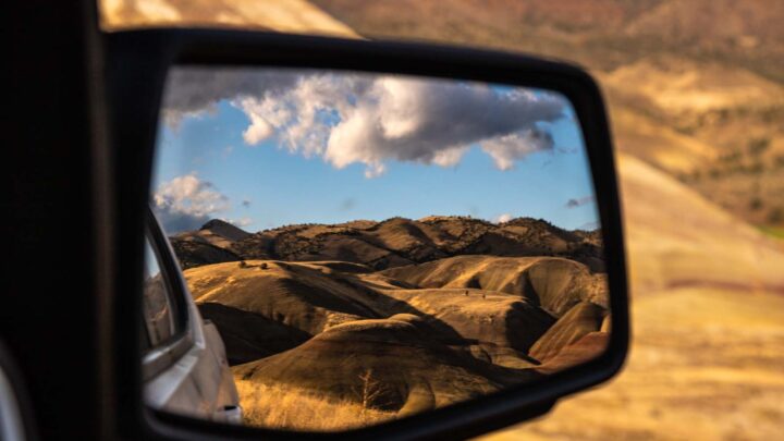
8. Succor Creek State Natural Area
Eastern Oregon, and Owyhee Canyonlands in particular, is known for the alien-esque landscape, the otherworldly rock formation, and the grandeur of unspoiled outdoor spaces.
For a stunning example of all these things, spend some time in the Succor Creek State Natural Area. This area spoils visitors with a variety of landscapes, tons of wildlife, and plenty of epic activities like hiking, OHV riding, and more.
READ MORE: Exploring Succor Creek State Natural Area in East Oregon
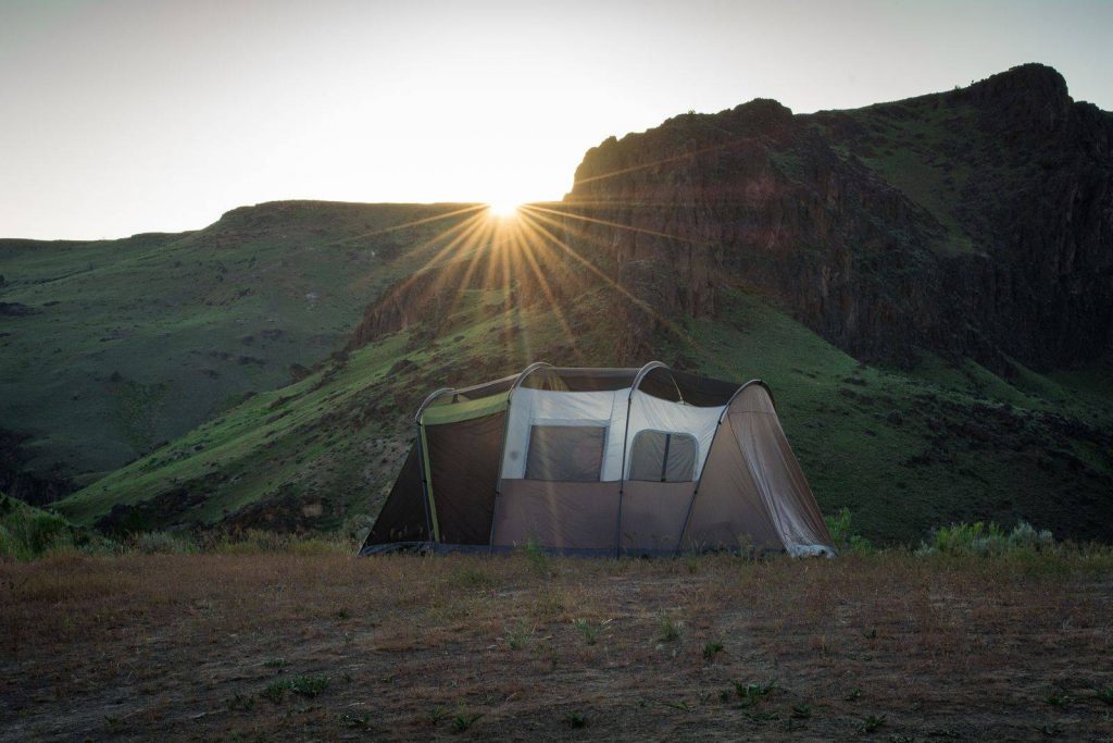
9. Camping in the Owyhee Canyonlands
There are four notable campsites, each is peaceful, with star-studded nights where you can see the Milky Way and otherworldly objects free of light pollution.
Anderson Crossing
Located on a somewhat rigorous washboard road sits Anderson Crossing, a primitive campground with secluded campsites and beautiful scenery. Although remote, most small and mid-size SUVs can manage the journey here.
This campground is popular as a starting point for multi-day backpacking trips, with easy access to Louse Canyon, smaller horseshoe canyons, caves and trout ponds (late spring and early summer).
Succor Creek State Natural Area Campground
The Succor Creek State Natural Area campground is about as good as it gets in the Owyhee Canyonlands, especially if you’re a birder, wildlife spotter, or rock hound.

The campground itself is quite rustic, but that’s pretty run-of-the-mill for this area. There are eight primitive sights, plus 15 walk-in sites. Amenities include vault toilets and epic views, but that’s about it! Bring your own water!
Three Forks Campground
Three Forks Campground is aptly named as the spot where three forks of the Owyhee River join. It’s a popular area for redband trout anglers and just exploring. You could also wade across the river to the Three Forks Hot Springs and soak in the pools.
Note that this campground is on private property and subject to the goodwill of the landowner. Respect of the springs will ensure its continued access. It’s a seldom-used road to Three Forks, truly and not to be taken when raining or with threatening skies.
Lake Owyhee State Park
The state park has two campgrounds to pick from: Indian Creek and McCormack.

If you are boating or want to be lakeside, Indian Creek Campground has 22 sites with electric and water, plus two cabins. McCormack has 29 sites with water only, no electric, but much appreciated hot showers and flush toilets.
Both are at boat launches, and you can pick up ice and firewood at either between April 15th and October 15th.
When you are ready to explore a truly wild and primitive section of Oregon, get yourself to the Owyhee Canyonlands.
Read our other guides in Eastern Oregon:
- Camping at Alvord Desert: What to Know!
- Your Guide to Visiting Wallowa Lake— 9 Best Adventures!
- A Guide to Hart Mountain Hot Springs & What to Do in the Area
- 29 Awesome Things To Do on an Eastern Oregon Road Trip
- Owyhee Canyonlands: 9 TOP Things to Do
- Guide to The Strawberry Mountain Wilderness
- The Painted Hills: Oregon’s Most Alien Landscape
- 7 Cool Things to do Around Summer Lake, Oregon
- Willow Creek Hot Springs in Oregon
- Exploring Around Jordan Valley, Oregon
- Exploring Succor Creek State Natural Area in East Oregon
- 7 Awesome Things To Do in Sumpter, Oregon
- Your Guide to The Ochoco National Forest
More Things to Do in Eastern Oregon

Don’t leave yet! Check out more things to do in eastern Oregon and more posts on Oregon’s adventures.