Three Capes Scenic Route on The Oregon Coast
Running from Tillamook to Pacific City, the Three Capes Scenic Route is one of the most stunning drives on the Oregon Coast.
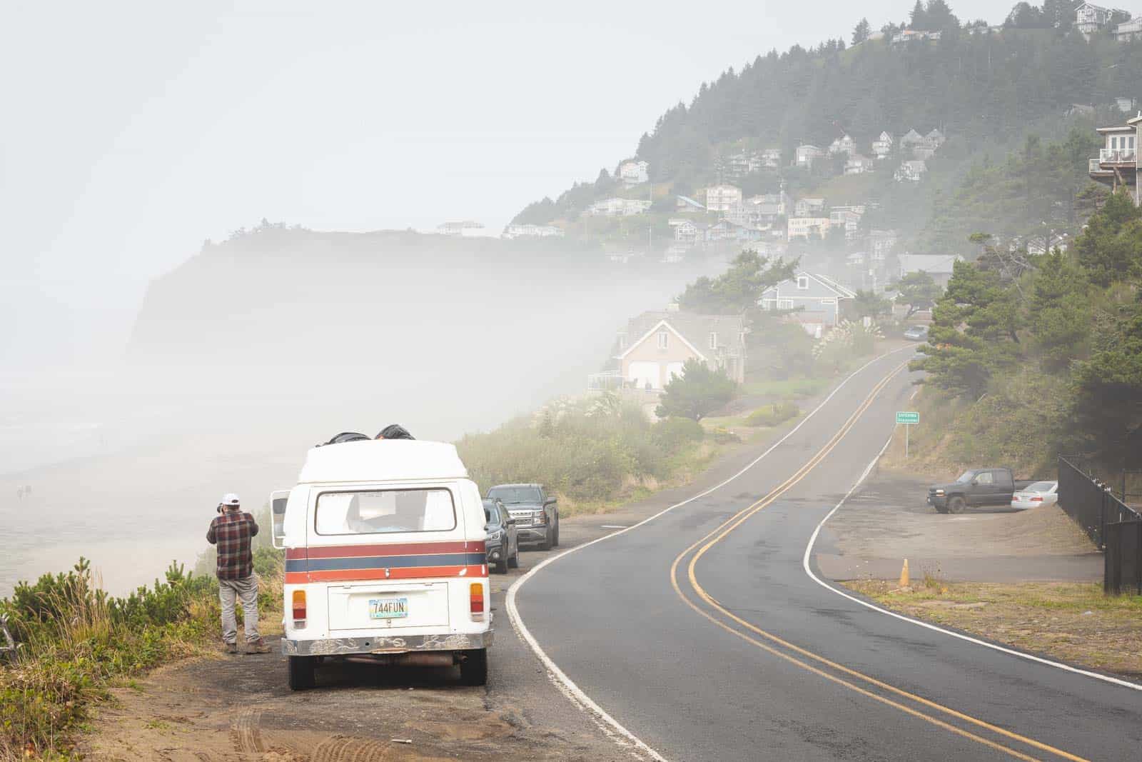
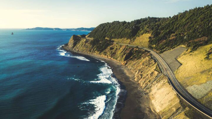
The route will take you past some of the most striking scenery in the area, including the three capes of Cape Meares, Cape Lookout, and Cape Kiwanda. Hugging the ocean, this alternative route certainly justifies leaving the highway, with new sights around every corner.
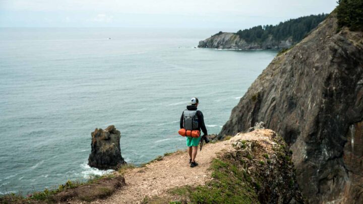
The twisting road offers glimpses of the ocean, running through quaint beach towns, dairy country, and second-growth forest. Although the drive itself is beautiful, be sure to stop at each cape and experience what each has to offer. Each headland has a distinctive ecosystem, with hikes, views, lighthouses, forests, and wildlife.
The Three Capes Scenic Route Loop
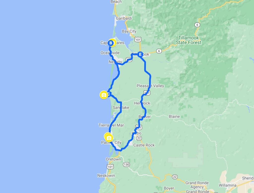
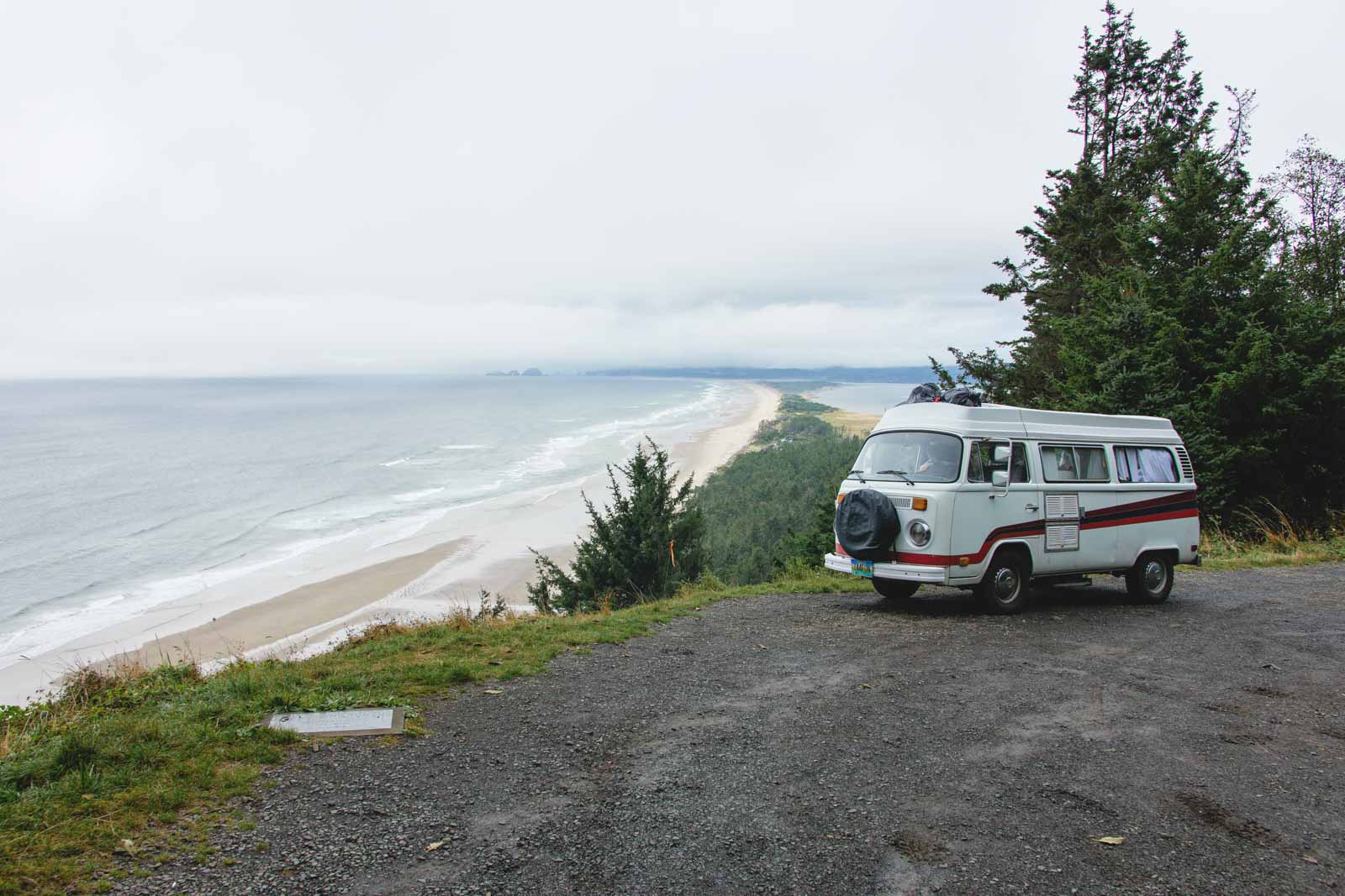
Starting at the town of Tillamook, US-101 veers inland for 50 miles. However, the scenic alternative is the Three Capes Scenic Route, which runs for 40 miles to Pacific City. The loop reaches the mouth of Tillamook Bay at Cape Meares.
If you’re coming from the north, from Tillamook, you’ll pass through the coastal villages of Oceanside and Netarts to reach Cape Meares. Unfortunately, the route to head north around the loop has been closed for quite some time so there’s a tiny bit of backtracking here as the map above indicates.
After heading back down, you’ll climb steadily onto the shoulder of Cape Lookout. Head a bit more south after that and you’ll reach the wild Cape Kiwanda, which sees some of the state’s wildest surf.
If you are coming from the south, you want to follow Neskowin’s signs to Pacific City and continue north. Then when you’ve reached Cape Meares, you’ll backtrack a bit and head to Tillamook to continue to your next Oregon adventure.
RELATED: 11 Adventurous Things To Do In Pacific City
📍 GET THE ULTIMATE PNW MAP 🗺️
Get our curated list of the best adventures, things to do, and places to grab a brew loaded onto your maps with just two clicks!
✅ Waterfalls ✅ Hikes ✅ Viewpoints
✅ Craft breweries ✅ National Parks ✅ 1400+ Pins


How to Do The Three Capes Scenic Route?
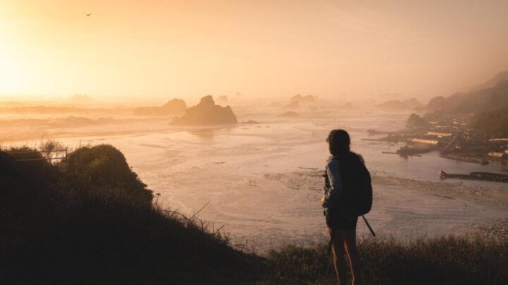
There is no best time to take the Three Capes Scenic Route, although many people choose summer as the trails are less muddy and warmer. However, if you choose the winter months, you are more likely to have the capes to yourself, or visiting during the whale migration season (March-June) will give you a better chance of observing these majestic beasts.
The route can easily be done one way, as an out and back drive, or you could turn it into the Three Capes Scenic Loop by taking Route 101 back to where you started.
If you didn’t stop at all, the Three Capes Scenic Loop would only take you a couple of hours. Still, there is no way you will be able to fully take in the beauty of the area or each of the cape’s district personalities if you didn’t stop to take in the views, do a few hikes, relax on the beach or explore the coastal towns along the way.
If you really want to explore all that this route has to offer, you could consider turning the drive into a multi-day adventure, exploring a cape a day, or stopping for the night at one end of the route before heading back the following day.
RELATED: 11 Stunning Things To Do on the North Oregon Coast
Cape Meares
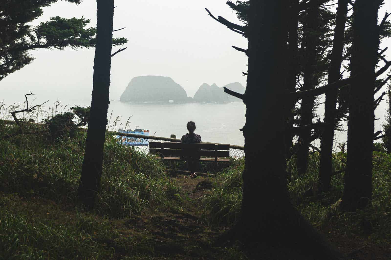
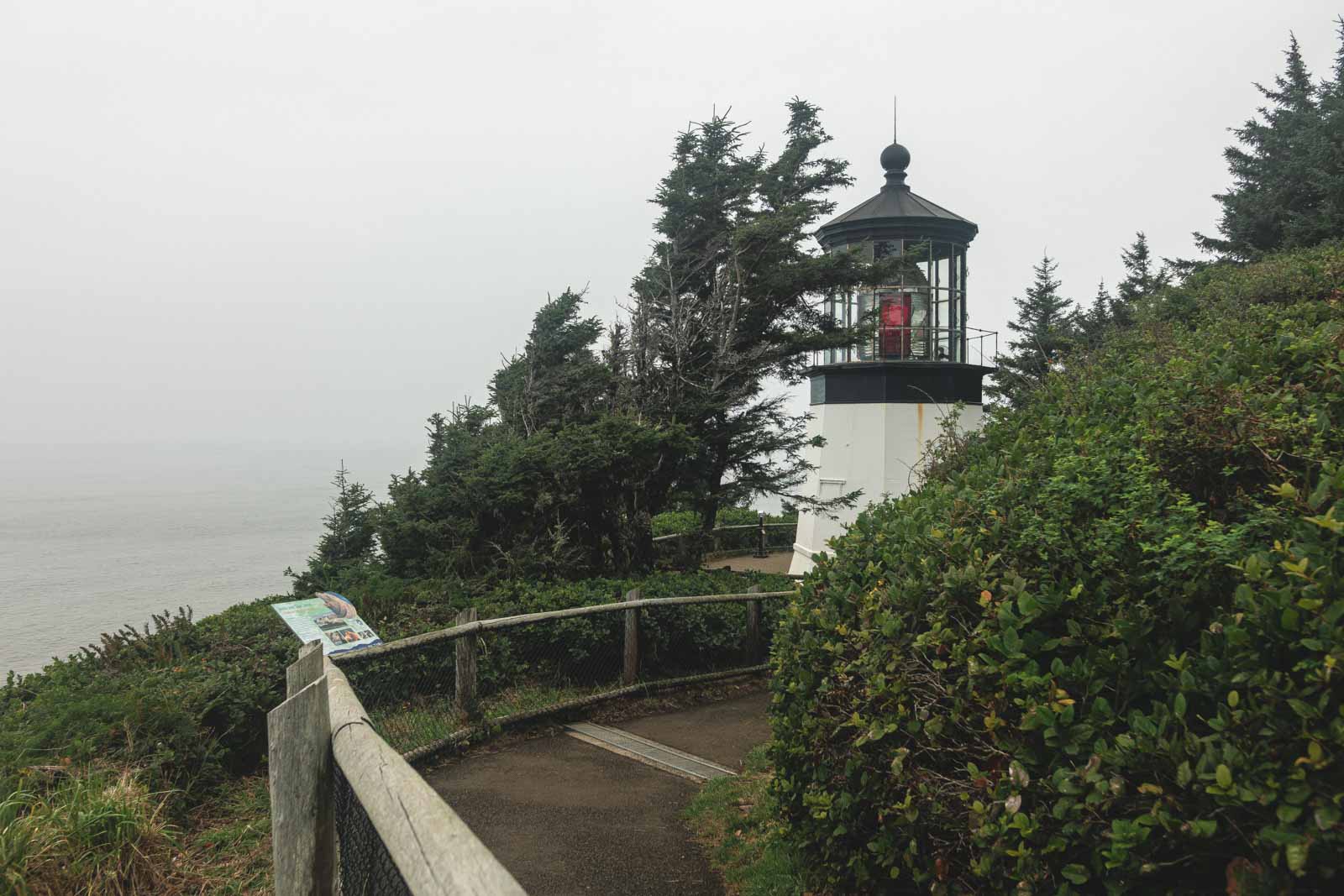
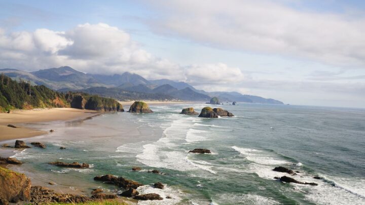
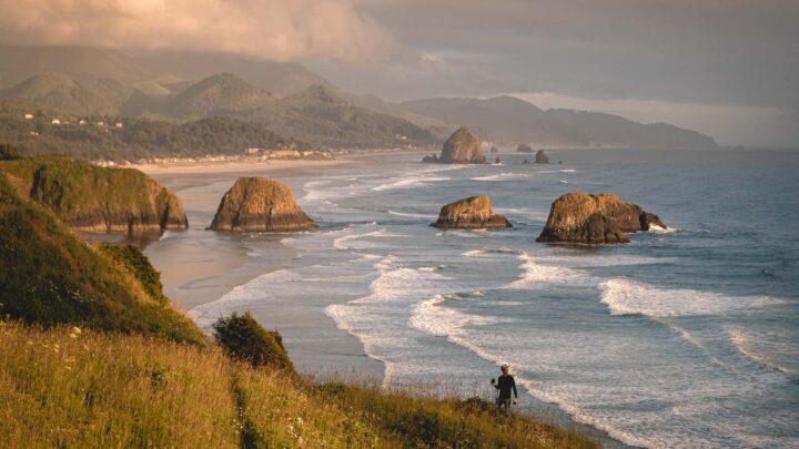
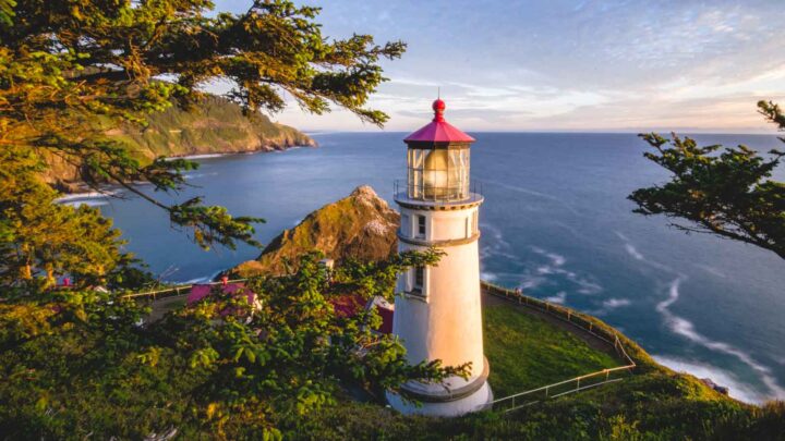
Cape Meares is one of the most dramatic of the three capes, with vertical sea cliffs plunging into the raging Pacific below. But it is this rugged beauty that draws visitors year after year. One of the most iconic sights on the cape is Cape Meares Lighthouse which you can hike right up to.
Other points of interest include the Octopus Tree, one of the most magnificent spruces you’ll ever see. The tree is a huge 14 feet across its base, boasting big tentacle-shaped branches reaching outwards and to the sky. Big Spruce is another famous tree on the cape, the oldest Sitka spruce in Oregon, towering 144 feet high.
The cape is home to some great hikes, including up to the cape, to the beach, and points of interest, with endless viewpoints along the way. A less-traveled hike is the Cape Meares Beach Trail, taking you down the cape to a secluded, rocky beach, which can be a bit of a scramble.
The Cape Meares National Wildlife Refuge is a mecca for wildlife lovers, home to a huge variety of sea birds, and you may even have a chance of spotting some whales.
Two other notable features of this cape are the rock formations of Pillar Rock and Pyramid Rock, which form part of the Oregon Islands Refuge. These two sea stacks alone are estimated to harbor more than 20,000 nesting seabirds.
READ MORE: Exploring Cape Meares State Scenic Viewpoint
Cape Lookout
The dramatic headland of Cape Lookout juts 2-miles dramatically out into the Pacific Ocean. It dates back 15 million years from when the lava flows from Eastern Oregon poured down the Columbia River.
The state park around the cape is home to over 8-miles of trails which range from family-friendly jaunts to longer hikes that will take you all the way to the tip of the cape, where the views are breathtaking.
The Cape Lookout Trail is one of the most popular in the park, a route of about 5-miles that snakes through dense pine forest but never straying far from ocean views. Once you reach the cape, you really will understand why it is called Cape Lookout.

Cape Lookout is one of the best spots for whale watching along the Oregon Coast, as the views from the peak allow you to see for miles in all directions. You are most likely to spot some of these extraordinary creatures if you visit during peak whale-watching time.
It is not just the cape that makes this park such a great spot on the coast. The shoreline below the cape is long and sandy and can be reached after crossing a wide section of cobblestones. The beach is also a popular area for beachcombing, with reports of glass floats being found here.
READ MORE: Your Guide to Cape Lookout State Park
GET THE ULTIMATE PNW MAP
Get our curated list of the best adventures, things to do, and places to grab a brew loaded onto your maps with just two clicks!
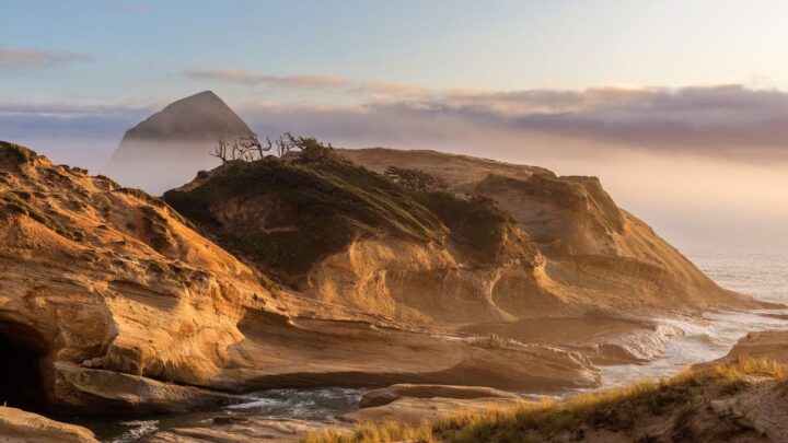
Cape Kiwanda
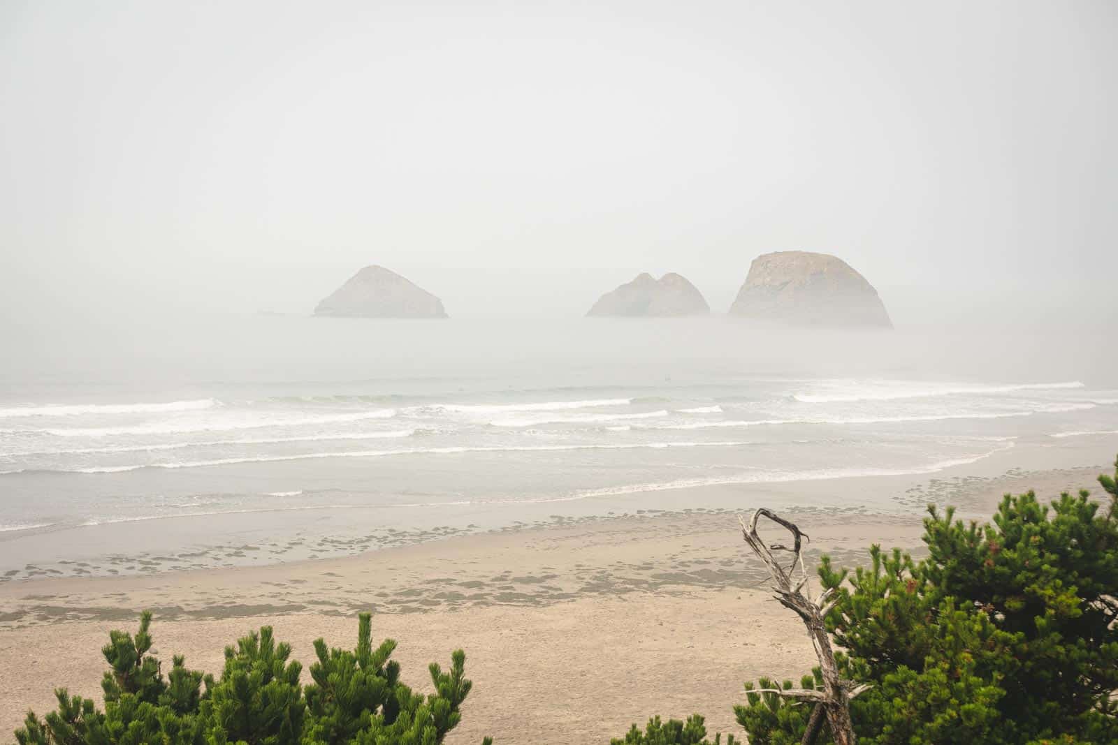
This is the smallest cape on the route, but that doesn’t mean it should be missed. The sandstone escarpment juts half a mile out to sea, sheltering the town of Pacific City that sits below it. The buffer of Haystack Rock protects it largely from the elements and relentless pounding sea.
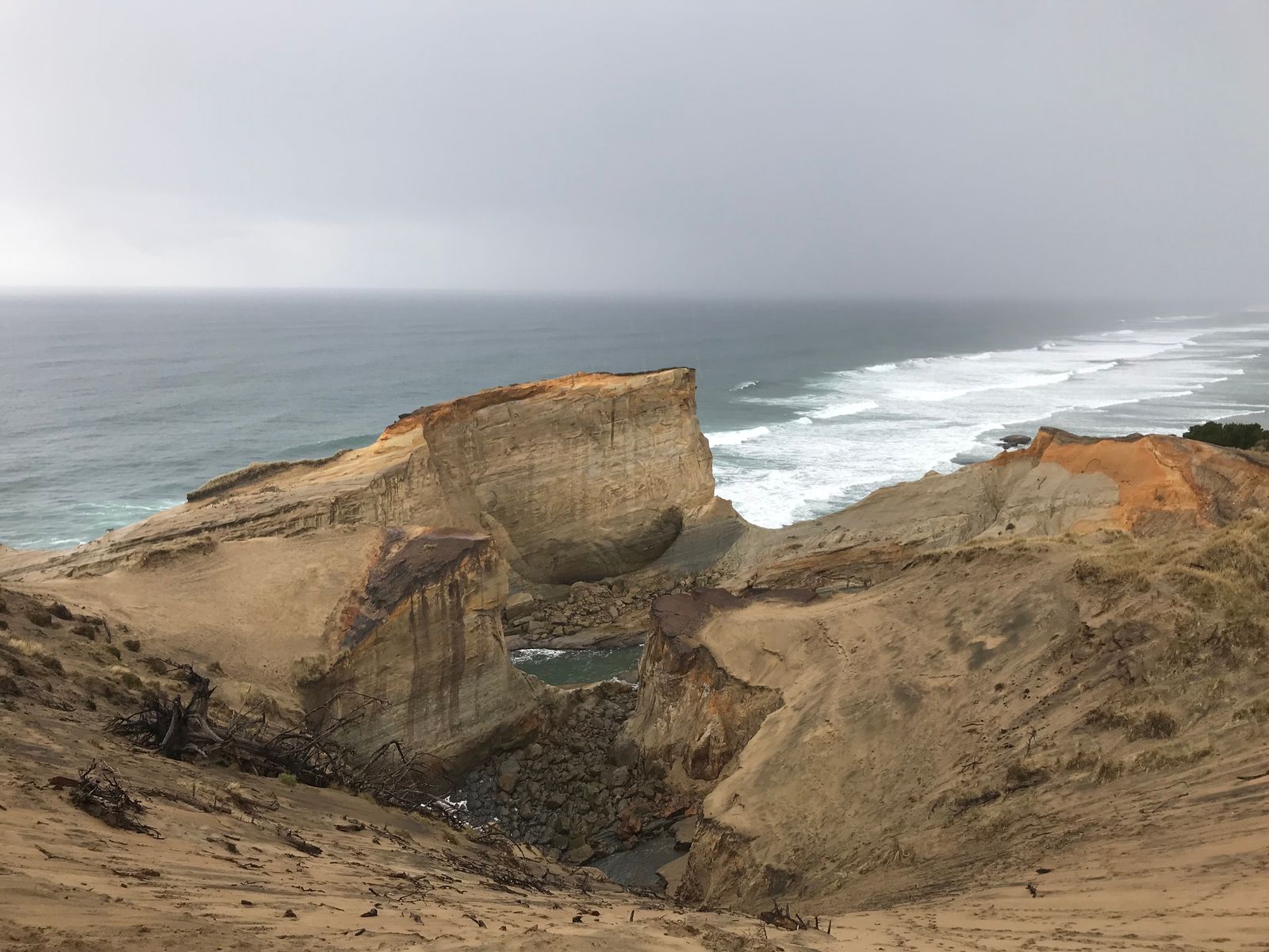
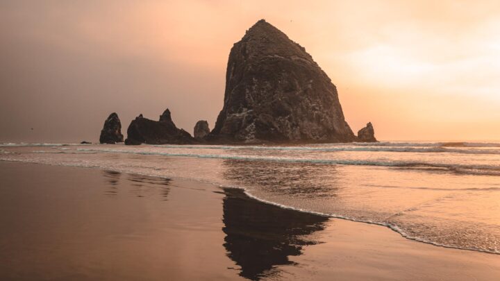
At its feet, the pounding tide rushes steadily in and out, carving smooth formations in the basalt. In the distance, you should see the tip of Haystack Rock, not to be confused with the rock formation of the same name at Cannon Beach.
If you come to Cape Kiwanda at the right time of day, you may be treated to the unique spectacle of the launch or return of the fleet of dory boats, a tradition that dates back to the 1920s. Another must-do activity at the cape is to hike to the top of the huge, 240-foot sand dune – it is pretty steep but completely worth the tough climb when you see the views.
READ MORE: Exploring Cape Kiwanda Near Pacific City, Oregon
Pacific City beach is a hotspot for surfers throughout the year. Surfers flock to the area to enjoy some of the longest waves on the Oregon Coast.
If hiking is not your thing, you could take a good old-fashioned stroll along the coast or explore the state natural area. The town of Pacific City is a bustling hub of hotels and restaurants, the perfect place to grab a drink before continuing on this coastal adventure.
More Things to Do on The Oregon Coast
We hope this post helped you better explore the Three Capes Scenic Route! Check out more posts on the Oregon Coast and even more adventures around the state.