7 Waterfall Hikes in Oregon’s Cascade Range You’ll Love
If you enjoy hiking and the peaceful sound of flowing water, Oregon’s Cascade Range offers some stunning waterfall trails that are perfect for exploring. Whether you’re looking for a quick nature escape or a rewarding day hike, these spots showcase the natural beauty of the area.
You’ll find waterfalls that vary in size and setting, each with its own unique charm to enjoy along your hike. These trails offer a chance to connect with nature, all within the diverse landscapes of the Cascades.
Table of Contents
Multnomah Falls Trail
The Multnomah Falls Trail is a must-do if you’re near Oregon’s Cascade Range. It’s about a 2.6-mile round trip with a steady climb that rewards you with amazing views of the tallest waterfall in Oregon, standing at 620 feet.
You start right from the big parking area along the Columbia River Highway. The trail takes you up to the iconic upper viewpoint, where you can look down at the lodge and the falls’ cascading tiers.
Along the way, you’ll pass through lush forests full of ferns and wildflowers. It’s a perfect mix of nature and easy access, making it great for most skill levels. You can learn more about the trail here.
📍 GET THE ULTIMATE PNW MAP 🗺️
Get our curated list of the best adventures, things to do, and places to grab a brew loaded onto your maps with just two clicks!
✅ Waterfalls ✅ Hikes ✅ Viewpoints
✅ Craft breweries ✅ National Parks ✅ 1400+ Pins


Salt Creek Falls Loop
If you’re looking for a solid day hike, the Salt Creek Falls Loop is a great choice. The trail offers easy access to Oregon’s second tallest single-drop waterfall, plunging 286 feet.
You’ll start at the Salt Creek Falls Observation Site, where a short paved trail leads you to a viewing platform. For a closer look, a steeper spur trail takes you down toward the base of the falls.
The loop also includes Diamond Creek Falls, adding more scenic variety. This spot is perfect for easygoing hiking and enjoying classic Pacific Northwest forest views. Check out this Salt Creek Falls hike for more details.
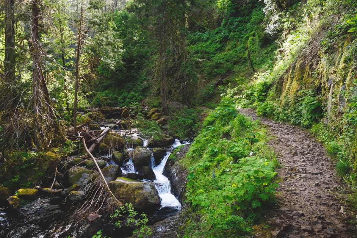
Ramona Falls via Pacific Crest Trail
You’ll start this hike by following the Pacific Crest Trail through a lush, shady forest. Early on, you’ll cross the sandy banks of the Sandy River, which offers a peaceful, scenic spot.
As you approach Ramona Falls, the trail opens up to reveal the waterfall’s unique fan-shaped cascades over basalt rock. The sound of water and the mossy surroundings make this a great place for a break.
The loop is about 7 miles long with some moderate elevation gain. Most people hike it counterclockwise, staying on the Pacific Crest Trail before turning onto the Ramona Falls Trail. This route gives you a great mix of forest, river views, and the waterfall itself.
For more info, check out the Ramona Falls Loop details on the AllTrails site.
Punch Bowl Falls Hike
If you’re looking for a scenic and fairly easy hike, Punch Bowl Falls is a great spot. You’ll follow the Eagle Creek Trail through lush forest and moss-covered cliffs. The waterfall spills into a deep, clear pool that looks just like a punch bowl.
The trail is about 3.8 miles round-trip with some elevation gain. Be ready for muddy sections and rocky areas, especially near the falls. Crossing the creek might require water shoes to keep your feet dry. The views are worth the effort.
Check out more details on the Punch Bowl Falls hike.
Sahalie Falls Walk
When you visit Sahalie Falls, expect a pretty easy walk along well-maintained trails. The falls plunge about 100 feet over a lava dam, creating a powerful, scenic drop.
You’ll find the trail right off Oregon Route 126, making it simple to reach. Along the way, you can enjoy views of the McKenzie River and the lush forest around you.
This spot is perfect if you want a quick nature break with stunning views. If you’re into photography or just want to soak up the sound of rushing water, Sahalie Falls won’t disappoint. Check out more details on the Sahalie Falls hike.
🏨 Need a place to crash nearby?
From rustic cabins to boutique inns—check prices and availability in just a click.
Shellburg Falls Hidden Trail
If you’re looking for a quiet spot, Shellburg Falls Hidden Trail is a great pick. This trail takes you through lush forest and ends at a scenic waterfall tucked away in the Santiam State Forest.
The hike is fairly short but can be a bit technical. You’ll want to visit after rain for the best water flow.
Keep in mind, you can no longer walk behind the falls, but the views from the trail are still worth it. Parking and the trailhead are easy to find near Shellburg Road.
Learn more about this trail at hikeseeker.com.
Kentucky Creek Double Falls
When you hike the Kentucky Falls Trail, you’ll come across the impressive double waterfalls on Kentucky Creek. The two falls are close together and create a beautiful scene, especially after rain.
The trail is about 4.4 miles roundtrip, so it’s a solid hike but not too long. You’ll pass Upper Kentucky Falls before reaching the lower double falls. Don’t miss the wooden viewing platform near the base—it gives you a great spot to take it all in.
The forest around the falls is lush and shady, perfect for a peaceful break from the trail. You’ll want to bring sturdy shoes because some parts of the trail can get steep. Check out more details about the Kentucky Falls hike.