
Thor’s Well on the Oregon Coast only performs for about two hours a day, and most people show up at the wrong time
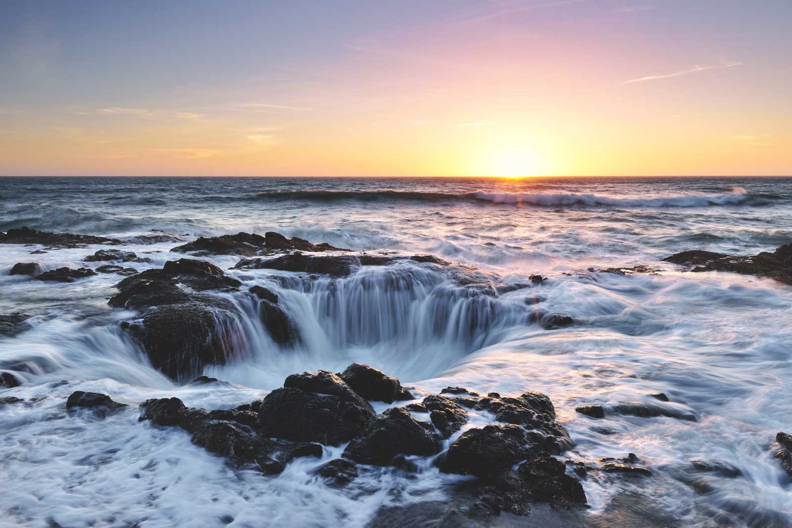
Most people who pull off Highway 101 for Thor’s Well see a hole in the rocks. The ones who check a tide table first see the ocean try to swallow itself.
The difference isn’t luck. It’s a roughly two-hour window around high tide that almost nobody plans around before they drive out.
Psst — we made you a West Coast Adventure Map. Nearly 1,900 of our favorite spots, already pinned, ready to load into Google Maps in two clicks — grab it here.
The two-hour window that actually matters
Thor’s Well is a collapsed sea cave carved into the basalt shoreline of Cape Perpetua, a few miles south of Yachats on Highway 101. At low tide, it’s basically a dry pit — interesting to look at, but static.
The show starts roughly an hour before high tide and runs through about an hour after it, when incoming waves surge up through the hole and blast water skyward before draining back down. Outside that window, you’re mostly looking at rocks.
Pull up a tide table for the Yachats stretch of coast before you go, and build your visit around the nearest high tide rather than whatever hour you happen to be driving through.
📍 GET THE ULTIMATE PNW MAP 🗺️
Get our curated list of the best adventures, things to do, and places to grab a brew loaded onto your maps with just two clicks!
✅ Waterfalls ✅ Hikes ✅ Viewpoints
✅ Craft breweries ✅ National Parks ✅ 1400+ Pins


Low tide is safer. High tide is the reason you drove out here
Here’s the trade-off nobody quite says out loud: low tide is the safest time to walk the basalt shelf, and it’s when the tide pools nearby are at their best. High tide is when Thor’s Well actually performs, and it’s also when rogue waves are most likely to sweep across the rocks without warning.
The footing out there is wet, slippery basalt, and sneaker waves on this stretch of coast have hurt people who got too close. Watch from the marked viewing areas, keep real distance from the edge, and don’t turn your back on the ocean — that’s not an opinion, it’s just how the accidents keep happening.
We’ve walked through the full approach and what to expect up close in our deep dive on visiting Thor’s Well, if you want the longer version before you go.
Devil’s Churn is one minute up the road
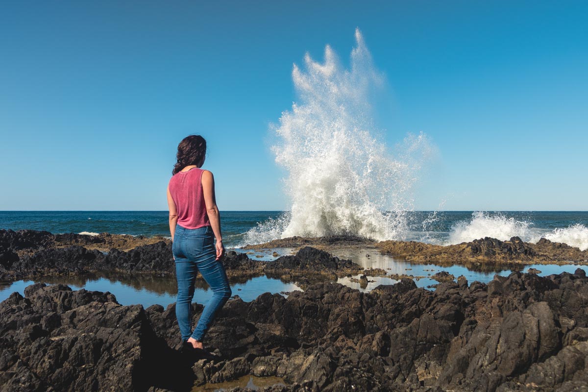
Devil’s Churn has its own parking lot just north of Thor’s Well, with a paved trail leading down from the lot to the water. It’s a narrow, wave-carved chasm that channels incoming swells into a genuinely violent churn, no tide-timing math required — it looks dramatic most of the time the surf is up.
Both stops are short walks off their own parking lots, so you can easily hit them back to back without eating up your whole afternoon.
While you’re up top, don’t skip the rest of Cape Perpetua
Cape Perpetua itself tops out around 800 feet, and the overlook up there is the highest viewpoint you can reach by car on the entire Oregon Coast. On a clear day, you can see close to 70 miles of coastline from the historic stone shelter the Civilian Conservation Corps built at the top in 1934, a 0.4-mile round trip from the parking lot.
If you want a longer stretch of legs, the Giant Spruce Trail is an easy 1.9-mile round trip through old growth to a Sitka spruce over 550 years old and 185 feet tall. We’ve mapped out the full lineup of stops in Cape Perpetua if you want to build a whole afternoon around it.
Cape Perpetua Scenic Area charges $5 per vehicle per day, payable at the visitor center or the self-pay station at Devil’s Churn. A NW Forest Pass covers it too, along with the Oregon Coast Passport, if you’re already carrying one for other stops along 101.
Trip tips: grab a rental car to make the coastal drive, lock in a hotel in Yachats before the good rooms are gone, or skip both and book a camper van if you’d rather wake up parked near the water.
Rules and fees change — always confirm current requirements before you go.
Have you timed a visit to Thor’s Well around the tide, or did you get the anticlimactic version like most people?