Hat Point puts you a mile above the Snake River, and the only way up is 22 miles of one-lane gravel
Everyone who’s driven the easy way into Hells Canyon country will tell you they’ve seen it. They haven’t — not really, not from a mile above the river, with nothing between you and the Snake but a fire lookout tower and a whole lot of open air.
That view belongs to Hat Point, a working fire lookout perched on the Oregon rim of Hells Canyon at the end of a 22-mile forest road out of Imnaha. It’s not a detour you stumble into on the way to somewhere else — it’s the destination.
Psst — we made you a West Coast Adventure Map. Nearly 1,900 of our favorite spots, already pinned, ready to load into Google Maps in two clicks — grab it here.
Hells Canyon is North America’s deepest river gorge, cut by the Snake River to a depth of 7,993 feet — deeper than the Grand Canyon, which tops out around 6,000 feet at its deepest point. From Hat Point, the river sits more than a mile below you, with the Seven Devils Mountains rising across the gorge on the Idaho side.
Getting there means Forest Road 2640, the aptly named Hat Point Road, climbing out of Imnaha for roughly 21 miles before a short final stretch to the lookout. The Forest Service’s own advisory calls it steep and narrow, not recommended for trailers or low-clearance vehicles when the road is wet — which is the polite government way of saying take it slow.
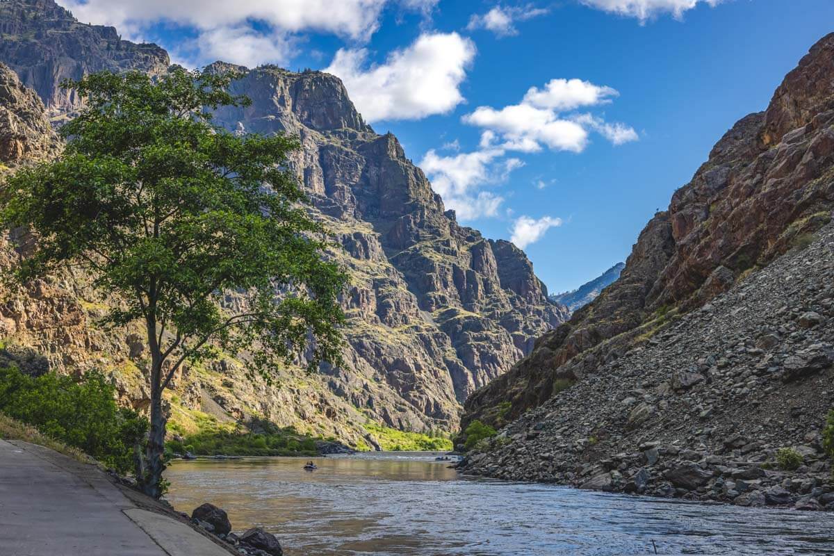
At the top, a working fire lookout tower and a couple of interpretive panels are the only things marking the edge of the continent’s deepest gorge. Climb the tower stairs and the Wallowa Mountains show up behind you, the Seven Devils rise across the canyon, and the Snake River disappears into the haze below — no crowds, no gift shop, just the view doing all the work.
If a one-lane cliff road isn’t how you want to spend your vacation day, the Hells Canyon Overlook out of Joseph gets you a similar panorama on a much easier drive. Hat Point is for the days you actually want to earn it.
Plan on a full day for the round trip from Joseph or Enterprise, since Imnaha itself is over half an hour from either town before the climb even starts. There’s no cell service out here, no potable water at the lookout, and no fee to park — just vault toilets, picnic tables, and whatever you packed in.
The road typically isn’t drivable until summer and closes again once snow returns, so late July sits squarely inside the window. Conditions and closures can shift fast in fire season, so check with the Wallowa-Whitman National Forest before you commit a full day to the drive.
Pair the detour with a broader loop through Eastern Oregon and one wild viewpoint turns into a full road trip. Worth the white knuckles? Stand at the rail with a mile of open air below you, and you won’t be asking anymore.
Trip tips: grab a rental car to make the drive out, lock in your hotel before the good rooms are gone, or skip both and book a camper van instead.
Rules and fees change — always confirm current requirements before you go.