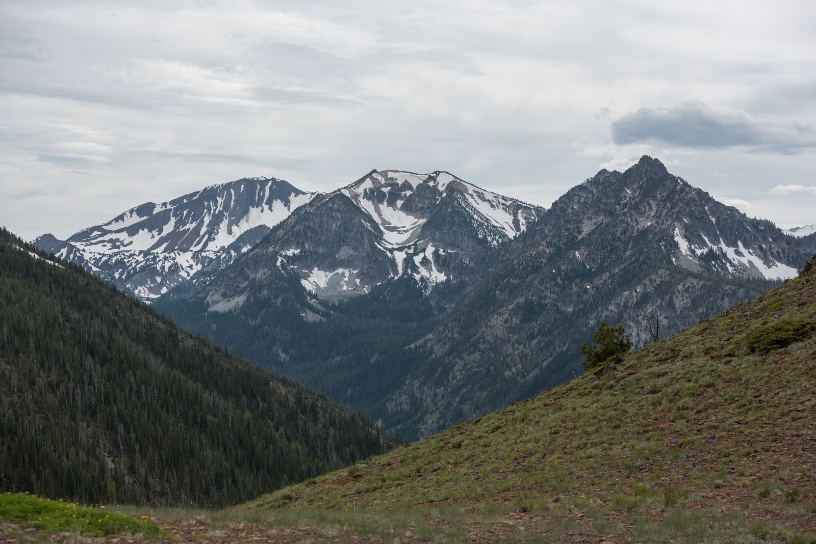
The Wallowa Mountains are Oregon’s version of the Alps, and almost nobody visits
Tell someone from out of state that Oregon has its own Alps, and they’ll assume you’re exaggerating. Drive out to the Wallowa Mountains in the state’s far northeast corner, and you’ll understand why locals just started calling them that instead of arguing about it.
Jagged granite peaks, a glacier-carved lake the color of blue Gatorade, and a town built almost entirely around bronze sculpture — this place makes you wonder how it stayed so quiet for so long. Even by Oregon standards, where every corner of the map seems to hide something dramatic, the Wallowas feel like a different state entirely.
The catch is the drive. The Wallowas sit about 330 miles from Portland, tucked against the Idaho border, which means this isn’t a weekend impulse trip for most of the state. That distance is also exactly why it’s stayed uncrowded, and why late summer, once the high trails clear of snow, is the best window to go.
Ride a tram to 8,000 feet without hiking a step
The Wallowa Lake Tramway hauls you 3,700 feet up Mount Howard in under 15 minutes flat, gondola-style, no elevation gain required on your end. At the top, easy walking trails wind through subalpine meadows with views stretching across the Wallowa Valley and, on a clear day, into Idaho.
Adult tickets run about $50, and the tram generally operates May through September, so check the current schedule before you drive out — mountain weather doesn’t care about your itinerary. There’s a restaurant at the summit too, which feels a little unfair to everyone who hiked somewhere else that day.

📍 GET THE ULTIMATE PNW MAP 🗺️
Get our curated list of the best adventures, things to do, and places to grab a brew loaded onto your maps with just two clicks!
✅ Waterfalls ✅ Hikes ✅ Viewpoints
✅ Craft breweries ✅ National Parks ✅ 1400+ Pins


Hike to an alpine lake that looks fake in photos
If the tram feels like cheating, the Ice Lake Trail evens things out. It’s a hard 15.6-mile round trip with about 3,400 feet of elevation gain, climbing through the Eagle Cap Wilderness past waterfalls and open granite slopes to a lake so clear and blue it looks color-corrected.
Wilderness permits are free and self-issued right at the trailhead, so there’s no fee to plan around on this one. Budget most of a day for it — this is the hike in the Wallowas actually worth the burning legs.
Bring bug spray if you’re going in July. The mosquitoes near the lake have zero chill.
Wander a tiny town that casts bronze for the National Archives
Joseph, the small town at the base of the mountains, has an odd claim to fame: bronze casting. Valley Bronze of Oregon has been pouring sculptures here since 1982, and their foundry has produced pieces on display at the National Archives and the U.S. Capitol Visitor Center.
Main Street is lined with monumental bronze statues instead of the usual gift-shop clutter, which makes wandering it feel more like an open-air gallery than a pit stop. The foundry runs tours a few days a week for around $20 a person if you want to see how it’s actually made.
Drive to the rim of the deepest river canyon in North America
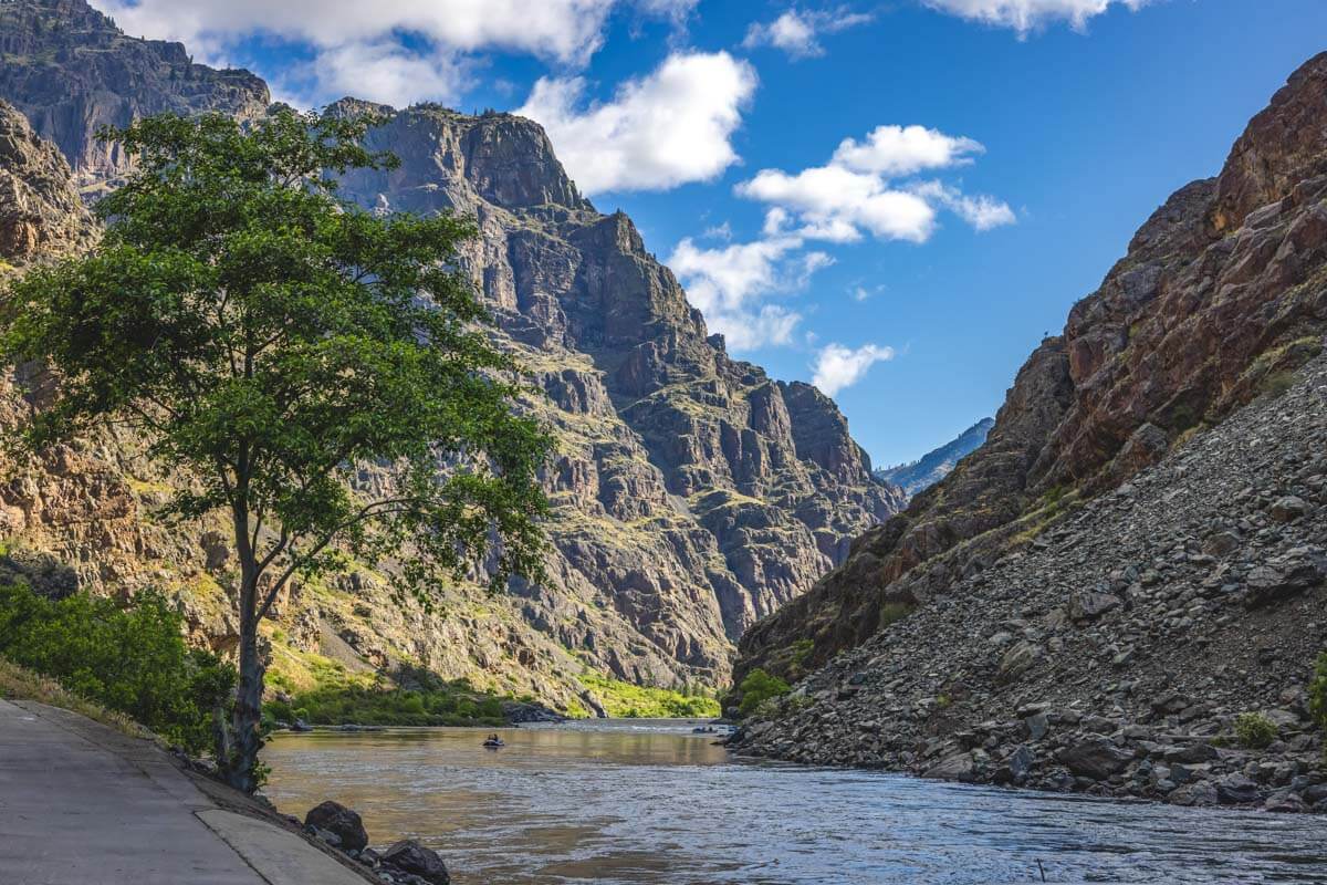
About 37 miles outside of Joseph, the Hells Canyon Overlook puts you at the edge of a gorge cut deeper than the Grand Canyon by the Snake River. The drive there, along the Wallowa Mountain Loop Road, is a destination in itself, winding through forest and switchbacks before the trees suddenly drop away and the canyon opens up beneath you.
Expect around four hours round trip with stops, and bring your own food and water, since there’s nothing out there once you leave town. No fee or pass is required at the overlook, which almost feels like an oversight given the view.
Camp lakeside, right at the foot of it all
Wallowa Lake State Park sits at the south end of the lake with the mountains rising directly behind it, and it’s the obvious home base for all of this.
The park has over 200 campsites between full hookups, tent-only sites, and a couple of yurts, plus showers and restrooms for when you’re done pretending you’re a mountaineer. Reserve ahead if you can — this is one of the more popular camping spots in eastern Oregon, especially once summer hits.

The Wallowas aren’t going to show up on anyone’s “best of the Pacific Northwest” listicle anytime soon, and honestly, that’s part of the appeal.
Pair this with a broader loop through Eastern Oregon and you’ve got a trip that barely resembles the coast-and-Portland itinerary most visitors stick to. Have you made it out to the Wallowas yet, or is this the nudge you needed?
Trip tips: grab a rental car to make the drive out, lock in your hotel before the good rooms are gone, or skip both and book a camper van if you want to wake up lakeside.
Rules and fees change — always confirm current requirements before you go.