8 Easy Oregon Hikes Near Ashland and Medford With Great Views
If you’re looking to enjoy the outdoors without tackling anything too tough, the Ashland and Medford areas in Oregon offer some great options. These easy hikes provide beautiful views and a chance to soak in the natural beauty of Southern Oregon without breaking a sweat.
You can find several accessible trails near Ashland and Medford that are perfect for a relaxed day out, whether you’re hiking solo, with friends, or family. These spots make it simple to enjoy nature, fresh air, and scenic landscapes any time you want.
Table of Contents
- White Rabbit Trail – easy 1.5 to 5 miles through hills above Ashland
- Lithia Park Loop – stroll through downtown Ashland’s city gem
- Mt. Ashland South Flank – popular 7-mile hike with wildflowers and views
- Pacific Crest Trail to Grouse Gap – scenic meadows and Mt. Shasta views
- Pilot Rock Trail – 2.8 miles with impressive rock formations
- Oredson Todd Woods to Mike Uhtoff Trail – forest and nature close to town
- Grizzly Peak Loop – wildflower meadows and panoramic Rogue Valley sights
- Panorama Point – easy to moderate trails with stunning Cascade views
White Rabbit Trail – easy 1.5 to 5 miles through hills above Ashland
You’ll find the White Rabbit Trail just above Ashland, offering hikes between 1.5 and 5 miles round-trip. The trail gently climbs through scenic hills with plenty of local plants and wildlife to spot along the way.
At the top, you can take a break on a bench while enjoying nice views of the area. Some spots might be slippery if it’s been raining, so watch your step. This trail is a solid choice if you want an easy escape into nature close to town.
More details can be found on the White Rabbit Trail AllTrails page.
📍 GET THE ULTIMATE PNW MAP 🗺️
Get our curated list of the best adventures, things to do, and places to grab a brew loaded onto your maps with just two clicks!
✅ Waterfalls ✅ Hikes ✅ Viewpoints
✅ Craft breweries ✅ National Parks ✅ 1400+ Pins


Lithia Park Loop – stroll through downtown Ashland’s city gem
You’ll find Lithia Park Loop right in the heart of downtown Ashland. This easy 2-mile trail takes about 40 to 45 minutes to walk.
The path is mostly paved and well-maintained, making it perfect for a casual stroll or a relaxing break from the city buzz. You’ll pass duck ponds, landscaped gardens, and quiet creekside spots.
Expect to see plenty of locals out walking or birdwatching. Just a heads up—dogs aren’t allowed on this trail. If you want a peaceful, scenic walk close to shops and cafes, this loop is a solid choice.
Explore more about Lithia Park Loop here.
Mt. Ashland South Flank – popular 7-mile hike with wildflowers and views
If you’re up for a moderate 7-mile round trip, the Mt. Ashland South Flank trail is a solid choice. You start near the Pacific Crest Trail crossing at Ashland Meadows, just past Bull Gap Sno-Park.
The hike passes through shady forests and spring-fed meadows filled with wildflowers. You’ll catch plenty of colorful blooms when the season is right.
Along the way, you’ll enjoy sweeping views of Mt. Shasta and the surrounding Siskiyou Mountains. It’s a peaceful trek with a good mix of scenery and nature.
More details about this hike are available at Travel Southern Oregon.
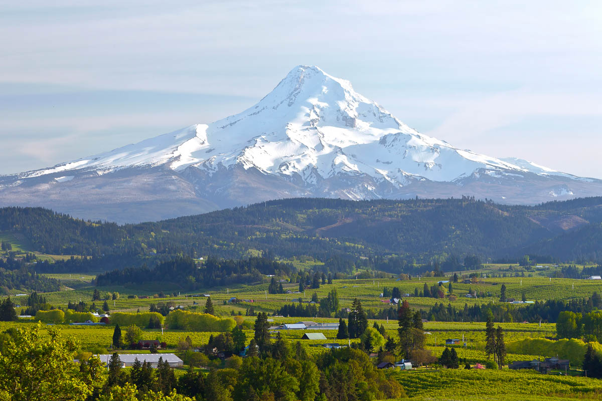
Pacific Crest Trail to Grouse Gap – scenic meadows and Mt. Shasta views
You’ll start your hike along the Pacific Crest Trail near Ashland, passing through forested areas before reaching open, spring-fed meadows. These meadows burst with wildflowers during the summer, offering colorful and peaceful scenery.
As you continue, you’ll reach Grouse Gap, where the trail opens up to stunning views of Mt. Shasta and distant mountain ranges like the Marble Mountains and Trinity Alps.
The trail is mostly easy, with some gentle climbs that make it perfect for a relaxed day hike. It’s a great spot to enjoy nature without too much effort.
For more details, check out the Day Hikes on the Pacific Crest Trail.
Pilot Rock Trail – 2.8 miles with impressive rock formations
You’ll find Pilot Rock near Ashland, offering a 2.8-mile out-and-back trail. It’s a moderate hike with a mix of forest paths and rocky sections.
The last stretch involves some scrambling up basalt cliffs. It’s not for beginners, but the views are worth the effort.
Make sure you wear proper hiking shoes. The trail is generally clear from late spring through fall. You can see Mt. Shasta and surrounding valleys once you reach the top.
If you want details on the route and how to get there, check out this Pilot Rock Trail guide.
🏨 Need a place to crash nearby?
From rustic cabins to boutique inns—check prices and availability in just a click.
Oredson Todd Woods to Mike Uhtoff Trail – forest and nature close to town
You’ll find shaded, peaceful paths as you start in Oredson Todd Woods. The trails here gently wind along creeks and through lush forest, perfect for a laid-back walk.
Connecting to the Mike Uhtoff Trail, the route stays mostly shaded and is pedestrian-only. It’s a quiet escape just minutes from Ashland’s center.
This trail links to other nearby paths like White Rabbit, giving you options to explore more if you’re up for it. The mix of forest scenery and easy access makes it a solid choice when you want nature close by.
Find more details about the trail on the Ashland Woodland & Trails Association site.
Grizzly Peak Loop – wildflower meadows and panoramic Rogue Valley sights
You’ll find the Grizzly Peak Loop just outside Ashland, perfect for an easy day hike. The trail takes you through colorful wildflower meadows, especially vibrant in late spring and early summer.
As you hike, you’ll get panoramic views of the Rogue Valley stretching out below. On clear days, you can see Mount Ashland, Mount McLoughlin, and even Mount Shasta in the distance.
The path winds through mixed forests and basalt cliffs, offering a nice mix of shade and open spots. It’s a lovely way to enjoy nature without too much strain on your legs. Learn more about the trail and planning your visit here.
Panorama Point – easy to moderate trails with stunning Cascade views
If you’re looking for a hike that’s not too tough but still rewards you with great views, Panorama Point is a solid pick. The trails here range from easy to moderate, letting you enjoy the scenery without too much effort.
You get clear views of the Cascade Mountains, including Mount Rainier on a good day. The hike loops through alpine meadows and forests, giving you a bit of variety as you go.
Starting near Paradise Visitor Center, the trail climbs gradually, topping out around 7,100 feet. It usually takes about 4-5 hours to complete, depending on your pace and stops. For more details and trail tips, you can check out this Panorama Point Loop via Skyline Trail.