
Oregon’s first rail-trail runs 21 flat miles through the Coast Range, and one bridge on it beats two football fields
Banks-Vernonia State Trail follows an old logging railroad for 21 miles between two small Coast Range towns, and because trains can’t climb steep grades, neither can you. It’s Oregon’s first rails-to-trails state park, built on a rail bed that hauled logs and lumber for half a century before the state turned it into pavement.
No dramatic elevation gain, no white-knuckle descents — just miles of forest and farmland unspooling in front of your handlebars. That’s the whole appeal.
—
Psst — we made you a West Coast Adventure Map. Nearly 1,900 of our favorite spots, already pinned, ready to load into Google Maps in two clicks — grab it here.
—
A railroad first, a trail second
The Spokane, Portland and Seattle Railway built this line through Washington and Columbia counties in the 1920s to move logs, lumber, freight, and passengers between the mill town of Vernonia and the rail hub at Banks. Burlington Northern later took over the tracks, but logging trucks eventually made the railroad obsolete.
Crews pulled up the rails for good in 1973. Oregon bought the abandoned right-of-way the following year, and by 1990 it belonged to the state parks department as Oregon’s first rail-trail park.
📍 GET THE ULTIMATE PNW MAP 🗺️
Get our curated list of the best adventures, things to do, and places to grab a brew loaded onto your maps with just two clicks!
✅ Waterfalls ✅ Hikes ✅ Viewpoints
✅ Craft breweries ✅ National Parks ✅ 1400+ Pins


Thirteen bridges, one very long trestle
The trail crosses thirteen bridges on its way through the Coast Range foothills, and the biggest one is impossible to miss. Buxton Trestle stretches 733 feet across a ravine and sits 80 feet above the ground — long enough that you could lay two football fields end to end beneath it and still have room to spare.
Time your ride for late morning if you want good light down in that ravine. It’s one of the better reasons to not just drive past on Highway 47.
What the ride actually involves
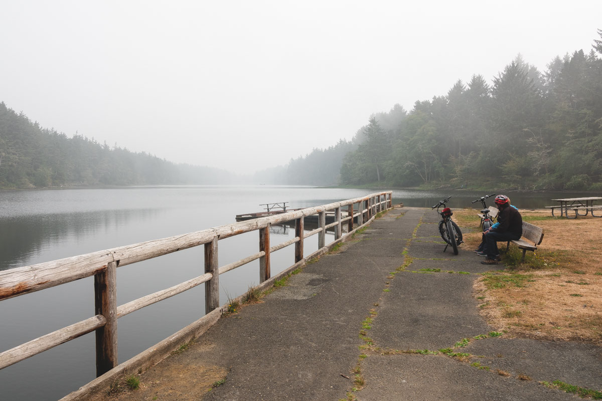
The main route runs 21 miles from Banks in the south to Vernonia in the north, on an 8-foot paved path that runs alongside a separate 4-foot gravel trail for horses. Five trailheads along the way have parking and restrooms, so you don’t have to commit to the full distance in one shot.
The southern half rolls past pastures and hay fields outside Banks. The trees close in for good as the trail climbs into thick Coast Range timber near Buxton, and by the time you roll into Vernonia, you’ve traded farm country for full coastal forest.
Because the path is wide enough, e-bikes are allowed on the whole route — a real advantage on a ride this long, even with a grade this gentle. My call: ride it one direction and shuttle a car back, rather than doing all 21 miles round trip.
The north end connects straight into L.L. Stub Stewart State Park, one of the better camping spots near Portland if you’d rather turn this into an overnight than a day trip.
The pass you already own won’t get you in
Banks-Vernonia requires an Oregon State Parks day-use parking permit — $10 a day for Oregon residents, $12 for everyone else — sold on-site from yellow fee machines at the trailheads. A 12-month permit runs $60 for residents or $75 for non-residents.
The Northwest Forest Pass and America the Beautiful Pass are both explicitly not valid here, since this is state park land, not national forest or federal land. Walk in, bike in, or get dropped off, though, and you skip the fee entirely.
Trailhead hours run 7 a.m. to 7 p.m. from September 2 through November 2, so plan your turnaround time if you’re riding it end to end this fall.
Twenty-one miles is a lot to bite off in one visit — which trailhead are you starting from?
Trip tips: grab a rental car to get out here, lock in your hotel before the good rooms are gone, or skip both and book a camper van instead.
Rules and fees change — always confirm current requirements before you go.