
Mount Thielsen’s summit scramble has killed more hikers than every technical climb on the mountain combined, and most people should stop before it
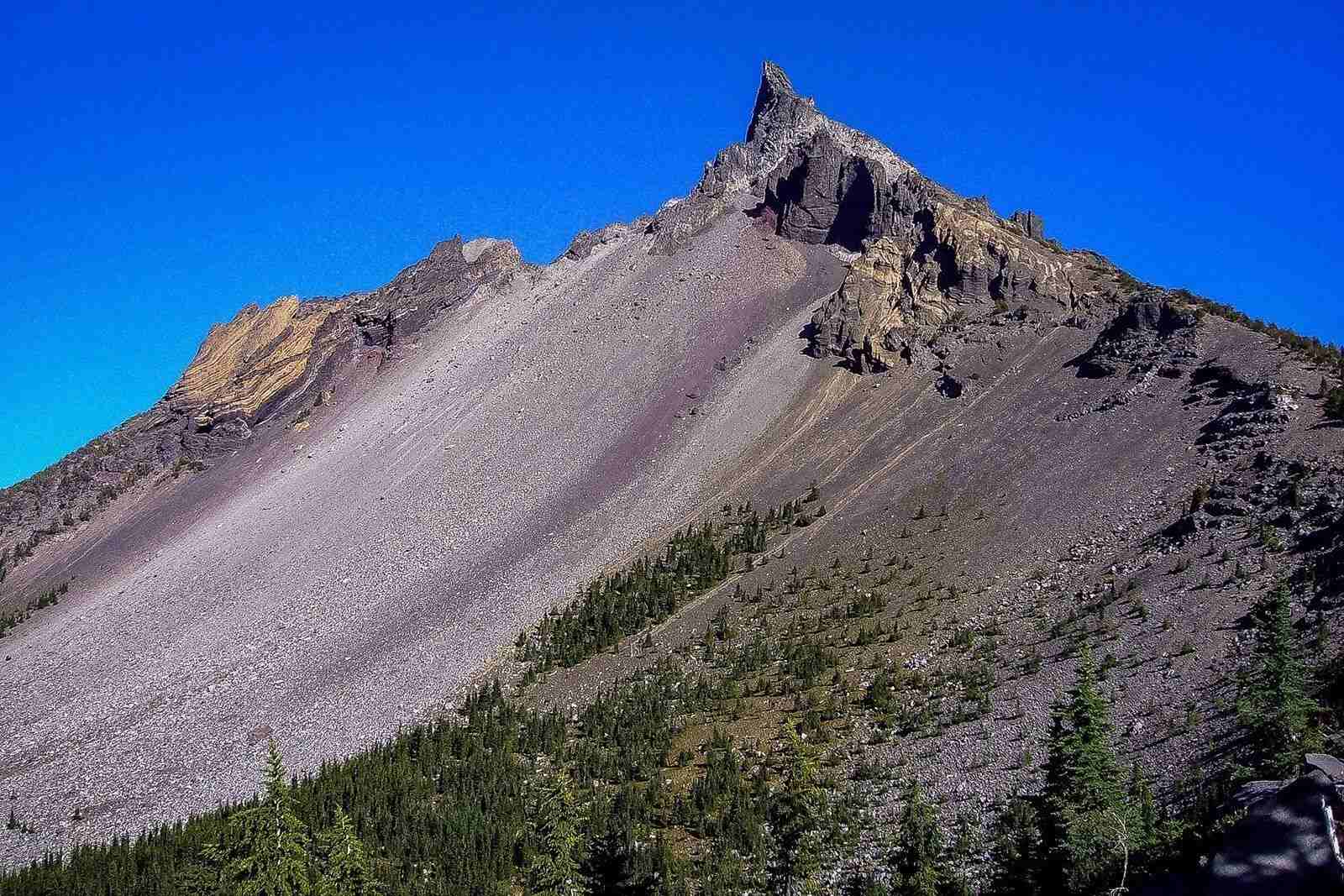
Mount Thielsen looks like it was carved into a point on purpose, and geologically, it basically was. The volcanic spire east of Diamond Lake sheds ice and rock into a summit sharp enough that it earned the nickname “the lightning rod of the Cascades” — it gets struck by lightning more than any other High Cascade peak.
The hiking trail up is open to anyone with sturdy boots and a full water bottle. The scramble to the actual summit is a different story, and it’s worth knowing exactly where that line falls before you go.
Psst — we made you a West Coast Adventure Map. Nearly 1,900 of our favorite spots, already pinned, ready to load into Google Maps in two clicks — grab it here.
The hike up is genuinely doable
Mount Thielsen Trail #1456 runs 9.3 miles round trip with about 3,671 feet of elevation gain, according to AllTrails — a full day, but not a technical one. The path starts through lodgepole pine and climbs above timberline around 7,200 feet, where the trees thin out and Thielsen’s spire keeps popping into view.
At 1.6 miles you’ll pass the Spruce Ridge Trail junction, where the mountain finally shows itself in full. By 2.9 miles you’re inside Mount Thielsen Wilderness and crossing the Pacific Crest Trail, with the volcano’s glacial features looming directly overhead.
📍 GET THE ULTIMATE PNW MAP 🗺️
Get our curated list of the best adventures, things to do, and places to grab a brew loaded onto your maps with just two clicks!
✅ Waterfalls ✅ Hikes ✅ Viewpoints
✅ Craft breweries ✅ National Parks ✅ 1400+ Pins


Where most people should turn around
Past the PCT junction, a scramble route continues up loose rock and talus toward the 9,182-foot summit. The Forest Service rates the final 200 feet — a hand-over-hand climb up the exposed spire — as a class IV to 5.1 scramble with extreme exposure.
That last stretch has produced more fatalities than every technical climbing route on the Umpqua National Forest combined, per the Forest Service’s own trail page. It’s not roped, it’s not marked once you’re above the trees, and it’s not a place to find out mid-climb that scrambling isn’t for you.
Most hikers get the real payoff well below the summit block — huge views stretching from the Three Sisters to Mount Shasta open up long before the exposed part starts. If you do want to attempt the true summit, go with an experienced partner or a guided group like the Mazamas, and watch the sky the entire time. Thielsen’s lightning reputation is not exaggeration, and cumulus buildup on a summer afternoon is a real reason to bail.
Permits, fees, and getting there
A free self-issued wilderness permit is required at the trailhead from Memorial Day through October 31 — just fill it out on-site, no advance booking needed. Parking runs $5 per vehicle per day, waived if you’ve already got a Northwest Forest Pass or America the Beautiful Pass on your dashboard.
The trailhead sits off Highway 138 near Diamond Lake, about 81 miles east of Roseburg and just north of Crater Lake National Park’s north entrance — an easy add-on if you’re already headed that way. There’s no potable water at the trailhead, so bring more than you think you’ll need.
Trip tips: grab a rental car to get out here, lock in a hotel near Diamond Lake before the good rooms are gone, or grab a Northwest Forest Pass before you go.
Rules and fees change — always confirm current requirements before you go.