More than 150,000 ducks, geese and swans winter on an island 10 miles from Portland, and the best seats are along one road
Forget the coast for a minute. Some of Oregon’s wildest winter scenery plays out on farm fields and wetlands about 10 miles from downtown Portland, and it’s loud.
Every winter, Sauvie Island hosts more than 150,000 ducks, geese and swans, plus sandhill cranes, herons and bald eagles. When a big flock lifts off all at once, the sky turns into moving static. If you only do one winter outing near Portland that isn’t a waterfall, make it this one.
Psst, we made you a West Coast Adventure Map. Nearly 1,900 of our favorite spots, already pinned, ready to load into Google Maps in two clicks: grab it here.
Why Sauvie Island fills up with birds in winter
Much of the island is Sauvie Island Wildlife Area, state land set aside in 1947 to protect waterfowl habitat. It sits along the Pacific Flyway, so ducks, geese and swans rest and feed in its lakes and sloughs all through the cold months.
The Oregon Department of Fish and Wildlife calls September through March the best window for waterfowl and sandhill cranes, with January through March prime for bald eagles. Translation: it’s go time right now, and it stays good all winter.
One thing to know before you plan a big walk: parts of the wildlife area close to the public from October 1 to April 15 so wintering birds get some peace. The viewing spots below stay open, and those quiet zones are a big reason the birds pile up here in the first place.

📍 GET THE ULTIMATE PNW MAP 🗺️
Get our curated list of the best adventures, things to do, and places to grab a brew loaded onto your maps with just two clicks!
✅ Waterfalls ✅ Hikes ✅ Viewpoints
✅ Craft breweries ✅ National Parks ✅ 1400+ Pins


The best places to watch along Reeder Road
Reeder Road runs up the island’s east side, and it’s where most of the winter action happens. Bring binoculars, real layers and a thermos, because this is a stand-and-wait kind of outing.
Coon Point
Near milepost 3 on Reeder Road, Coon Point (also called Raccoon Point) puts you on a dike looking out over open water and fields. It’s open year-round and at its best in winter, with swans, ducks, geese and raptors all in play.
Local birders scan these flocks for rare visitors like Ross’s or emperor geese tucked in among the Canada, cackling, snow and white-fronted geese. Finding one is a bit like spotting a celebrity at Costco: unlikely, but you’ll never stop looking.
The Eastside Viewing Platform
Keep driving past milepost 7 and the viewing platform shows up on your left. It’s open all year, and the island’s own visitor guide rates it a terrific spot for ducks, geese and raptors in winter.
Don’t just stare at the water, though. Look up, because wedges of cranes and geese often pass right overhead.
Rentenaar Road
This one-lane gravel spur off Reeder Road is the pick if you’d rather walk than perch. It’s known for sparrows, geese, sandhill cranes, bald eagles and hawks, and the island’s visitor guide suggests walking the road instead of driving it.
The overlook here faces Gay Lake, where birding groups have counted up to 5,000 snow geese at a time. Hunt days can thin the flocks at some spots, so if one lake is quiet, move on to the next.
🏨 Need a place to crash nearby?
From rustic cabins to boutique inns—check prices and availability in just a click.
Wapato Access Greenway: the no-permit loop
Here’s the smart move on a short winter day. Wapato Access Greenway sits on the island’s west side along Multnomah Channel, and because it’s part of the state’s Willamette River Greenway, you don’t need the wildlife area parking permit to use it.
The trail loops around Virginia Lake for roughly 2.4 miles with only about 40 feet of elevation change, so it’s flat and easy. In winter the lake spreads into marshy wetland, and a viewing platform and bird blind let you get a closer look without spooking anyone.
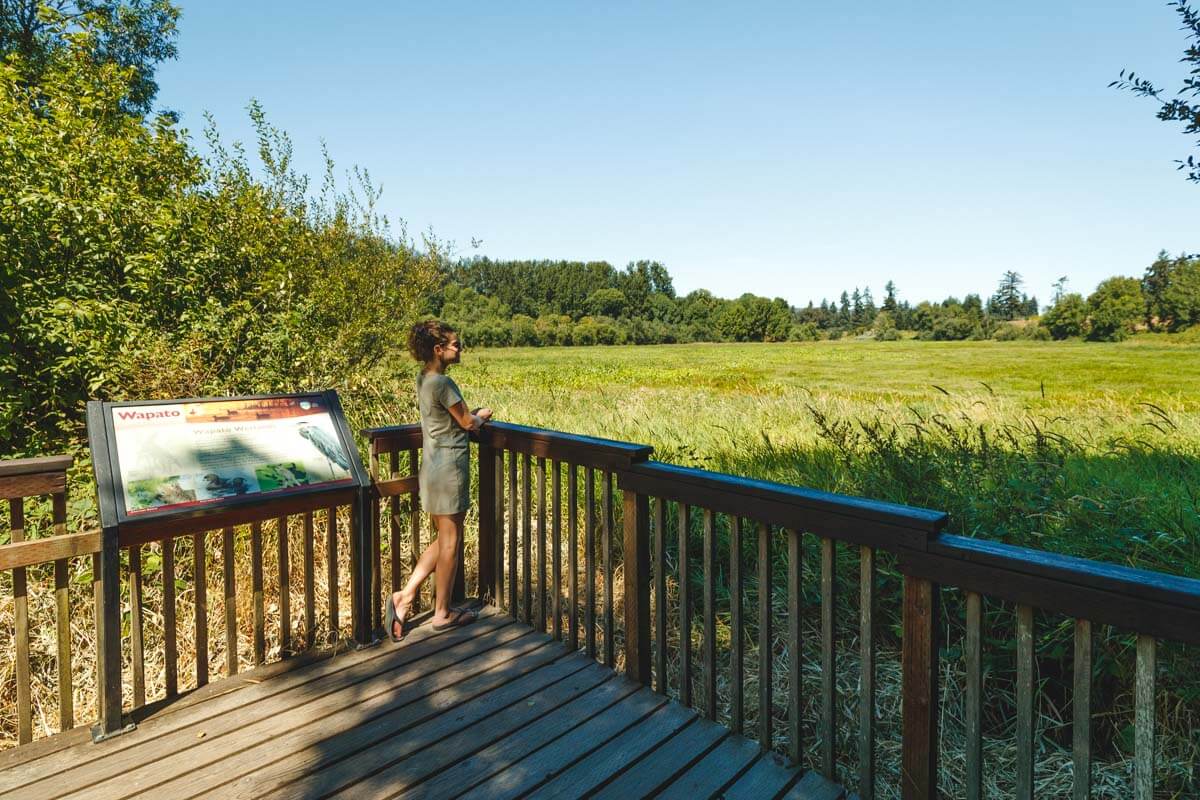
There’s a covered picnic shelter at the trailhead area too, which matters more than you’d think when the rain shows up mid-loop. For the rest of the island’s trails, beaches and farms, check out our guide to things to do on Sauvie Island.
Earn it: the walk to Warrior Rock Lighthouse
Want more than a viewing deck? Drive to the very end of Reeder Road, where the last couple of miles turn to gravel, and walk to Warrior Rock Lighthouse, a still-working light near the island’s northern tip.
It’s about 6 miles out and back to the lighthouse, or roughly 7 if you push on to Warrior Point, and the elevation gain barely registers. The woods here are mostly leafy trees that go bare in winter, so the river views open up, and on a clear day Mount St. Helens shows up across the Columbia.

This is a riverside trail, so it can get soggy or even flood when the Columbia runs high. Check conditions before you commit to the full distance. Love little lighthouses? Here are Oregon’s lighthouses and the adventures near each one.
The permit and how to get there
Every vehicle parked in Sauvie Island Wildlife Area needs an ODFW Wildlife Area Parking Permit. A daily permit is $10, and a $30 annual permit covers all 17 ODFW wildlife areas for the year.
Buy it online through ODFW before you go, or pick one up at the Cracker Barrel Grocery near the bridge. Dogs are welcome on a leash.
Getting there is simple: take Highway 30 west from Portland and turn onto the Sauvie Island Bridge. Reeder Road branches off Sauvie Island Road about two miles past the bridge.
Trip tips: grab a rental car to get out to the island, and if you’re coming from out of town, lock in your hotel before the good rooms are gone.
So which are you hoping to spot first: a sky full of snow geese, a line of sandhill cranes or a bald eagle? Tell us how your count goes!
Rules and fees change, so always confirm current requirements before you go.