Astronauts trained for the moon on this Oregon lava field, and the only road there closes for winter soon
NASA needed a place on Earth that looked like the moon, and in 1964 it found one on an Oregon mountain pass. That spot is McKenzie Pass, a black sea of jagged lava on Highway 242 between Sisters and McKenzie Bridge. Right now is the best time of year to see it.
There’s a catch, though. The road over the pass shuts down every winter, and once the gates lock, nobody’s driving up there again until June.
Psst, we made you a West Coast Adventure Map. Nearly 1,900 of our favorite spots, already pinned, ready to load into Google Maps in two clicks. Grab it here.
What you’re actually looking at
From the summit, you’re staring across 65 square miles of black lava rock. It looks like someone smashed a parking lot with a sledgehammer and spread the pieces across the mountains.
This is young ground, geologically speaking. Nearby Belknap Crater, one of the vents that built this landscape, last erupted about 1,500 years ago, which in volcano time is practically yesterday.
Standing in the middle of it feels a little eerie. Much of the flow is bare, the rock is rough and jagged, and snowy Cascade peaks rise up on every side like they’re keeping an eye on you.
📍 GET THE ULTIMATE PNW MAP 🗺️
Get our curated list of the best adventures, things to do, and places to grab a brew loaded onto your maps with just two clicks!
✅ Waterfalls ✅ Hikes ✅ Viewpoints
✅ Craft breweries ✅ National Parks ✅ 1400+ Pins


Dee Wright Observatory is the reason to stop
Right at the summit sits a squat stone tower that looks like it grew straight out of the lava, and in a way, it did. The Civilian Conservation Corps built Dee Wright Observatory from lava rock in 1935 and named it for the crew’s foreman, who died the year before it was finished.
Climb the stairs to the roof and you’ll find a bronze peak finder labeling the summits and buttes on the horizon. Inside, openings cut through the stone frame the surrounding mountains like windows in a very rugged art gallery.
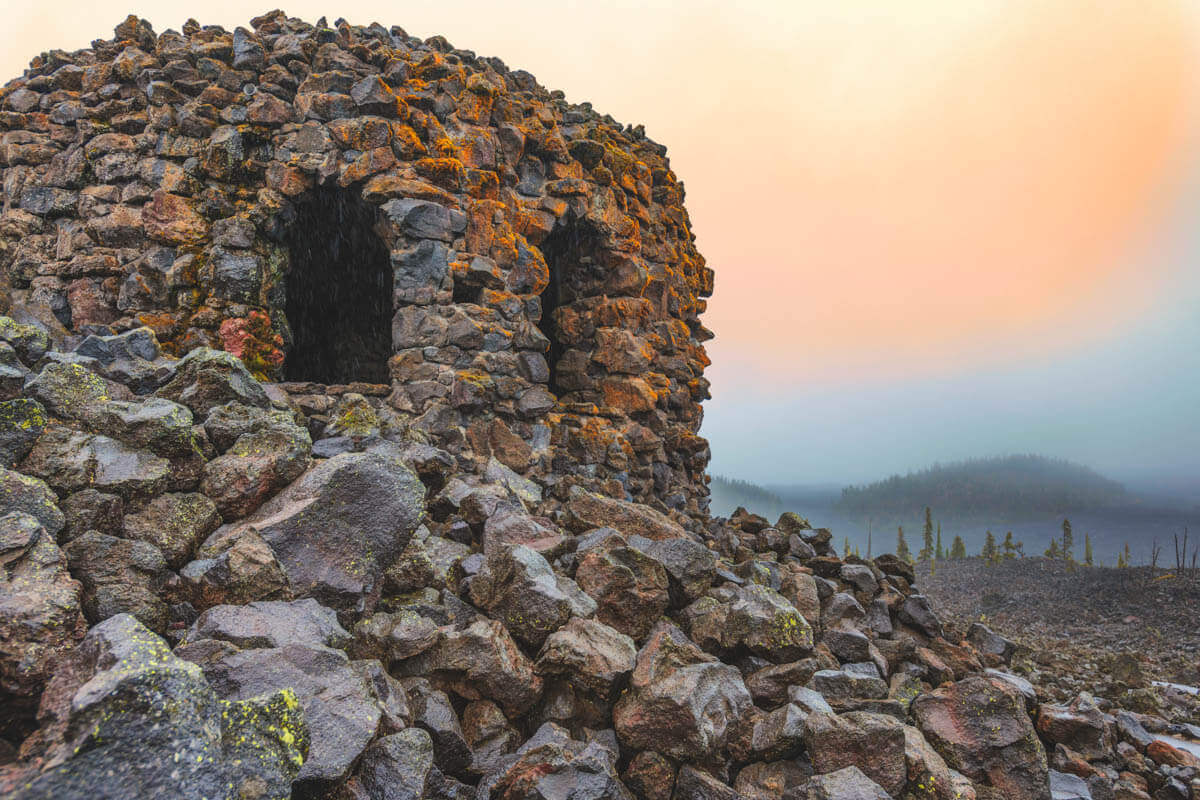
On a clear day, you can pick out Mount Washington, Mount Jefferson, all three of the Three Sisters, and even Mount Hood, 78.5 miles to the north. That’s a lot of volcano for a roadside pullout!
Stopping here costs nothing. There are vault toilets at the site but no drinking water, so bring your own.
Walk the lava on an easy loop
Next to the observatory, the Lava River National Recreation Trail loops through the flow for just under a mile, with only about 100 feet of elevation change. It’s accessible, it’s easy, and interpretive signs along the way explain how all this rock ended up here.
Short on time? Spend it here. Walking through the middle of the lava hits completely differently than staring at it from the parking lot.
Why fall is the time to go
Here’s our take: autumn is the best season on this road, no contest. The west side of the pass drops into thick forest, and in fall the vine maples flare red right up against the black rock, a color combo that almost looks fake.
The summer crowds thin out, too. Even in peak season, ODOT counts only about 300 cars a day on this highway, so an autumn weekday can feel like you’ve got the whole pass to yourself.
Add Proxy Falls on the way up
Coming from the west side? Pull over at the Proxy Falls trailhead, about 9 miles up Highway 242 from its junction with Highway 126. The loop is 1.6 miles with about 164 feet of elevation gain, rated moderate, and it crosses an old lava flow before ducking into the forest to reach two separate waterfalls.
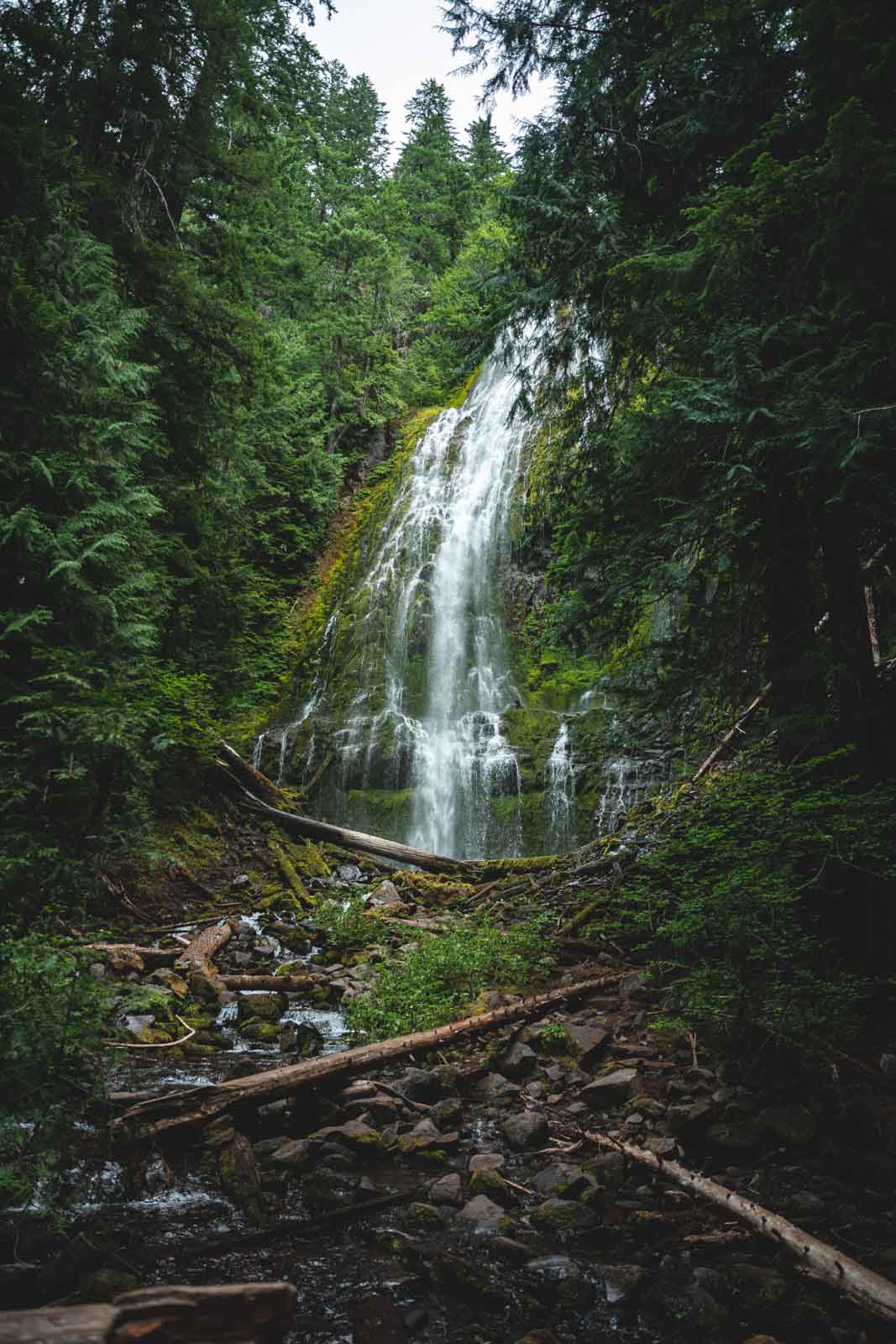
You’ll need a recreation pass to park at this trailhead, so grab a Northwest Forest Pass before you go. The trail also enters the Three Sisters Wilderness, and through October 15, day hikers fill out a free self-issue wilderness permit at the trailhead.
We’ve got a full guide to the Proxy Falls hike if you want the play-by-play before you lace up.
🏨 Need a place to crash nearby?
From rustic cabins to boutique inns—check prices and availability in just a click.
The closing date nobody can promise you
ODOT closes Highway 242 every year from November to mid-June, and the road isn’t maintained at all while the gates are locked. The exact date depends on the weather, and snow can beat the calendar.
Case in point: in 2025, the western section closed for the season on October 14 after a weekend of snow. So don’t sit on this one, and check TripCheck before you leave.
Vehicles over 35 feet long aren’t allowed on the pass, since the road is narrow, twisty, and short on shoulder. The observatory is about 15 miles west of Sisters, or roughly 22 miles up Highway 242 from the west side.
Sisters makes an easy home base, and there are plenty of things to do in Sisters once you’re back down. Trip tips: grab a rental car to get out here, lock in your hotel before the good rooms are gone, or skip both and book a camper van instead.
Have you driven McKenzie Pass yet, or is this the year you finally beat the gates? Tell us which side you’d start from, and whether you’re stopping for waterfalls or heading straight for the moon rocks.
Rules and fees change, so always confirm current requirements before you go.