
A 1933 stone shelter sits 800 feet above the Oregon coast, and you can drive to it or earn it on foot
The best seat on the central Oregon coast is a stone shelter that’s been perched up there since 1933. Cape Perpetua’s West Shelter sits about 800 feet above the Pacific, and on a clear day the view stretches roughly 70 miles of coastline and about 40 miles out to sea.
Picture a rugged stone hut hugging the edge of a headland, with the whole ocean spread out below like a map. It’s the kind of stop that makes you quietly cancel your plans for the next hour.
Psst, we made you a West Coast Adventure Map. Nearly 1,900 of our favorite spots, already pinned, ready to load into Google Maps in two clicks: grab it here.
A shelter with a real backstory
Civilian Conservation Corps workers built the West Shelter in 1933, part of the Depression-era crews that left their mark all over the national forests. Because of that sweeping vantage point, it later served as a lookout during World War II.
The shelter was listed on the National Register of Historic Places in 1989. Weather is rough on it up here, and in September 2019 a volunteer crew spent two weeks replacing wood beams and cedar shakes as part of a $50,000 Forest Service project.
📍 GET THE ULTIMATE PNW MAP 🗺️
Get our curated list of the best adventures, things to do, and places to grab a brew loaded onto your maps with just two clicks!
✅ Waterfalls ✅ Hikes ✅ Viewpoints
✅ Craft breweries ✅ National Parks ✅ 1400+ Pins


The easy way: drive right up
Yes, you can drive to the top of Cape Perpetua. From Highway 101 about three miles south of Yachats, head east on Forest Road 55, then north on Forest Road 5553 to the parking area at the end of the road.
Parking is $5 per vehicle per day, paid by card at an automated machine (no cash). A Northwest Forest Pass works too, and the overlook is open daily from 6 AM to 10 PM, year-round.
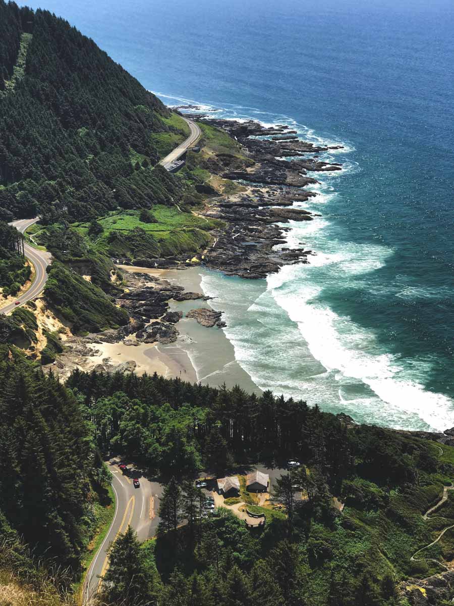
Want a little leg-stretching without a real hike? The Whispering Spruce Trail makes a 0.3-mile loop around the summit area, which is the laziest possible way to feel like you earned the view.
The earn-it way: hike up from the visitor center
If you’d rather feel like you deserved that view, the Saint Perpetua Trail climbs from the Cape Perpetua Visitor Center up to the shelter. Expect about 700 feet of climbing on a route rated moderate, so you’ll be breathing a little harder by the top.
The path winds through spruce forest and wildflower meadows, and the way back is all downhill. Our vote? Hike up, drive down if your knees are begging for mercy.

What to look for once you’re up there
Bring binoculars. In season, you can spot gray whales moving along the coast from the shelter, and the meadows nearby fill with wildflowers in spring and early summer.
If you’re also chasing the famous rock well below, our guide to Thor’s Well covers the tide timing so you can pair both stops in one trip.

So which team are you on: drive up and soak it in, or hike up and earn every switchback?
Trip tips: grab a rental car to get out here, lock in your hotel before the good rooms are gone, or skip both and book a camper van instead.
Rules and fees change, so always confirm current requirements before you go.