These flat-topped Oregon mesas used to be a riverbed, and one summit had its own airstrip until the 1980s
Table Rock isn’t a mountain, and it never was. These two flat-topped mesas outside Medford are what’s left after millions of years scraped away everything around them — and Lower Table Rock’s summit used to have its own airstrip.
We hiked out to the rim of Lower Table Rock a while back, and the moment that sticks is cresting the last switchback into open oak woodland with the entire Rogue Valley spread out below. Here’s what both hikes actually involve, and why fall is a genuinely good time to go if you don’t mind skipping the wildflowers.
Psst — we made you a West Coast Adventure Map. Nearly 1,900 of our favorite spots, already pinned, ready to load into Google Maps in two clicks — grab it here.
These aren’t mountains, they’re what’s left after everything else washed away
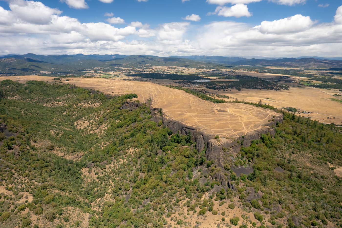
About 40 million years ago, a braided river system geologists call the Ancestral Rogue River spread thick layers of sand, gravel and mud across this part of the valley. A lava flow capped that older rock around 7 million years back, and every softer layer the lava didn’t cover has slowly eroded away ever since — leaving these two flat-topped mesas standing nearly 800 feet above everything around them.
Geologists call it inverted relief: the hardest rock ends up on top, and the valley floor down below is actually younger ground than the mesa capping it.
📍 GET THE ULTIMATE PNW MAP 🗺️
Get our curated list of the best adventures, things to do, and places to grab a brew loaded onto your maps with just two clicks!
✅ Waterfalls ✅ Hikes ✅ Viewpoints
✅ Craft breweries ✅ National Parks ✅ 1400+ Pins


Two hikes, two different summits
Upper Table Rock is the shorter of the two, at roughly 2.5 miles round trip with about 720 feet of climbing to the rim, plus more if you wander the open top. Lower Table Rock runs longer — closer to 5.5 miles round trip if you explore the full mesa — with around 780 feet of gain and a real stretch of switchbacks partway up.
The lower loop at Lower Table Rock just got repaved this spring, so that stretch is in better shape than it’s been in years.
What’s actually up there
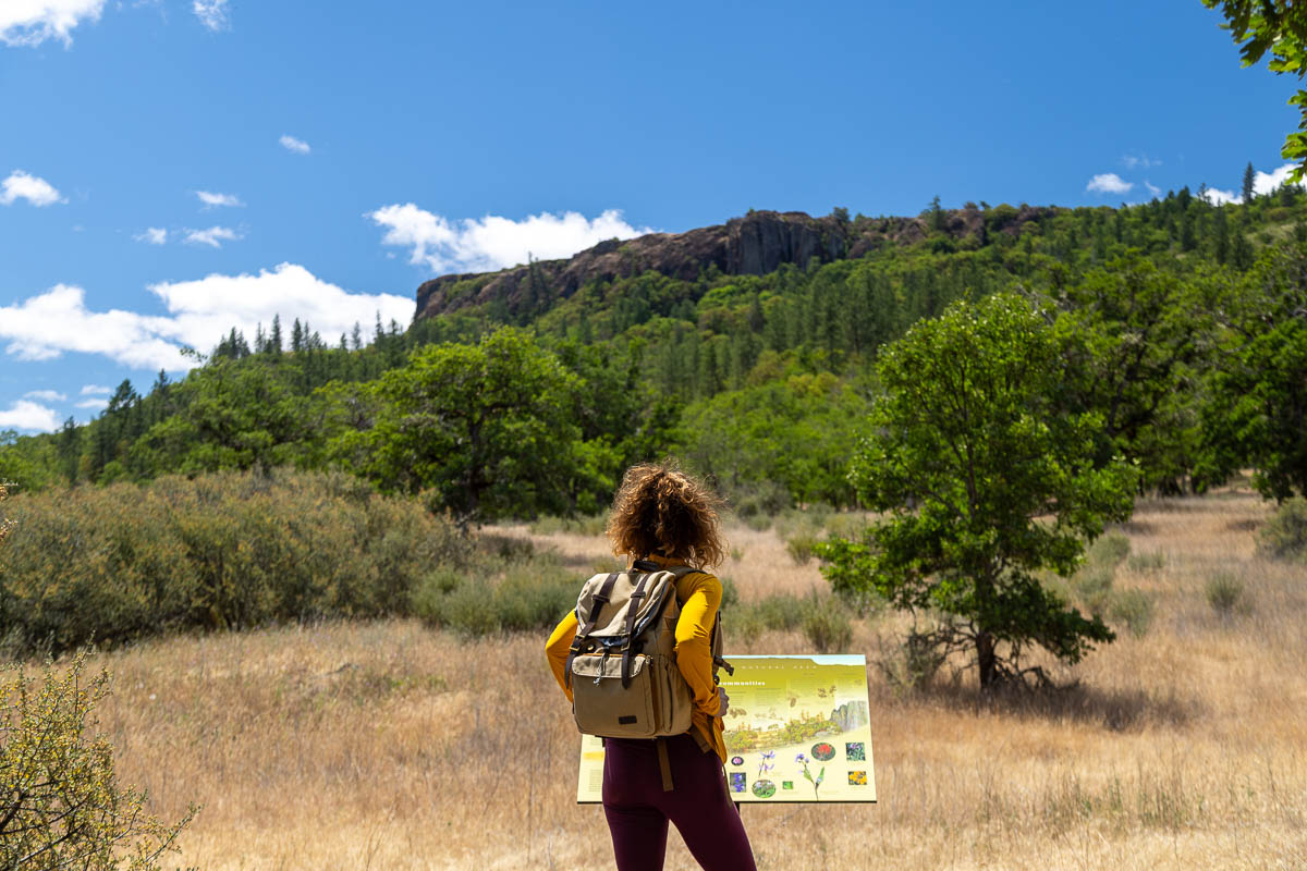
Both summits open into oak savanna and grassland instead of forest, with views stretching across the Rogue Valley to the Cascades on a clear day. Vernal pools dot the flat tops each spring, home to more than 200 wildflower species and a federally threatened fairy shrimp that only hatches when the pools fill.
Lower Table Rock has the stranger history: the Forest Service graded an actual airstrip up there in 1948, and small planes used it until the Bureau of Land Management closed it in the late 1980s. Look closely near the summit and you can still make out where the runway ran.
One rule worth knowing before you go
Dogs aren’t permitted on either trail, full stop — the wildlife and vernal pools here are sensitive enough that the BLM and The Nature Conservancy, which manages most of this land, enforce it. Cell service is spotty to nonexistent on both mesas, so download a trail map before you leave the trailhead.
This valley carries a heavier history too
The 1853 Battle of Table Rock happened at the base of these cliffs, and the treaty signed afterward forced the Takelma people off land they’d lived on for thousands of years. It’s worth knowing before you stand at the rim.
Spring gets all the attention here for the wildflower bloom, and it earns it. But fall trades the crowds and mud for cooler air and some of the clearest valley views of the year — our pick, if you don’t mind skipping the flowers.
Rim views, a ghost airstrip, or 40 million years of geology written into the cliffs — which one gets you out there first?
Trip tips: grab a rental car to get out here, and lock in your hotel in Medford before the good rooms are gone.
Rules and fees change — always confirm current requirements before you go.