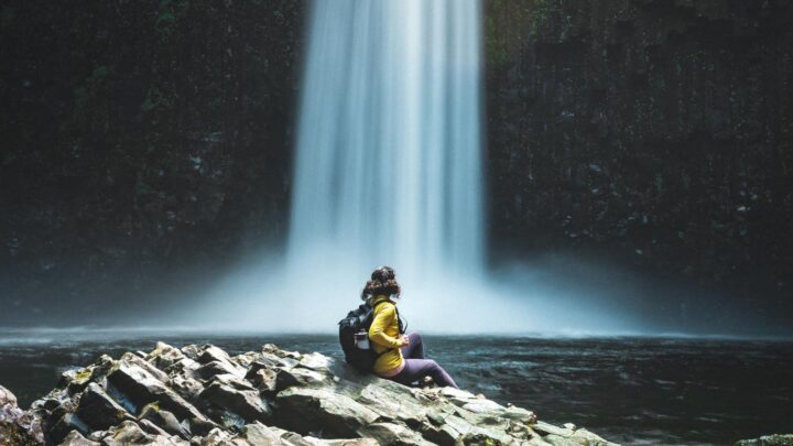
25 Columbia River Gorge Hikes + Other Adventures
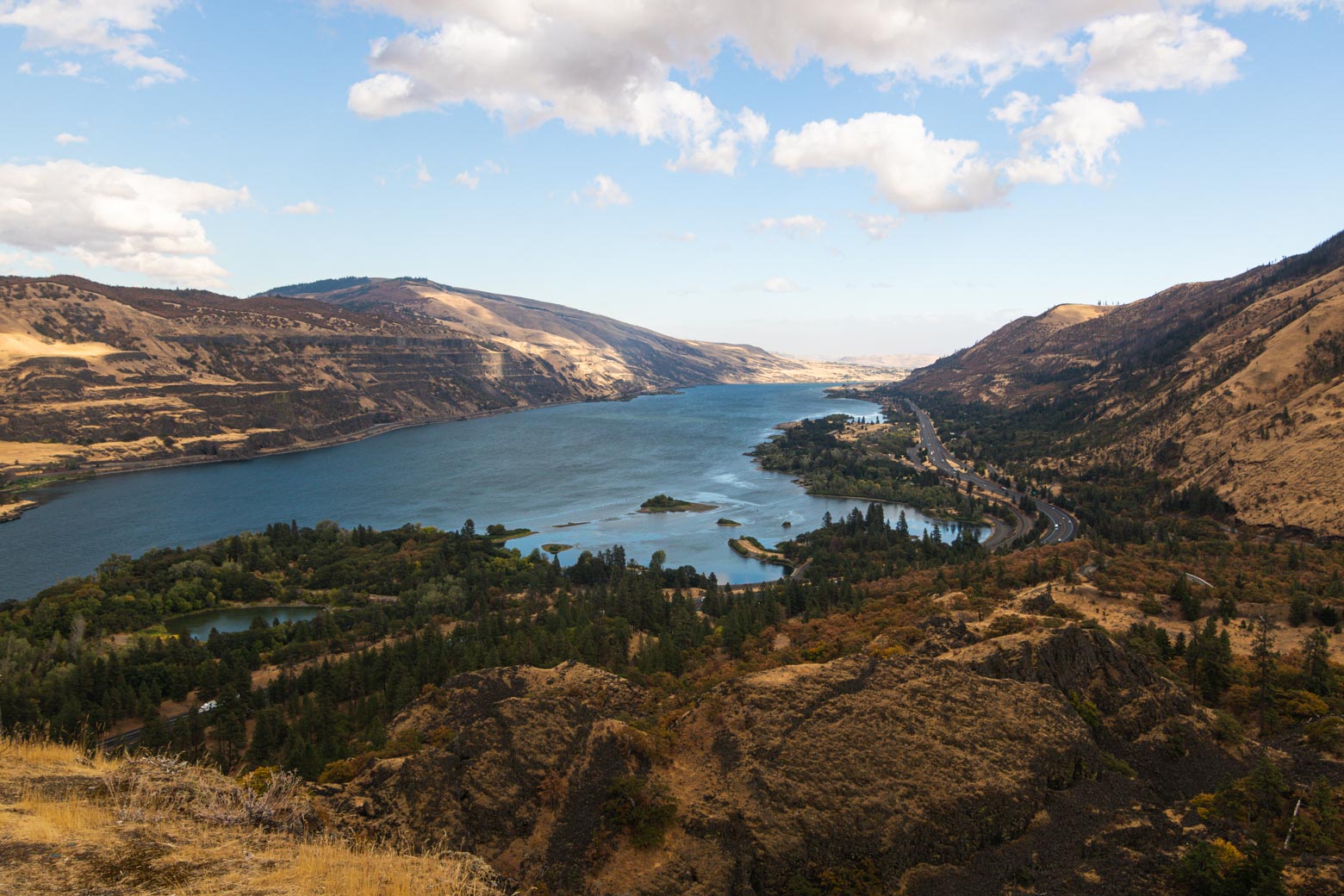
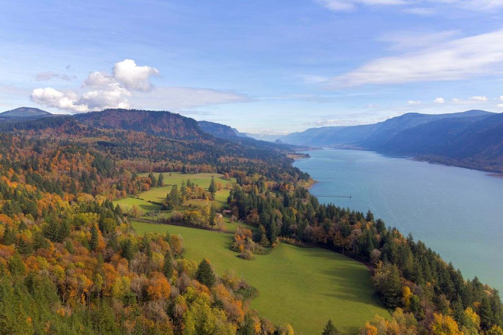
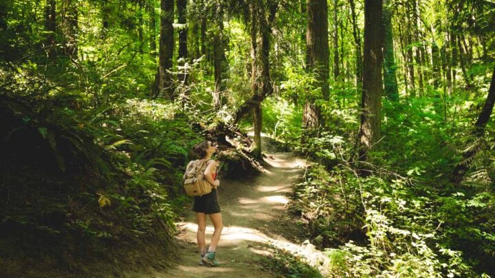
There’s no place like the Gorge. People travel from all around the country to take in this natural wonder of the Pacific Northwest.
From hiking to windsurfing and boating, there are many ways to enjoy the Columbia River Gorge.
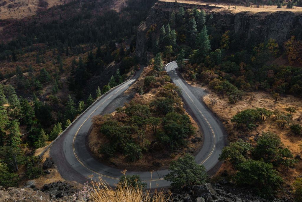
You can get a sense of its majesty just by driving through on the Scenic Columbia River Highway. Mile after mile reveals towering peaks and wide vistas. Day use areas allow you to paddleboard, kayak, and fish in the giant river.
If you want to get a birds-eye view, there are a number of hikes that take you to natural spires where you can take in the whole gorge. In this article, we’ll cover a number of ways that you can enjoy this magical place.
Table of Contents
- Exploring The Columbia River Gorge
- Columbia River Gorge Hikes (with Waterfalls!)
- More Columbia River Gorge Hikes
- Columbia River Gorge Hikes in Washington
- Other Things to Do Around the Columbia River Gorge
- Camping in the Columbia River Gorge
- More Places to Stay in the Columbia River Gorge: Cabins & Glamping Options
- More Hiking in Oregon
- 17+ Badass Bend Hikes to Conquer During Your Visit
- 37 of The Best Oregon Hikes You've Got to Check Out
- 21+ Awesome Hikes Near Portland to Escape The Bustle
- 17+ Must-Visit Columbia River Gorge Waterfalls
- Waterfalls Near Portland: 17 Gorgeous Waterfall Hikes
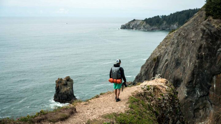
- 17 Breathtaking Oregon Coast Hikes
- 28 Stunning Oregon Waterfall Hikes
Exploring The Columbia River Gorge
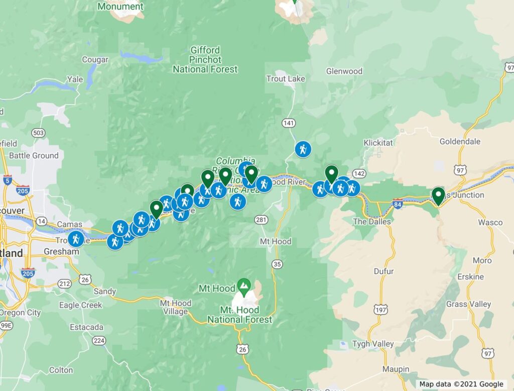
Below you’ll find over 20 of our favorite hikes in the Columbia River Gorge, many with waterfalls, others with enchanting views of the Gorge from above. Some of the suggestions take you “over the border” and into Washington since the Gorge is shared between the two states.
We’ve also mapped everything out for your convenience, this map has all of the hikes listed as well as the campsites nearby so you can grab a cheap night’s sleep and wake up bright and early ready to tackle another section of the Gorge! We hope this helps plans your visit.
Columbia River Gorge Hikes (with Waterfalls!)
Columbia River Gorge hikes are all spectacular and unique but perhaps best of all, are so incredibly close to Portland. Even though a few trails are still closed because of the Eagle Creek Fire, there are plenty of trails that are open.
In this article, we’ll focus on the hikes that you can go do right now.
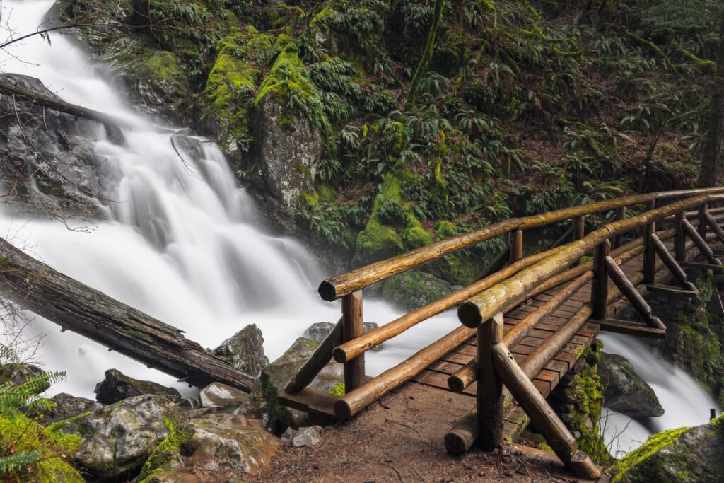
As if a giant river isn’t enough, many of the Columbia River Gorge hikes take you to enchanting waterfalls as well. The Gorge is known as a land of waterfalls after all.
RECOMMENDED GEAR:
| Water Filter | Rain Jacket | Backpack |
|---|---|---|
 |  |  |
| Check Price | Men’s/Women’s | Men’s/Women’s |
1. Bridal Veil Falls
Distance: 0.5 miles
Type of Trail: Out & Back
Difficulty: Easy
This waterfall is located on a short 0.5-mile out-and-back hike. At this spot, you have two options.
First, there’s a paved universal-access path that circles up to a viewpoint of the gorge and the Pillars of Hercules rock formation.
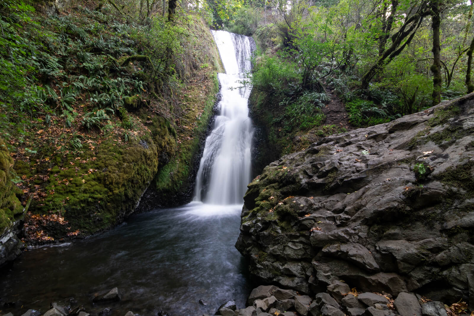
Second, you can take a lower trail down to the base of the falls. Even though the second hike is short, there are stairs and switchbacks so this trail is not wheelchair accessible.
At the bottom, you’ll have a great view of Bridal Veil and understand where it got its name.
2. Coopey Falls via Angel’s Rest and Devil’s Rest
Distance: 1.0 miles
Type of Trail: Out & Back or Loop
Difficulty: Easy/Moderate/Hard
The Angel’s Rest trail is located off the same highway exit as Bridal Veil. To see Coopey Falls, you just need to hike in half a mile (easy).
However, you can continue on to the gorgeous view at Ange’s Rest and make it a 4.5-mile out-and-back (moderate). Also, it’s a little hard to come here and not go see Angel’s Rest.
And if you’re really feeling adventurous, you do a 10-mile loop that includes Coopey Falls, Angel’s Rest, and Devil’s Rest (hard).
3. Dry Creek Falls
Distance: 3.6 miles
Type of Trail: Out & Back
Difficulty: Easy
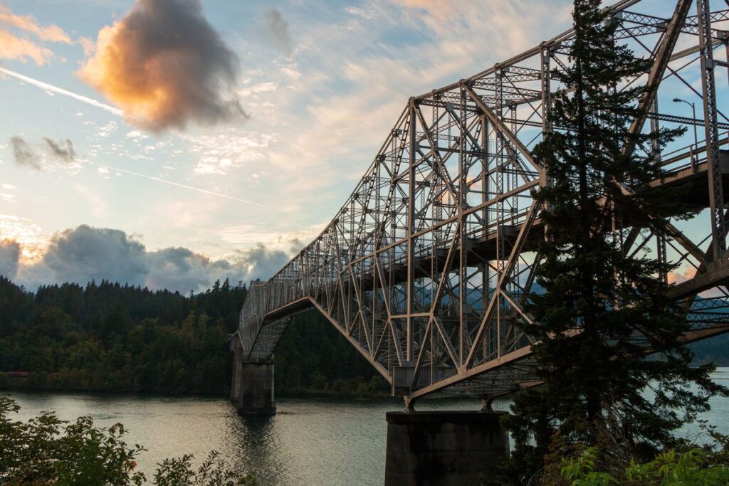
This waterfall is located where the Pacific Crest Trail crosses the Bridge of the Gods. You’ll hike part of the PCT as a 4.4-mile out-and-back to get to this waterfall.
The area is very secluded and offers an immersive escape from daily life. Also, the falls create a nice breeze that you’ll enjoy when you reach it.
You will need to pay $5 or use your Northwest Forest Pass.
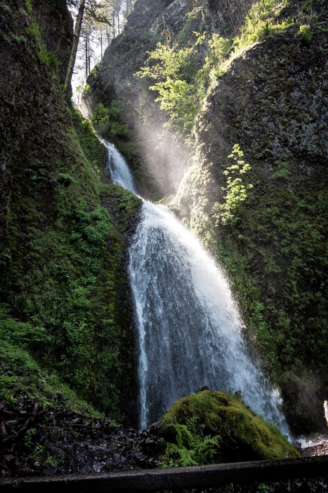
4. Horsetail Falls – Only to Ponytail Falls
Distance: 0.8 miles
Type of Trail: Out & Back
Difficulty: Easy
Horsetail Falls is one of the most popular Columbia River Gorge hikes. Also, people come from all around just to see these waterfalls.
Unfortunately, the Eagle Creek Fire had an impact on this site. But the good news is that you can still go up and see Ponytail Falls.
However, the trail is closed after that point. Just going up to Ponytail and back will be 0.8 miles.
Even with the closure, it’s still an awesome waterfall near Portland to see.
5. Latourell Falls Loop Trail
Distance: 2 miles
Type of Trail: Loop
Difficulty: Moderate
This loop trail is 2 miles long and gives you some awesome views of the waterfall. In fact, there are two waterfalls and three viewpoints. First, you’ll see Lower Latourell Falls from the bottom.
Next, you’ll hike around and up to see the same falls from the top. After that, you’ll follow Latourell Creek upstream and walk past Upper Latourell Falls.
To finish the loop out, you’ll follow the other side of the creek back to the highway.
→ For a fun and active tour to Latourell Falls and other beautiful falls in the Columbia River Gorge, take this hike and bike waterfall tour from Portland.
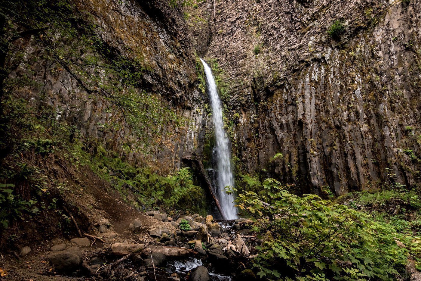
6. Mosier Plateau Trail (Mosier Falls)
Distance: 2.7 miles
Type of Trail: Out & Back
Difficulty: Moderate
This 2.7-mile out-and-back takes you right to the top of Mosier Falls, a 100-foot waterfall. During the summer, intrepid hikers are known to jump from the falls into the deep pool below.
Also, the falls are only 0.2 miles into the hike. Beyond that, you’ll get some great views of the Gorge.
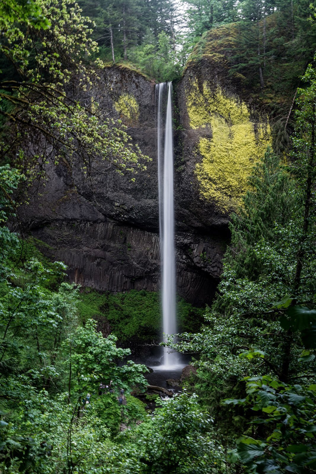
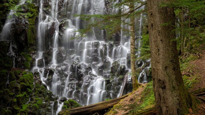
7. Mount Defiance Trail
Distance: 12.4 miles
Type of Trail: Loop
Difficulty: Hard
In Starvation Creek State Park you’ll find a few different hiking trails. However, if you want to see all the sights, you’ll take the Mount Defiance Trail.
This trail is a 12.4-mile loop that will take you by four waterfalls: Starvation Creek Falls, Cabin Creek Falls, Hole-in-the-Wall Falls, and Lancaster Falls.
The good news is that you’ll see all these falls within about two miles from the parking lot, so you don’t have to do the whole loop if you aren’t up for it. However, if you do the whole thing, you’ll pass by the gorgeous Warren Lake.
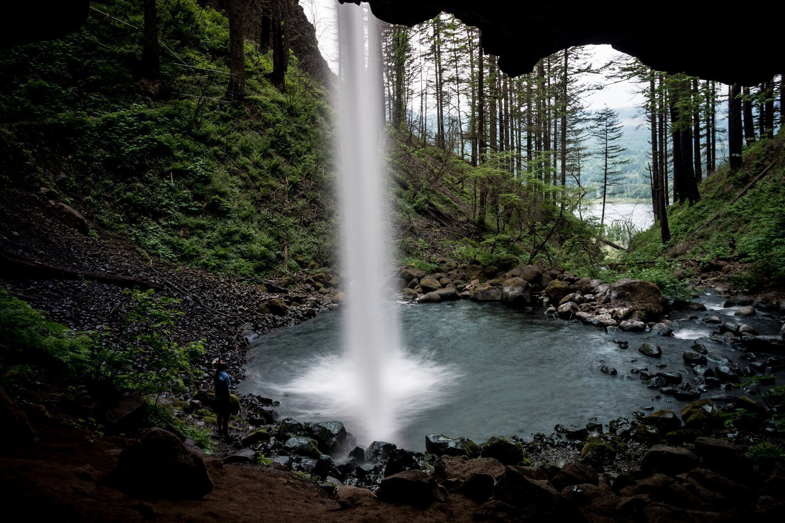
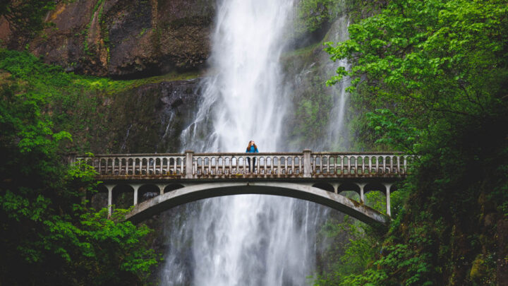
8. Wahkeena and Multnomah Falls Loop Trail
Distance: 4.7 miles
Type of Trail: Loop
Difficulty: Moderate
Multnomah Falls is one of the most iconic waterfalls in the Columbia River Gorge, and it’s open. However, the loop hike we recommend starts at Wahkeena Falls.
On this 4.6-mile loop trail, you’ll hike past a number of falls including Wahkeena Falls, Fairy Falls, Ecola Falls, and Weisendanger Falls.
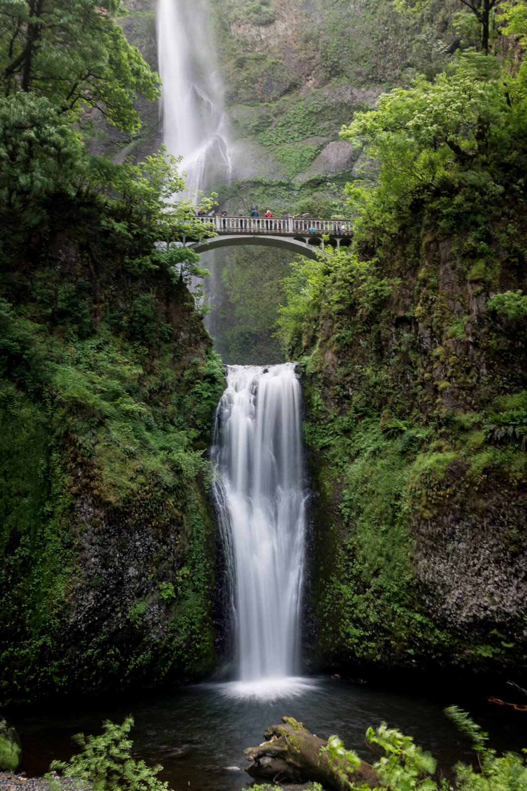
After all of that, you’ll come over the top of Multnomah Falls and finish at the lodge area. Multnomah Falls is the tallest waterfall in Oregon, and the view from the top is spectacular.
→ If you are traveling alone, join this awesome waterfall hiking tour to the Columbia River Gorge from Portland.
RELATED: 13 Portland Tours for The Adventurous!
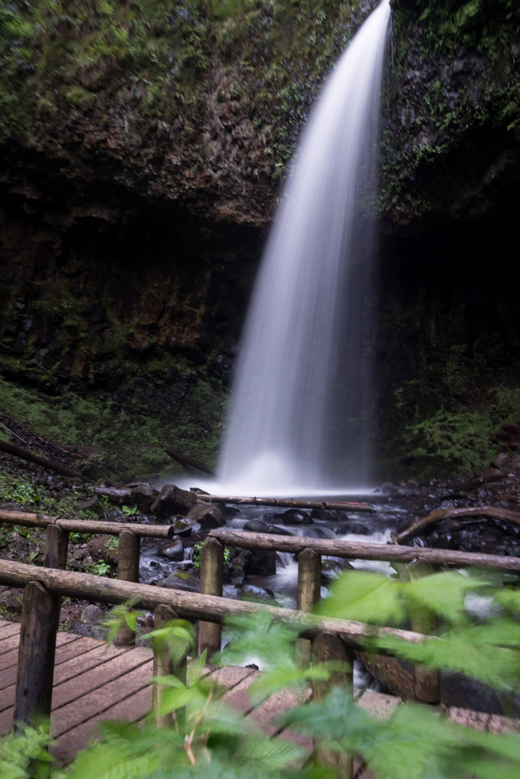
9. Wahclella Falls
Distance: 1.9 miles
Type of Trail: Out & Back
Difficulty: Easy
The Wahclella Falls Trail is a 1.9-mile out-and-back that is great for the whole family. That’s because it’s not too hard and it stays pretty flat the whole time. In the end, you’re greeted with a beautiful waterfall deep in the forest.
Also, the trail follows the creek the whole time, which adds to the beauty.
Normally, this hike is a lollipop/loop hike. However, damage from the fire has closed the upper portion of the loop. Even so, you can still access the waterfall via the single out-and-back trail.
You will need to pay $5 or use your Northwest Forest Pass.
Read more: Awesome waterfall hikes near Portland | Best Mount Hood hikes
More Columbia River Gorge Hikes
Here are some more great Columbia River Gorge hikes to get out and explore. These won’t have waterfalls but they will certainly offer beautiful views and walks.
10. Mitchell Point
Distance: 1.7 miles
Type of Trail: Out & Back
Difficulty: Moderate
Here’s another great hike with a tremendous view. Mitchell Point is an 1170-foot peak right along the Columbia River, and you’ll climb it on a 2-mile out-and-back trail.

Also, the trail is steep. You should be ready to gain 1000 feet in elevation within one mile.
11. Indian Point Loop
Distance: 7.3 miles
Type of Trail: Loop
Difficulty: Hard
Indian Point is a viewpoint that gives you huge vistas of the Columbia River Gorge. Even though this hike is a bit hard, the views are worth it.
Also, this 7.3-mile loop includes the Hermon Creek, Nick Eaton, and Gorton Creek trails. Finally, it’s best to wear pants on this hike since there may be patches of poison oak.
You will need to pay $5 or use your Northwest Forest Pass.
12. Memaloose State Park Loop
Distance: 4.5 miles
Type of Trail: Loop
Difficulty: Moderate
This hike is a densely forested 4.5-mile loop near The Dalles. In fact, the growth is so dense that it’s a good idea to take a map and a GPS.
However, if you really want to get out into nature, this is the hike for you. Also, you’ll get to enjoy some amazing wildflowers and take in views of the Gorge.
As you walk along the trails, you’ll see the little Memaloose Island in the river. The Chinook Indian tribes in the area used to put the bones of their dead on pyres on this island.
Also, you’ll see a granite monument signifying pioneer Victor Trevitt’s resting place. He had wished his remains to enter the afterlife in the same way that the Chinook’s did.
⇒UPDATE: This hike seems to be overgrown now and difficult to follow, check the conditions before taking this hike on!
13. Herman Creek Trail
Distance: 19.8 miles
Type of Trail: Out & Back
Difficulty: Hard
Depending on the time of year that you go on this trail, you may see some small waterfalls. Either way, the Herman Creek Trail is a beautiful 19.8-mile out-and-back trek. It is a hard trail with steep areas.
Also, you may want to wear pants since this trail is known for poison oak. It definitely has less traffic than many other spots in the Gorge. That means you can enjoy the wilderness more.
You will need to pay $5 or use your Northwest Forest Pass.
14. Rowena Plateau Trail
Distance: 2 miles
Type of Trail: Loop
Difficulty: Easy
On this trail, you’ll get to admire some prehistoric geology. That’s because the Gorge and its surrounding landscape show evidence of the last ice age in this area.
And in the springtime, you can enjoy a hike surrounded by wildflowers.
The hike is a 2-mile loop that is located near The Dalles. Be aware that this hike is within the Tom McCall Nature Preserve. That means it’s gorgeous and pristine, but it also means it’s closed from Nov. 1 through April 30.
15. Sandy River Delta Perimeter Trail
Distance: 4.8 miles
Type of Trail: Loop
Difficulty: Easy
If you don’t want to venture too far into the Gorge, this is a great place to go. The Sandy River Delta Park is located at the edge of Troutdale where the Sandy River flows into the Columbia.
This day-use park includes areas for fishing, horseback riding, and some hunting. There are a few different trails here, but the Perimeter Trail will take you through all the various vegetation and give you some good views of Mt. Hood.
Also, this easy loop trail is 4.8 miles long and is pretty flat.
Columbia River Gorge Hikes in Washington
Of course, both Oregon and Washington share the Columbia River Gorge. So, now we turn our attention to some great hikes along the Gorge in Washington.
16. Cape Horn Loop Trail
Distance: 7.5 miles
Type of Trail: Loop
Difficulty: Moderate
This hike has it all. A high viewpoint to take in the Gorge, fields of lava rock, and a waterfall that cascades into the Columbia River.
Also, the Cape Horn Loop Trail is east of Washougal, Washington and is 7.5 miles long.
You’ll gain 1587 feet in elevation on this trail. Be aware, the lower half of the trail is closed between February 1 and July 15th for falcon mating season.
Also, this trail is hazardous to dogs, so leave them at home.
17. Dog Creek Falls
Distance: 2 miles
Type of Trail: Out & Back
Difficulty: Easy
After you climb the popular Dog Mountain, you can squeeze Dog Creek Falls into your excursion. Just head east on Highway 14 for about 2 miles.
The very next left-hand exit from the road is the parking area for Dog Creek Falls. You can see the waterfall right away, so there’s really not much of a hike.
But that might be good if Dog Mountain wore you out.
You will need to pay $5 or use your Northwest Forest Pass.
18. Hamilton Mountain Trail
Distance: 5.1 miles
Type of Trail: Out & Back
Difficulty: Moderate
This 5.1-mile out-and-back trail takes you up Hamilton Mountain. Also, it’s a popular hike, so it’s a good idea to go in the early morning if you want to beat the crowds.
On this hike, you’ll get to see Hardy Falls, The Pool of the Winds, and Rodney Falls.
The Pool of the Winds is an enclosed rocky pool at the base of the middle waterfall. It’s deep, dark, and windy from the rushing water.
The 2488-foot summit of this mountain doesn’t quite have the view you’d expect, but if you turn and walk across the saddle to a plateau you’ll have a better view of Mount Hood, Mount Adams, Mount St. Helens, and Table Mountain.
You will need to pay $10 or use your WA Discover Pass.
19. Augspurger Mountain
Distance: 11.5 miles
Type of Trail: Out & Back
Difficulty: Hard
The Augspurger Mountain Trail climbs 4409 feet over 11.5 miles. And it’s not for the faint of heart. But if you can stick it out, you’ll be rewarded along the way with fantastic views.
However, the view at the summit isn’t the best since there’s a lot of plant growth.
This trail leaves from the same spot as Dog Mountain. That means you actually have the option to go up the Dog Mountain Trail and continue on Augspurger, though you’ll encounter fewer people if you start on Augspurger from the beginning.
You will need to pay $5 or use your Northwest Forest Pass.
20. Balfour-Klickitat Loop
Distance: 0.9 miles
Type of Trail: Loop
Difficulty: Easy
This is another great trail for a quick stroll with views. That’s because it’s paved and is about 0.9 miles long.
Here, you can see the Columbia River along with the Klickitat River that flows into it. Also, it’s a great spot to see bald eagles nesting in the winter months and many other birds year-round.
21. Fort Cascades Trail
Distance: 1.3 miles
Type of Trail: Loop
Difficulty: Easy
Here’s another easy loop trail to do on your day off. This 1.3-mile loop runs right along the Columbia River and offers a great view of the Bonneville Dam and Beacon Rock.
Also, this area is historic as a Native American fishing and trading post. Lewis and Clark even wrote about an Indian village here.
To learn more, you can pick up a brochure for your self-guided hike at the trailhead.
22. Beacon Rock Trail
Distance: 1.5 miles
Type of Trail: Out & Back
Difficulty: Moderate
If the view of Beacon Rock from the Fort Cascades Trail left you wanting more, you’ll be pleased to know it’s there for the climbing. You can get to the summit of this ancient volcano in around an hour.
It’s suitable for most hikers thanks to the series of switchbacks made of wooden boards, but be aware that not all of the route is paved. It’s a bit of a workout, but the views from the top are worth it.
You will need to pay $10 or use your WA Discover Pass.
23. Lyle Cherry Orchard Trail
Distance: 5 miles
Type of Trail: Out & Back
Difficulty: Moderate
On this trail, you’ll enjoy beautiful views of the gorge, dense oak groves, and grassy plateaus. The Lyle Cherry Orchard Trail is just east of the small town of Lyle, Washington.
This 5-mile out-and-back trail gains 1246 feet in elevation, but it’s worth it.
The effort you put in on the climb will be rewarded by panoramic views of the Gorge. Also, you’ll see a boot brush here.
Take the time to clean your boots before and after your hike whenever you see one of these. It helps to keep weeds out of these areas.
24. St. Cloud Loop
Distance: 1 mile
Type of Trail: Loop
Difficulty: Easy
The St. Cloud Loop Trail is a paved path that winds through an old apple orchard on the side of the river. It’s located just east of Cruzan, Washington. On this trail, you’ll enjoy being so close to the river.
Also, it’s a lot less crowded than other spots in the Gorge.
25. Table Mountain Trail via Pacific Crest Trail
Distance: 16.4 miles
Type of Trail: Out & Back
Difficulty: Hard
This 16.4-mile lollipop trail starts off on the same trail that goes to Gillette Lake. However, you’ll pass the lake and add some significant mileage to get to Table Mountain.
Towards the end, you have the option of continuing up Heartbreak Ridge or choosing the easier, slightly longer Westway trail to the summit. Make sure you pack enough water for Heartbreak Ridge if you go that way.
It is very steep. Also, at the top, you can enjoy an almost 360-degree view of the surrounding wilderness.
You will need to pay $5 or use your Northwest Forest Pass.
26. Weldon Wagon Road Trail
Distance: 4.4 miles
Type of Trail: Out & Back
Difficulty: Moderate
This trail is located a bit north of White Salmon in Washington, which is across the Columbia from Hood River. It’s actually an old wagon trail that people used to transport apples from nearby farmlands.
The trail is very peaceful and quiet in the mornings but it’s uphill the whole way until the turnaround. The 4.4-mile out-and-back gains 1190 feet in elevation. However, you might not notice.
That’s because you could be surrounded by wildflowers along the way depending on the time of year. You’ll also get some great views of Mount Hood to the south.
→ To experience the Columbia River Gorge from a different perspective, take a scenic flightseeing tour or sail through the gorge on a classic yacht!
Other Things to Do Around the Columbia River Gorge
After those Columbia River Gorge hikes have tired you out, there are still plenty of things to do on the river.
Windsurfing at Hood River
Hood River is known as the windsurfing capital of the world. The local geography, weather, and the Gorge all combine to make the perfect storm for windsurfers. And you don’t have to be an expert to try it.
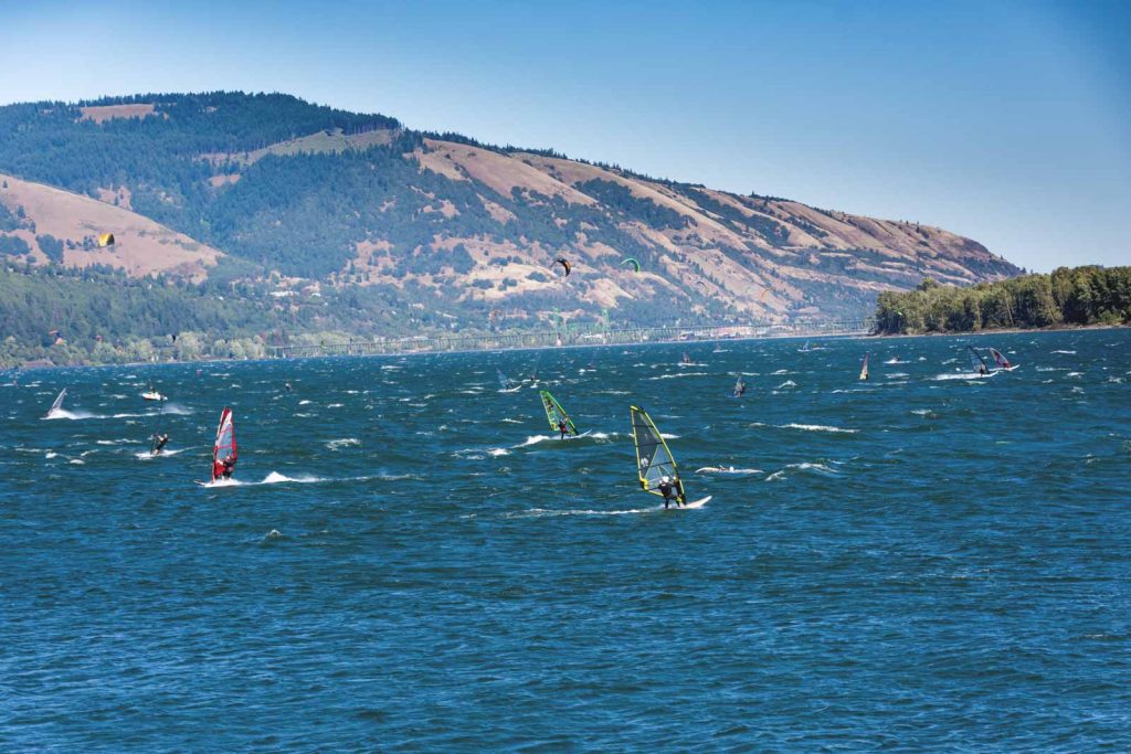
There are plenty of beginner windsurfing excursions and lessons in Hood River. Beginner lessons will include everything you need, like a wetsuit, helmet, booties, board, and sail. Some local teachers even say they can get first-timers to surf within minutes.
Also, don’t worry if you come to Hood River on a particularly un-windy day. You can still rent paddleboards, jet skis, and kayaks.
Visit Bonneville Dam
After you hike Fort Cascades Trail, why don’t you head down to the dam for a closer look? It’s awesome to see such a feat of engineering up close.
The Bonneville Dam has visitor centers on each side of the river. That makes it easy for people in Oregon and Washington to learn more about it.
The visitor centers are open from 9 to 5 every day and provide fun and educational experiences for your whole family. Also, a team of rangers is available to answer any questions you might have.
Vista House
The not-to-be-missed Vista House is located on the Historic Columbia River Highway. Also, the Columbia River Gorge hike nearest to this is the Latourell Falls Loop Trail.
This house was built in 1917 to give travelers a place to rest as they came down the Gorge. And the architecture is just as stunning as the view.
The house sits on a high point that lets you take in a panoramic view of the Gorge.
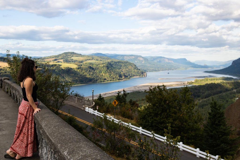
Volunteers with The Friends of Vista House are on site to give you more information about the history of the house and the Gorge.
Visit The Dalles Lock and Dam
The Dalles Lock and Dam is another great thing to do to round out a day or weekend of discovery. You can pair it with the Rowena Plateau hike or a hike in Memaloose State Park.
There’s one visitor center for this dam and it’s on the Oregon side of the river. Here, you can watch a short film about the dam, explore interactive displays, and see fish migrating up the fish ladder.
Reed Island State Park
If you’re going out to the Washington side to do a Gorge hike, why not stop by Reed Island State Park on your way back? This park is actually an island in the Columbia River.
Also, it’s right on the edge of Washougal, so it’s not very far from the Portland area.
Just one thing. The park is accessible only by water. However, that makes things more fun, right?
Just grab a paddleboard or kayak and paddle on over. And once you’re there, you can enjoy views of the Vista House and basalt cliffs to the south and watch for wildlife in the Steigerwald National Wildlife Refuge to the north.
Be aware, there aren’t any boat docks on this island. That means you’ll have to anchor your boat and swim to shore if you have one.
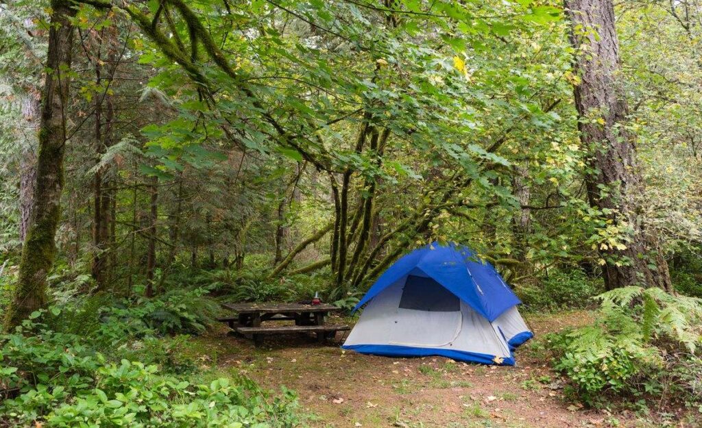
Camping in the Columbia River Gorge
As you’re well aware, there are tons of Columbia River Gorge hikes. To get the most out of the area, why don’t you consider camping There are a number of great spots, so we’ll cover a few of them below.
Read more about camping near Portland and camping around Oregon!
Ainsworth State Park
Ainsworth Campground is located right in Ainsworth State Park and it’s a short walk from the Horsetail Falls trailhead. Also, it’s pretty central to any spot in the western Gorge area and is what you’d expect from a great campsite.
There are about 40 full-hookup spots you can reserve along with six walk-in tent sites. From May 1 to September 30 (peak season), a tent site will cost you $17 while a full hookup costs $24 per night.
Off-season, those prices drop to $13 and $16.
Deschutes River State Recreation Area
This campground is right where the Deschutes River flows into the Columbia. That means it’s a great spot to access eastern-Gorge trails like the Rowena Plateau Trail and the Memaloose State Park Loop.
The campground has 34 electrical sites, 25 primitive sites (just drinking water and restrooms), and four large group tent/RV sites that accommodate up to 25 people each. Here’s how the fees stack up:
- Electrical: $22 peak, $16 off-peak, open year-round but water shut off in winter
- Primitive: $10, $5, closed in winter
- Group: $71, $51, closed in winter
Eagle Creek Campground
Eagle Creek Campground is another central spot in the gorge. Also, it’s a few miles east of Ainsworth State Park and it gives you easy access to the Bonneville and Bridge of the Gods areas.
Even though the Eagle Creek trail is closed, the campground is still open. It’s a very popular spot, so it’s a good idea to make reservations well in advance.
The campground is only open during the summer months, from May 1 through the end of September. There are 17 campsites here, though three of them are for walk-in campers only. The price is $15 per site.
Herman Creek Campground
This campsite contains the trailhead for Herman Creek Trail, as you may have guessed. Also, the Pacific Crest Trail runs through here.
It’s east of the Bridge of the Gods and offers seven camping spots. All of the spots are on a first-come, first-served basis and are $10. Herman Creek Campground is open from May 1 through the end of September.
Memaloose State Park
Memaloose State Park also offers a large campground. There are 40 full-hookup sites and 65 tent sites.
The tent sites have access to water nearby. During the summer season, you’ll pay $28 for a full-hookup or $19 for a tent. Off-season, those prices go down to $20 and $15.
Viento State Park
Viento State Park is just a minute away from Mount Defiance Trail and all its waterfalls. It’s in a great area, though it’s a bit less popular than other campsites. That means there’s almost always a spot to camp when other sites are full.
Though the Gorge is windy, it’s a coincidence that the name Viento means wind in Spanish. The place was actually named after three railroad tycoons who built the first railroad in the area. Their names were Villard, Endicott, and Tollman.
The Viento State Park Campground has 55 electrical sites with water and at least 15 tent sites with water nearby. One of the campsites is accessible to campers with disabilities, as well.
To camp, a tent site is $17 in the summer and $13 off-peak. For an electrical site, you’d pay $22 or $16.
Wyeth Campground
This campground is just east of Herman Creek. Also, it has its own hiking trails that cross Gorton Creek and Harphan Creek. Be aware, this site doesn’t offer any potable water, so be sure to bring enough with you.
Here you’ll find 13 individual sites and 3 group sites. The individual sites are $20/night, and the group sites are $30/night. This campsite is open from May 1 through the end of September.
With everything the area has to offer, the Columbia River Gorge can certainly keep you busy for many months. From panoramic views to enchanting waterfalls, it’s definitely a natural wonder of the Pacific Northwest.
READ MORE: 17 Amazing Spots to Go Camping on The Columbia River Gorge
More Places to Stay in the Columbia River Gorge: Cabins & Glamping Options
Conductor’s Cottage
This cozy cottage is located right across from the river on the Washington side of the gorge. It has two bedrooms, a well-equipped kitchen, and mountain views.
Dragonfly Creek Retreat Cabin
Located in Mosier, this artsy cabin sits on 24 wooded acres with a seasonal creek. It’s only two miles from town but it feels secluded and wildlife abounds.
Cottage in the Heart of the Gorge
This beautifully remodeled cottage in Mosier has river views, which are best enjoyed from the deck. It has everything you need for a relaxing and comfortable vacation.
More Hiking in Oregon
We hope this guide to the Columbia River Gorge will help you plan your trip! Here are more awesome adventures in Oregon and around Portland too.